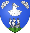
Les Sables-d'Olonne (Les Sables-d'Olonne)
| Les Sables-d'Olonne | ||
|---|---|---|

|
|
|
| local community | Les Sables-d'Olonne | |
| region | Pays de la Loire | |
| Department | Vendée | |
| Arrondissement | Les Sables-d'Olonne | |
| Coordinates | 46 ° 30 ′ N , 1 ° 47 ′ W | |
| Post Code | 85100 and 85320 | |
| Former INSEE code | 85194 | |
Les Sables-d'Olonne is a village with an average of 10 meters above sea level with 13,940 inhabitants (as of 2015) in the French department of Vendée in the administrative region of Pays de la Loire . The settlement area is located directly on the Bay of Biscay , which belongs to the Atlantic Ocean . The municipality of Les Sables-d'Olonne was founded on December 14, 1789 and covered 8.7 square kilometers. It later became the capital of the Arrondissement of Les Sables-d'Olonne and the canton of the same name . By decree of August 17, 2018 and with effect from January 1, 2019, it was merged with Château-d'Olonne and Olonne-sur-Mer to form the Commune nouvelle Les Sables-d'Olonne . Since then it has been a Commune déléguée .
Web links
Commons : Les Sables-d'Olonne (ancienne commune) - Collection of images, videos and audio files
