
Lewis Pass (New Zealand)
| Lewis Pass | |||
|---|---|---|---|
 Lewis Pass , with 907 m as the highest point |
|||
| Compass direction | west | south | |
| Pass height | 907 m | ||
| region | Buller District West Coast | Hurunui District Canterbury | |
| Watershed | Maruia River | Lewis River | |
| Valley locations | Springs Junction | Boyle Village | |
| expansion | New Zealand State Highway 7 | ||
| Mountains | New Zealand Alps | ||
| profile | |||
| Ø pitch | % (? m / 21 km) | % (? m / 16.5 km) | |
| Map (New Zealand) | |||
|
|||
| Coordinates | 42 ° 22 '26 " S , 172 ° 23' 50" O | ||

The Lewis Pass is a mountain pass in the northern third of the South Island of New Zealand .
Origin of name
In April 1860, the settler Henry Lewis discovered the mountain range from the valley of the Maruia River to the Lewis River . This made a connection between Nelson in the north and Christchurch on the east coast possible via the New Zealand Alps . The Lewis Pass was later named in his honor .
geography
The Lewis Pass is located around 53 km southeast of Reefton between the up to 1817 m high Freyberg Range in the north, the up to 1755 m high Opera Range in the east and the up to 1580 m high mountain range that extends west of the pass and north the 1870 m high Mount Technical is located.
The pass originally discovered by Henry Lewis and named after him is located around 750 m south-southeast of today's pass, over which the New Zealand State Highway 7 runs. The map material also takes account of the old transition and indicates the pass near a small lake with a height of 863 m . Today's pass, however, crosses the Lewis River in a northerly direction and makes a sharp left turn to the west in front of the Maruia River . The curve forms the highest point of today's pass road and is indicated at 907 m height.
Lewis Pass Scenic Reserve
The Department of Conservation has set up a so-called Scenic Reserve around Lewis Pass , giving hikers and nature lovers the opportunity to camp, relax, hike and observe nature. Three hiking or tracking trails are available in the area, the Lewis Tops Track , which leads to the summit of the adjoining 1568 m high mountain to the west , the Rolleston Pack Track , which runs parallel to State Highway 7 to the south and is well signposted St James Walkway which runs north along the Maruia River Right Branch through Cannibal Gorge .
Photo gallery
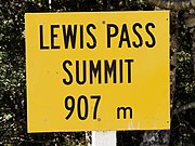
Sign pointing to the highest point of Lewis Pass
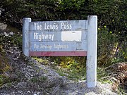
Signpost for the Lewis Pass Highway
.jpg)
.jpg)
Panoramic photo
.jpg)
Web links
- John Wilson : Canterbury Places - Hanmer and Lewis Pass . In: Te Ara - the Encyclopedia of New Zealand . Ministry for Culture & Heritage , August 17, 2015, accessed July 16, 2018 .
Individual evidence
- ↑ a b Ward Representation - Wards and Councilors . Hurunui District Council , accessed July 16, 2018 .
- ^ History . Lewis House , archived from the original on November 29, 2010 ; accessed on July 16, 2018 (English, original website no longer available).
- ↑ a b c Topo maps . Land Information New Zealand , accessed July 16, 2018 .
- ^ Lewis Pass Scenic Reserve . Department of Conservation , accessed July 16, 2018 .