Lez (Hérault)
| Lez | ||
|
The river at Castelnau-le-Lez |
||
| Data | ||
| Water code | FR : Y32-0400 | |
| location | France , Occitania region | |
| River system | Lez | |
| source | in the municipality of Les Matelles, 43 ° 43 ′ 5 ″ N , 3 ° 50 ′ 39 ″ E |
|
| Source height | approx. 110 m | |
| muzzle | on the southern outskirts of Palavas-les-Flots in the Mediterranean Coordinates: 43 ° 31 ′ 32 " N , 3 ° 56 ′ 7" E, 43 ° 31 ′ 32 " N , 3 ° 56 ′ 7" E |
|
| Mouth height | 0 m | |
| Height difference | approx. 110 m | |
| Bottom slope | approx. 3.7 ‰ | |
| length | 30 km | |
| Catchment area | 194 km² | |
| Big cities | Montpellier | |
| Small towns | Castelnau-le-Lez , Lattes , Palavas-les-Flots | |
| Navigable | from the mouth to Lattes | |
|
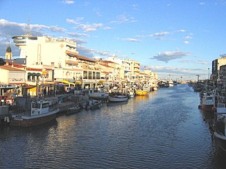
The crossing of Palavas-les-Flots |
||
The Lez is a coastal river in Hérault in the region Occitania in France . It rises in the municipality of Les Matelles and flows into the Mediterranean at Palavas-les-Flots .
geography
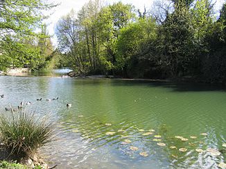
Source du lez
The source of the Lez ( Source du Lez ) is located southeast of Les Matelles. The approx. 10 m deep spring pot has a diameter of approx. 30 m and lies below a limestone rock. The flow of the karst spring averages 1040 liters per second and can rise to around 28,000 l / s. Right next to the source was in 1982 a pumping station with four holes for drinking water supply of Montpellier built. This takes up about 1700 l / s. 160 l / s are constantly discharged into the Lez, since otherwise there would be no above-ground runoff if the spring was poured low. For a long time it was believed that the Source du Lez had an underground overflow that would emerge in the nearby Source du Lirou . However, this has been proven wrong.
course
The Lez generally drains south to south-east, crosses the city of Montpellier and the city of Lattes and flows into the Mediterranean after 30 kilometers below Palavas-les-Flots . For the last few kilometers, it runs as a freshwater channel through the lagoon lakes Étang de l'Arnel , Étang de Méjean , Étang de Prévost , Étang du Grec and crosses the canal du Rhône à Sète at the same level .
Places on the river
- Saint-Clément-de-Rivière
- Prades-les-Lez
- Montferrier-sur-Lez
- Clapiers
- Castelnau-le-Lez
- Montpellier
- Lattes
- Palavas-les-Flots
Tributaries
The main tributaries of the Lez are (downstream):
shipping
The river was expanded in the 17th century under the name Canal de la Grave for shipping to Montpellier over a length of about ten kilometers with three locks . In 1942, shipping on the Lez was completely stopped due to increasing siltation. In the meantime, work is being done to restore this canal, with the section to Lattes, where a new port facility for pleasure craft has been built under the name Port Ariane , is already in operation again.
Flora and fauna
The headwaters of the Lez are the only habitats for the petit bullhead ( Cottus petiti ), a small freshwater fish.
Web links
Remarks
- ↑ Source geoportail.fr (1: 32,000)
- ↑ mouth geoportail.fr (1: 32,000)
- ↑ a b c The information on the river length is based on the information about the Lez at SANDRE (French), accessed on November 2, 2011, rounded to full kilometers.
- ↑ Cottus petiti on Fishbase.org (English)


