Mosson (Lez)
| Mosson | ||
|
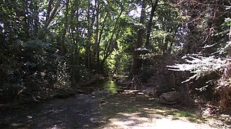
The Mosson at Juvignac |
||
| Data | ||
| Water code | FR : Y31-0400 | |
| location | France , Occitania region | |
| River system | Lez | |
| Drain over | Lez → Mediterranean | |
| source | in the municipality of Saint-Paul-et-Valmalle 43 ° 37 ′ 54 ″ N , 3 ° 40 ′ 43 ″ E |
|
| Source height | approx. 201 m | |
| muzzle | on the municipal boundary of Villeneuve-lès-Maguelone , Lattes and Palavas-les-Flots in the Lez Coordinates: 43 ° 32 ′ 25 ″ N , 3 ° 53 ′ 59 ″ E, 43 ° 32 ′ 25 ″ N , 3 ° 53 ′ 59 ″ O |
|
| Mouth height | approx. 1 m | |
| Height difference | approx. 200 m | |
| Bottom slope | approx. 5.1 ‰ | |
| length | 39 km | |
| Catchment area | 395 km² | |
| Right tributaries | Coulazou | |
| Big cities | Montpellier | |
| Small towns | Grabels , Juvignac , Saint-Jean-de-Védas , Villeneuve-lès-Maguelone | |
|
The Mosson Valley, in the background: Montpellier's Hauts de Massane district |
||
The Mosson is a river in France that runs in the Hérault department in the Occitanie region . It rises under the name Ruisseau des Mages in the municipality of Saint-Paul-et-Valmalle , initially drains north-west to west, but turns south to south-west at Combaillaux and flows after 39 kilometers at the municipal boundary of Villeneuve-lès-Maguelone , Lattes and Palavas-les-Flots as a right tributary to the Lez . The original estuary reaches the Etang de l'Arnel lagoon just east of Villeneuve-lès-Maguelone . However, it is sealed off by a weir that is only opened when the Mosson has extremely high water levels.
Places on the river
- Saint-Paul-et-Valmalle
- Montarnaud
- Vailhauquès
- Combaillaux
- Grabels
- Juvignac
- Montpellier
- Lavérune
- Saint-Jean-de-Védas
- Villeneuve-lès-Maguelone
Attractions
- Château de la Mosson in the municipality of Montpellier
- Oppidum de la Roque in the municipality of Fabrègues - Monument historique
See also
Web links
Commons : Mosson - collection of images, videos and audio files
Individual evidence
- ↑ Source geoportail.fr (1: 32,000)
- ↑ mouth geoportail.fr (1: 32,000)
- ↑ a b c The information on the length of the river is based on the information about the Mosson at SANDRE (French), accessed on November 2, 2011, rounded to full kilometers.

