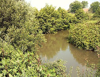
Liana (river)
| Liana | ||
|
The liana in Hesdigneul-lès-Boulogne |
||
| Data | ||
| Water code | FR : E53-0020 | |
| location | France , Hauts-de-France region | |
| River system | Liana | |
| source | in the parish of Quesques, 50 ° 42 ′ 15 ″ N , 1 ° 56 ′ 12 ″ E |
|
| Source height | approx. 100 m | |
| muzzle | in Boulogne-sur-Mer in the English Channel Coordinates: 50 ° 43 ′ 55 " N , 1 ° 35 ′ 10" E 50 ° 43 ′ 55 " N , 1 ° 35 ′ 10" E |
|
| Mouth height | 0 m | |
| Height difference | approx. 100 m | |
| Bottom slope | approx. 2.7 ‰ | |
| length | 37 km | |
| Medium-sized cities | Boulogne-sur-Mer | |
| Small towns | Saint-Etienne-au-Mont , Outreau | |
The Liane is a river in France that runs in the Pas-de-Calais department in the Hauts-de-France region . It has its source in the municipality of Quesques , in the Caps et Marais d'Opale Regional Nature Park . The river generally drains in a westerly direction and flows into the English Channel after 37 kilometers in the urban area of Boulogne-sur-Mer .
Places on the river
- Quesques
- Selles
- Crémarest
- Wirwignes
- Hesdin-l'Abbé
- Samer
- Isques
- Saint-Léonard
- Saint-Etienne-au-Mont
- Outreau
- Boulogne-sur-Mer
Web links
Commons : Liane - collection of images, videos and audio files
