
Caps et Marais d'Opale Regional Natural Park


The Regional Nature Park Caps et Marais d'Opale ( French: Parc naturel régional des Caps et Marais d'Opale ) is located in the French region of Hauts-de-France and extends mainly in the Pas-de-Calais department , with a small portion but also to the north . It borders the English Channel and the North Sea to the west and is nestled between the historic provinces of Flanders in the north and Artois in the south.
The park is located roughly between the cities
- Boulogne-sur-Mer to the west,
- Calais to the north and
- Saint-Omer to the east.
Park management

The nature park was founded on February 12, 1986, but at that time it still consisted of the separate nature parks Parc du Boulonnais and Parc du Audomarois , which were combined under the current term in 2000. The park currently covers an area of around 136,500 hectares. The park administration with the “Maison du Parc” is based in the Manoir du Hubois in Le Wast ( 50 ° 44 ′ 57 ″ N , 1 ° 48 ′ 6 ″ E, ). 153 municipalities (as of January 1, 2018) with a catchment area of around 200,000 inhabitants form the park, further municipalities are associated with the nature park as "access points".
Larger places in the park
In the Pas-de-Calais department
In the north department
Arques Town Hall

View of Desvres

Guînes, Place des Tilleuls
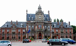
Longuenesse Town Hall

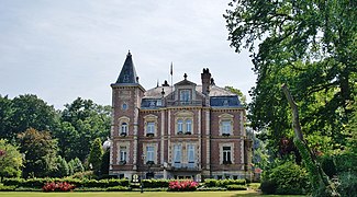
Marquise Town Hall

Windmill in Saint-Martin-au-Laert, municipality of Saint-Martin-lez-Tatinghem

View of the Cathedral of Saint-Omer
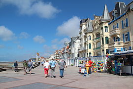
Waterfront in Wimereux


.JPG)
.jpg)
.JPG)


landscape
The park impresses with an overwhelming landscape facade by the sea, especially in the area of the Territoire des Deux-Caps . Inland, bocage landscapes alternate with valleys, which are lined with limestone rocks and extend to a number of wetlands , such as. B. the Marais Audomarois , which is planned as a biosphere reserve by UNESCO .
Larger forest areas
- Forêt Domianale de Boulogne near Boulogne-sur-Mer ,
- Forêt Domianale de Desvres near Desvres ,
- Forêt Domianale de Tournehem near Tournehem ,
- Forêt Domianale de Guînes near Guînes ,
- Forêt Domianale de Rihoult-Clairmarais near Clairmarais - the area is also called Audomarois , after the 7th century founder Bishop Audomar , who is buried in the cathedral of Saint-Omer .
River valleys
Special attractions
- Côte d'Opale , coastal strip between Boulogne-sur-Mer and Calais ,
- Cap Gris-Nez , gray headland between Boulogne-sur-Mer and Calais,
- Cap Blanc-Nez , white headland south of Calais,
- Collines du Boulonnais , rolling hills of the Boulonnais
- Réserve naturelle nationale des Grottes et des Pelouses d'Acquin-Westbécourt et des Côteaux de Wavrans-sur-l'Aa , nature reserve near Lumbres ,
- Réserve naturelle nationale des Étangs du Romelaëre , nature reserve with many lakes northeast of Saint-Omer .
gallery

Stately beech tree in the Forêt Domaniale de Desvres

In the Audomarois

Forêt domaniale de Tournehem

The mouth of the Slack at Ambleteuse

The liana at Hesdigneul-lès-Boulogne

The Aa at Blendecques

Cote d'Opale

Cap Gris-Nez

Cap Blanc-Nez

Bocage landscape in the hills of the Boulonnais

Grotto in Acquin-Westbécourt

Étangs du Romelaëre lake district


.JPG)


.jpg)
See also
Web links
- Natural park website (French)