List of municipalities in the Kitzbühel district
The list of municipalities in the Kitzbühel district includes all political communities in the Tyrolean Kitzbühel district . The Kitzbühel district consists of a total of 20 communities in which 64,168 people (all population figures as of January 1, 2020) have their main residence. In relation to the area of the district with 1,162.25 square kilometers , this results in a population density of around 24 inhabitants per square kilometer.
The district of Kitzbühel is the third smallest district in Tyrol and has the smallest number of municipalities in Tyrol with 20 municipalities (with the exception of the statutory city of Innsbruck). Of the 20 municipalities, only the district capital Kitzbühel has town charter; there are also three market municipalities: Fieberbrunn , Hopfgarten im Brixental and St. Johann in Tirol .
The largest municipality in the Kitzbühel district, measured by its population, is the market town of St. Johann in Tirol with 9,547 inhabitants. The counterpart in terms of population is the community of St. Jakob in Haus with 795 inhabitants. The largest municipality in terms of area is Hopfgarten im Brixental with a municipality area of 166.33 km². The municipality with the smallest area in the district is the municipality of St. Jakob in Haus with a municipality area of just 9.6 km².
Municipalities in the Kitzbühel district
The commune names given are the official names of the communes used by the communes, as determined by state law.
The population figures (EWZ) and the population densities calculated from them (inhabitants / km²) refer to publications by Statistics Austria as of January 1, 2020; these are exclusively registered main residences .
The municipal areas and the names of the cadastral municipalities are taken from the current lists of the Federal Office for Metrology and Surveying (BEV) .
| local community | coat of arms | height | EWZ | surface | EW / km² | Cadastral communities | image |
|---|---|---|---|---|---|---|---|
| Aurach near Kitzbühel |

|
846 m | 1,116 | 54.21 km² | 21st | - Aurach | |
| Brixen im Thale |

|
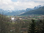
794 m | 2,639 | 31.36 km² | 84 | - Brixen im Thale |
|
| Fieberbrunn |

|
790 m | 4,333 | 76.27 km² | 57 | - Fieberbrunn |

|
| Going at the Wilder Kaiser |

|
772 m | 1,884 | 20.55 km² | 92 | - Going |

|
| Hochfilzen |

|
959 m | 1,243 | 32.66 km² | 38 | - Hochfilzen |

|
| Hopfgarten in Brixental |

|
622 m | 5,630 | 166.33 km² | 34 | - Hopfgarten Land - Hopfgarten Market |

|
| Itter |

|
703 m | 1,177 | 10.42 km² | 113 | - Itter |

|
| Jochberg |

|
923 m | 1,519 | 87.79 km² | 17th | - Jochberg |

|
| Kirchberg in Tyrol |

|
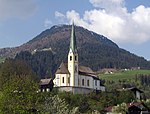
837 m | 5,230 | 97.73 km² | 54 | - Kirchberg |
|
| Kirchdorf in Tirol |

|
641 m | 3,975 | 113.69 km² | 35 | - Church Village |

|
| Kitzbühel |

|
762 m | 8,225 | 57.97 km² | 142 | - Kitzbühel Land - Kitzbühel City |

|
| Kössen |

|
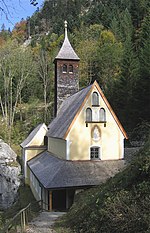
589 m | 4,426 | 69.29 km² | 64 | - Kössen |
|
| Oberndorf in Tyrol |

|
687 m | 2,290 | 17.71 km² | 129 | - Oberndorf |

|
| Reith near Kitzbühel |

|
762 m | 1,674 | 15.65 km² | 107 | - Reith near Kitzbühel |
|
| St. Jacob in house |

|
855 m | 795 | 9.6 km² | 83 | - St. Jacob |

|
| St. Johann in Tirol |

|
659 m | 9,547 | 59.08 km² | 162 | - St. Johann in Tirol |

|
| St. Ulrich am Pillersee |

|
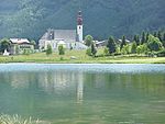
847 m | 1,874 | 51.99 km² | 36 | - Ortisei |
|
| Schwendt |

|
702 m | 857 | 30.83 km² | 28 | - Schwendt |
|
| Waidring |

|
778 m | 2,050 | 63.71 km² | 32 | - Waidring |

|
| Westendorf |

|
783 m | 3,684 | 95.41 km² | 39 | - Westendorf |

|
Former communities of the Kitzbühel district
| Parish name | annotation |
|---|---|
| Hopfgarten Land | Unified on January 1st, 1948 to form the municipality of Hopfgarten im Brixental |
| Hopfgarten market | |
| Kitzbühel Land | united to form the municipality of Kitzbühel |
| Kitzbühel city |
See also
Individual evidence
- ↑ a b c d Statistics Austria - Population at the beginning of 2002–2020 by municipalities (territorial status 01/01/2020) - Status 01 January 2020
- ↑ Tyrolean Municipal Code 2001 - TGO
- ↑ a b Free BEV products (Static Link)
- ↑ Statistics Austria , Directory 2001 - Tyrol
- ↑ Calculation based on the number of inhabitants
