List of municipalities in the Wörgl urban region
The urban region of Wörgl is an Austrian agglomeration in Tyrol . The region consists of the core zone (code: SR251) and the outer zone (code: SR252) .
History of the classification
The delimitation of the urban regions (urban centers) was carried out by Statistics Austria for 1971 to 2001 every 10 years. For the reference date October 31, 2013, delimitation was carried out for the first time according to the urban-rural typology developed by Statistics Austria for statistical purposes , which integrates the delimitation of the city regions.
List of municipalities according to the 2001 delimitation
- The population figures in the lists are from January 1, 2020.
- Regions in the table are Tyrolean planning associations (as of March 2017)
Core zone Wörgl
| local community | location | Ew | km² | Ew / km² | Judicial district | region | Type
|
photo | Metadata |
|---|---|---|---|---|---|---|---|---|---|
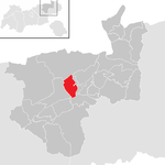
Worgl
|

|
14,059 | 19.68 | 714 | Kufstein | 29 Wörgl and the surrounding area | urban community
|

|
According to code: 70531 |
Angath
|

|
1.006 | 3.49 | 288 | Kufstein | 29 Wörgl and the surrounding area | local community
|

|
Acc. To code: 70502 |
Angerberg
|

|
1,892 | 19.48 | 97 | Rattenberg | 29 Wörgl and the surrounding area | local community
|

|
Acc. To code: 70528 |
Bad Haring
|

|
2,846 | 9.28 | 307 | Kufstein | 29 Wörgl and the surrounding area | local community
|

|
Acc. To code: 70503 |
Kirchbichl
|

|
5,858 | 14.93 | 392 | Kufstein | 29 Wörgl and the surrounding area | local community
|

|
Acc. To code: 70511 |
Mariastein
|

|
448 | 2.38 | 188 | Kufstein | 29 Wörgl and the surrounding area | local community
|

|
Acc. To code: 70516 |
Wörgl outer zone
| local community | location | Ew | km² | Ew / km² | Judicial district | region | Type
|
photo | Metadata |
|---|---|---|---|---|---|---|---|---|---|
Breitenbach am Inn
|

|
3,455 | 37.97 | 91 | Rattenberg | 29 Wörgl and the surrounding area | local community
|

|
According to code: 70505 |
See also
Web links
Individual evidence
- ↑ Classifications according to urban and rural areas . STATISTICS AUSTRIA. Retrieved July 18, 2019.