List of cultural monuments in Bad Blankenburg
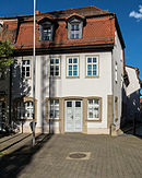
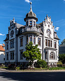
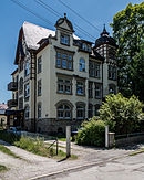
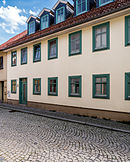
The list of cultural monuments in Bad Blankenburg contains all the cultural monuments of the Thuringian city of Bad Blankenburg (district of Saalfeld-Rudolstadt) and its districts (as of February 12, 2013).
Bad Blankenburg
- Monument ensemble
| image | location | Official name | description |
|---|---|---|---|

|
Location 50 ° 41 ′ 3 ″ N, 11 ° 15 ′ 49 ″ E |
Monument ensemble "Stadtkern Bad Blankenburg" within the former city wall |
- Individual monuments
| image | location | Official name | description |
|---|---|---|---|

|
On the west, north and east borders of the old town 50 ° 41 ′ 6 "N, 11 ° 15 ′ 38" E |
Remains of the city wall | |

|
Am Eichwald 20 50 ° 40 ′ 46 ″ N, 11 ° 16 ′ 46 ″ E |
State "Friedrich Froebel" high school | |

|
On the Mount of Olives 50 ° 41 ′ 2 ″ N, 11 ° 16 ′ 3 ″ E |
Memorial stone "Death March of the Buchenwald prisoners" | |

|
Apostelgasse 1 50 ° 41 ′ 3 ″ N, 11 ° 15 ′ 51 ″ E |
Rococo door jambs / part of the monument ensemble "Stadtkern Bad Blankenburg" | |

|
Bahnhofstrasse 27 50 ° 40 ′ 59 ″ N, 11 ° 16 ′ 24 ″ E |
Residential and commercial building | |

|
Bahnhofstrasse 29 50 ° 40 ′ 59 ″ N, 11 ° 16 ′ 26 ″ E |
Residential and commercial building | |

|
Bahnhofstrasse 34 50 ° 40 ′ 58 ″ N, 11 ° 16 ′ 17 ″ E |
Post office | |

|
Bahnhofstrasse 38 50 ° 40 ′ 58 ″ N, 11 ° 16 ′ 23 ″ E |
Former Station hotel | |

|
Bähringstrasse 4 50 ° 40 ′ 58 ″ N, 11 ° 15 ′ 52 ″ E |
State Regular school "Geschwister Scholl" | |

|
Bähringstrasse 6 50 ° 40 ′ 59 ″ N, 11 ° 15 ′ 54 ″ E |
Kindergarten (Froebelhaus) | |

|
Bähringstrasse 7 50 ° 40 ′ 59 ″ N, 11 ° 15 ′ 58 ″ E |
Residential building | |

|
Bähringstrasse 11 50 ° 40 ′ 59 ″ N, 11 ° 16 ′ 1 ″ E |
Residential building | |

|
Esplanade 50 ° 41 ′ 8 ″ N, 11 ° 15 ′ 55 ″ E |
Anna von Weling's grave site | |

|
Esplanade 10 50 ° 41 ′ 9 ″ N, 11 ° 15 ′ 46 ″ E |
Conference hall of the German Evangelical Alliance | |

|
Froebelstrasse 7 50 ° 40 ′ 50 ″ N, 11 ° 16 ′ 9 ″ E |
Residential house (Villa "Roseneck") | |

|
Georgstrasse 16 50 ° 40 ′ 50 ″ N, 11 ° 16 ′ 4 ″ E |
Residential building | |

|
Goetheweg 11 50 ° 40 ′ 40 ″ N, 11 ° 15 ′ 55 ″ E |
Villa "Goldeck" with property | |

|
Goetheweg 12 50 ° 40 ′ 37 ″ N, 11 ° 15 ′ 56 ″ E |
Residential building | |

|
Goetheweg 16 50 ° 40 ′ 38 ″ N, 11 ° 15 ′ 58 ″ E |
Residential building | |

|
Greifensteinstrasse 3 50 ° 41 ′ 25 ″ N, 11 ° 15 ′ 46 ″ E |
Greifenstein Castle | |

|
Griesbachstrasse 2 50 ° 41 ′ 1 ″ N, 11 ° 15 ′ 41 ″ E |
City mill with equipment | |

|
Heinrich-Heine-Strasse 4 50 ° 40 ′ 37 ″ N, 11 ° 16 ′ 8 ″ E |
Residential building | |

|
Johannisgasse 50 ° 41 ′ 6 ″ N, 11 ° 15 ′ 40 ″ E |
Laufbrunnen (Johannisgasse / corner of Obere Marktstraße) / part of the monument ensemble "Stadtkern Bad Blankenburg" | |

|
Johannisgasse 2 50 ° 41 ′ 5 ″ N, 11 ° 15 ′ 49 ″ E |
Residential and commercial building with courtyard development / part of the monument ensemble "Stadtkern Bad Blankenburg" | |

|
Johannisgasse 4 50 ° 41 ′ 7 ″ N, 11 ° 15 ′ 50 ″ E |
"House above the cellar" ( Froebel Museum ) / part of the monument ensemble "Stadtkern Bad Blankenburg" | |

|
Johannisgasse 38 50 ° 41 ′ 6 ″ N, 11 ° 15 ′ 40 ″ E |
Residential building with courtyard gate / part of the monument ensemble "Stadtkern Bad Blankenburg" | |

|
Kirchplatz 50 ° 41 ′ 5 ″ N, 11 ° 15 ′ 51 ″ E |
City church with equipment / part of the monument ensemble "Stadtkern Bad Blankenburg" | |

|
Markt 1 50 ° 41 ′ 3 ″ N, 11 ° 15 ′ 50 ″ E |
Town hall / part of the monument ensemble "Stadtkern Bad Blankenburg" | |

|
Obere Marktstrasse 8 50 ° 41 ′ 5 ″ N, 11 ° 15 ′ 46 ″ E |
Residential and commercial building (Café Lösche) / part of the monument ensemble "Stadtkern Bad Blankenburg" | |

|
Obere Marktstrasse 22 50 ° 41 ′ 6 ″ N, 11 ° 15 ′ 41 ″ E |
Residential and commercial building / part of the monument ensemble "Stadtkern Bad Blankenburg" | |

|
Pestalozzistraße 28 50 ° 40 ′ 48 ″ N, 11 ° 16 ′ 1 ″ E |
Catholic church with furnishings as well as parish and parish hall | |

|
Schillerstrasse 5 50 ° 40 ′ 43 ″ N, 11 ° 16 ′ 1 ″ E |
Residence Dr. med. Helmut Steuer | |

|
Schwarzburger Strasse 50 ° 40 ′ 23 ″ N, 11 ° 15 ′ 55 ″ E |
Weir in the Schwarza (Chrysoprase Weir) | |

|
Schwarzburger Strasse 50 ° 40 ′ 51 ″ N, 11 ° 16 ′ 14 ″ E |
Froebel monument | |

|
Schwarzburger Strasse 10 50 ° 40 ′ 47 ″ N, 11 ° 16 ′ 14 ″ E |
Residential house with hall extension, coach house, property and enclosure (Villa Schönau) | |

|
Schwarzburger Strasse 13 50 ° 40 ′ 44 ″ N, 11 ° 16 ′ 13 ″ E |
Villa Vollrath with property and enclosure | |

|
Schwarzburger Strasse 18 50 ° 40 ′ 37 ″ N, 11 ° 16 ′ 12 ″ E |
Residential house with outbuildings, land and fencing | |

|
Untere Marktstrasse 22 50 ° 41 ′ 3 ″ N, 11 ° 15 ′ 57 ″ E |
Homestead / part of the monument ensemble "Stadtkern Bad Blankenburg" | |

|
Untere Mauergasse 37/39 50 ° 41 ′ 2 ″ N, 11 ° 15 ′ 50 ″ E |
Sundial / part of the monument ensemble "Stadtkern Bad Blankenburg" | |

|
Wirbacher Strasse 10 50 ° 40 ′ 30 ″ N, 11 ° 16 ′ 29 ″ E |
Former Grandstand building of the state sports school | |

|
Zeigerheimer Weg 50 ° 41 ′ 5 ″ N, 11 ° 16 ′ 1 ″ E |
Former Plague cemetery / grave of Wilhelmine Froebel (?) |
Böhl disks
- Individual monuments
| image | location | Official name | description |
|---|---|---|---|

|
South. from Böhlplatten on the steep slope 50 meters above the L 1112 50 ° 40 ′ 4 ″ N, 11 ° 13 ′ 52 ″ E |
Environmental information and nature conservation station "Dr. Helmut Steuer" | Slate quarries with tunnels etc. |

|
Center 50 ° 40 ′ 26 ″ N, 11 ° 14 ′ 6 ″ E |
Church with equipment | |

|
Böhl disks 12 50 ° 40 ′ 24 ″ N, 11 ° 14 ′ 4 ″ O |
Homestead |
Cordobang
- Individual monuments
| image | location | Official name | description |
|---|---|---|---|

|
Center 50 ° 40 ′ 16 ″ N, 11 ° 12 ′ 24 ″ E |
Church with equipment |
Grossgölitz
- Individual monuments
| image | location | Official name | description |
|---|---|---|---|

|
Muschelkalkhang above Großgölitz 50 ° 42 ′ 22 ″ N, 11 ° 14 ′ 8 ″ E |
Monument "Froebel-Blick" | |

|
On the eastern outskirts 50 ° 42 ′ 19 ″ N, 11 ° 13 ′ 28 ″ E |
Cemetery with enclosure | |

|
On the eastern outskirts 50 ° 42 ′ 19 ″ N, 11 ° 13 ′ 28 ″ E |
So-called. Schäferhaus (near the church) | |

|
On the eastern outskirts 50 ° 42 ′ 19 ″ N, 11 ° 13 ′ 28 ″ E |
Church with equipment | |

|
Großgölitz 1c 50 ° 42 ′ 19 ″ N, 11 ° 13 ′ 20 ″ E |
So-called. Parish hall | |

|
Großgölitz 14 50 ° 42 ′ 20 ″ N, 11 ° 13 ′ 25 ″ E |
Residential building |
Kleingölitz
- Individual monuments
| image | location | Official name | description |
|---|---|---|---|
|
50 ° 41 ′ 56 ″ N, 11 ° 14 ′ 19 ″ E |
Sandstone quarry (with column blank) | ||

|
Kleingölitz 50 ° 41 ′ 55 ″ N, 11 ° 14 ′ 44 ″ O |
Church of St. Nicolai with furnishings |
Oberwirbach
- Individual monuments
| image | location | Official name | description |
|---|---|---|---|

|
Oberwirbach 50 ° 39 ′ 5 ″ N, 11 ° 16 ′ 32 ″ E |
Church with equipment | St. Bartholomew's village church |
Watzdorf
- Individual monuments
| image | location | Official name | description |
|---|---|---|---|

|
Location 50 ° 41 ′ 23 ″ N, 11 ° 14 ′ 6 ″ E |
Church with equipment | |

|
Local road 8 50 ° 41 ′ 28 ″ N, 11 ° 14 ′ 21 ″ E |
Darre (small building on a slope) | |

|
Local road 35 50 ° 41 ′ 22 ″ N, 11 ° 14 ′ 10 ″ E |
Homestead | |

|
Watzdorf 13 50 ° 41 ′ 32 ″ N, 11 ° 14 ′ 9 ″ E |
Residential building | |

|
Watzdorf 14 50 ° 41 ′ 30 ″ N, 11 ° 14 ′ 14 ″ E |
Brewery (with brewhouse, machine hall with technical equipment) | |

|
Watzdorf 15 50 ° 41 ′ 29 ″ N, 11 ° 14 ′ 15 ″ E |
Residential building (of the former brewery administrator) |
Pointer home
- Monument ensemble
| image | location | Official name | description |
|---|---|---|---|

|
Zeigerheim 1 - 24 50 ° 42 ′ 3 ″ N, 11 ° 17 ′ 51 ″ E |
Monument ensemble "Location Zeigerheim" |
- Individual monuments
| image | location | Official name | description |
|---|---|---|---|

|
Hilltop northeast of Zeigerheim 50 ° 42 ′ 16 ″ N, 11 ° 18 ′ 23 ″ E |
Geschwister-Scholl-Tower (formerly Bismarck Tower) | |

|
Center 50 ° 42 ′ 3 ″ N, 11 ° 17 ′ 46 ″ E |
Church with furnishings, churchyard and enclosure / part of the monument ensemble "Ortlage Zeigerheim" | |

|
Zeigerheim 4 50 ° 42 ′ 2 ″ N, 11 ° 17 ′ 48 ″ E |
Shepherd's house / part of the monument ensemble "Ortlage Zeigerheim" | |

|
Zeigerheim 12 50 ° 42 ′ 6 ″ N, 11 ° 17 ′ 55 ″ E |
Homestead / part of the monument ensemble "Ortlage Zeigerheim" |
source
- Thuringian State Office for Monument Preservation: List of monuments of the district of Saalfeld-Rudolstadt (PDF; 632 kB)
Web links
Commons : Cultural monuments in Bad Blankenburg - collection of images, videos and audio files

