List of cultural monuments in Königsee
In the list of cultural monuments in Königsee , all cultural monuments of the Thuringian city of Königsee (district of Saalfeld-Rudolstadt) and its districts are listed (status: February 12, 2013).
Barigau
- Individual monuments
| image | location | Official name | description |
|---|---|---|---|

|
location | Barigauer tower | |

|
Barigau 31 ( location ) | Residential building | |

|
Barigau 34 ( location ) | Residential building |
Dörnfeld an der Heide
- Individual monuments
| image | location | Official name | description |
|---|---|---|---|

|
On the B 88 between Dörnfeld ad Heide and Pennewitz 50 ° 39 ′ 37 ″ N, 11 ° 3 ′ 53 ″ E |
State emblem (sovereign stone) of the Principality of Schwarzburg-Rudolstadt on the B 88 between Dörnfeld ad Heide and Pennewitz | |

|
Dörnfeld 14 50 ° 39 ′ 47 ″ N, 11 ° 4 ′ 24 ″ E |
Church with fittings and bell house | |

|
Dörnfeld 15 50 ° 39 ′ 47 ″ N, 11 ° 4 ′ 23 ″ E |
Former Rectory with barn | |

|
Dörnfeld 20 50 ° 39 ′ 49 ″ N, 11 ° 4 ′ 20 ″ E |
Gasthaus "Tiroler Hof" | |

|
Dörnfeld 78 50 ° 39 ′ 52 ″ N, 11 ° 4 ′ 23 ″ E |
Wappenstein at the former manor house |
Egelsdorf
- Individual monuments
| image | location | Official name | description |
|---|---|---|---|
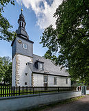
|
Kirchgasse location |
Church with equipment |
Cooking seat
- Individual monuments
| image | location | Official name | description |
|---|---|---|---|
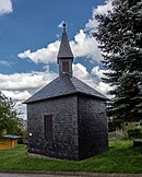
|
On the north-western outskirts 50 ° 39 ′ 2 ″ N, 11 ° 4 ′ 30 ″ E |
Bell house with equipment |
Hengelbach
- Individual monuments
| image | location | Official name | description |
|---|---|---|---|

|
On the southern outskirts 50 ° 43 '23 "N, 11 ° 6' 36" E |
Church with equipment |
Horba
- Individual monuments
| image | location | Official name | description |
|---|---|---|---|

|
On the southern outskirts 50 ° 40 ′ 47 ″ N, 11 ° 7 ′ 28 ″ E |
Church with furnishings, cemetery, enclosure and war memorial | |
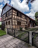
|
Horba 55 50 ° 40 ′ 52 ″ N, 11 ° 7 ′ 26 ″ E |
Outbuilding (barn) | |

|
Horba 59 50 ° 40 ′ 52 ″ N, 11 ° 7 ′ 29 ″ E |
sundial |
Koenigsee
Monument ensemble
| image | location | Official name | description |
|---|---|---|---|

|
Town center 50 ° 39 ′ 43 ″ N, 11 ° 5 ′ 49 ″ E |
Monument ensemble "City center Königsee" |
Individual monuments
| image | location | Official name | description |
|---|---|---|---|

|
Old town 50 ° 39 ′ 44 ″ N, 11 ° 5 ′ 59 ″ E |
Catholic Church (Friedenskirche) | |
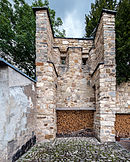
|
On the wall 50 ° 39 ′ 47 ″ N, 11 ° 5 ′ 47 ″ E |
City fortifications / part of the monument ensemble "Stadtkern Königsee" | |

|
Bahnhofstrasse 1 50 ° 39 ′ 43 ″ N, 11 ° 6 ′ 1 ″ E |
Elementary school (Goethe school) with first extension | The construction of a new school was only approved on April 9, 1886. The most important construction work should be completed by June 1, 1887. With enough building materials and a large workforce, mostly local craftsmen, the school could be completed on October 18, 1887. |

|
Bahnhofstrasse 5, 5a, 5b 50 ° 39 ′ 41 ″ N, 11 ° 6 ′ 0 ″ E |
Factory building Otto Bock | |
|
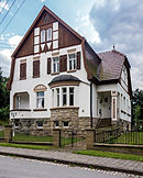
Dr.-Dinkler-Allee 5 50 ° 39 ′ 49 ″ N, 11 ° 5 ′ 44 ″ E |
Residential building | |

|
Gartenstrasse 2 50 ° 39 ′ 45 ″ N, 11 ° 6 ′ 10 ″ E |
Residential house with land and fencing | |

|
Gehrener Strasse 8 50 ° 39 ′ 39 ″ N, 11 ° 5 ′ 36 ″ E |
villa | |

|
Gehrener Strasse 9 50 ° 39 ′ 37 ″ N, 11 ° 5 ′ 39 ″ E |
Residential and commercial building with garden | |

|
Hainstrasse 4 50 ° 39 ′ 38 ″ N, 11 ° 5 ′ 46 ″ E |
Residential building | |

|
Kirchplatz 50 ° 39 ′ 43 ″ N, 11 ° 5 ′ 40 ″ E |
Evangelical Church (City Church) | |

|
Old town 50 ° 39 ′ 44 ″ N, 11 ° 5 ′ 59 ″ E |
Cemetery: Mortuary | |

|
Old town 50 ° 39 ′ 44 ″ N, 11 ° 5 ′ 58 ″ E |
Cemetery: celebration hall (northwest of the morgue) | |

|
Old town 50 ° 39 ′ 47 ″ N, 11 ° 6 ′ 0 ″ E |
Cemetery: two cast iron grave crosses belonging to the Bauer family | |

|
Old town 50 ° 39 ′ 47 ″ N, 11 ° 6 ′ 0 ″ E |
Cemetery: Gravesite of the Dinkler family | |

|
Old town 50 ° 39 ′ 47 ″ N, 11 ° 6 ′ 1 ″ E |
Cemetery: Grave of the von Obstfelder family | |

|
Old town 50 ° 39 ′ 47 ″ N, 11 ° 5 ′ 59 ″ E |
Cemetery: Gravesite of the Riedeler family | |

|
Old town 50 ° 39 ′ 47 ″ N, 11 ° 6 ′ 0 ″ E |
Cemetery: Schwartz family grave | |

|
Lindenstrasse 9 50 ° 39 ′ 34 ″ N, 11 ° 5 ′ 58 ″ E |
Villa with garden and enclosure / part of the monument ensemble "Stadtkern Königsee" | |

|
Lindenstrasse 12 50 ° 39 ′ 36 ″ N, 11 ° 6 ′ 11 ″ E |
Villa with garden | |

|
Markt 1 50 ° 39 ′ 41 ″ N, 11 ° 5 ′ 50 ″ E |
Town hall / part of the monument ensemble "Stadtkern Königsee" | |

|
Markt 2 50 ° 39 ′ 42 ″ N, 11 ° 5 ′ 52 ″ E |
Former Pharmacy / part of the monument ensemble "Stadtkern Königsee" | |
|
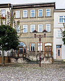
Markt 16 50 ° 39 ′ 42 ″ N, 11 ° 5 ′ 48 ″ E |
Residential building / part of the monument ensemble "Stadtkern Königsee" | |

|
Market 20 50 ° 39 ′ 40 ″ N, 11 ° 5 ′ 49 ″ E |
Former District court / part of the monument ensemble "Stadtkern Königsee" | |

|
Schwarzburger Strasse 2 50 ° 39 ′ 41 ″ N, 11 ° 5 ′ 52 ″ E |
Residential and commercial building with courtyard development and property / part of the monument ensemble "Stadtkern Königsee" | |

|
Wilhelm-Pieck-Strasse 2 50 ° 39 ′ 41 ″ N, 11 ° 5 ′ 48 ″ E |
Residential and administrative building / part of the monument ensemble "Stadtkern Königsee" |
Leutnitz
- Individual monuments
| image | location | Official name | description |
|---|---|---|---|

|
Leutnitz 1 50 ° 41 ′ 45 ″ N, 11 ° 12 ′ 32 ″ E |
Residential building | |

|
Leutnitz 10 50 ° 41 ′ 44 ″ N, 11 ° 12 ′ 36 ″ E |
Residential building |
Lichta
- Individual monuments
| image | location | Official name | description |
|---|---|---|---|

|
Industrial and commercial park 3 50 ° 39 ′ 59 ″ N, 11 ° 7 ′ 15 ″ E |
villa | |

|
Lichta 28 50 ° 39 ′ 24 ″ N, 11 ° 7 ′ 17 ″ E |
Homestead |
Mankenbach
- Individual monuments
Milbitz near Rottenbach
- Individual monuments
| image | location | Official name | description |
|---|---|---|---|

|
Schulgasse 50 ° 41 ′ 39 ″ N, 11 ° 8 ′ 22 ″ E |
Church with furnishings and historical tombstones | |

|
Local road 22 50 ° 41 ′ 43 ″ N, 11 ° 8 ′ 17 ″ E |
Outbuildings |
Oberhain
- Individual monuments
| image | location | Official name | description |
|---|---|---|---|

|
At the upper end of town | Church with equipment | |

|
At the rectory | Running fountain | |

|
Oberhain 12 | Rectory | |

|
London 50 | Residential building |
Oberköditz
- Individual monuments
| image | location | Official name | description |
|---|---|---|---|

|
Hillside location on the southern outskirts 50 ° 39 ′ 56 ″ N, 11 ° 8 ′ 15 ″ E |
Cemetery chapel with fittings and outside staircase | |

|
Main Street 22 50 ° 40 ′ 11 ″ N, 11 ° 7 ′ 27 ″ E |
Factory owner's villa with outbuildings, garden and enclosure |
Paulinzella
- Individual monuments
| image | location | Official name | description |
|---|---|---|---|

|
On the L1114 at the fish pond 50 ° 41 ′ 48 ″ N, 11 ° 7 ′ 2 ″ E |
Smokehouse by the fish ponds | |

|
Center of the village in the valley near the monastery 50 ° 42 ′ 11 ″ N, 11 ° 6 ′ 12 ″ E |
Interest floor | |

|
North-east about 800 m in the forest 50 ° 42 ′ 18 ″ N, 11 ° 6 ′ 47 ″ E |
Mönchsbrunnen in the Pechstal | |

|
On the hiking trail towards Singen 50 ° 42 ′ 7 ″ N, 11 ° 6 ′ 4 ″ E |
Railway viaduct | |

|
Paulinzella station 1 50 ° 42 ′ 4 ″ N, 11 ° 6 ′ 22 ″ E |
Railway station (station complex with reception building and tool shed) | |
| Cemetery 50 ° 42 ′ 6 ″ N, 11 ° 6 ′ 18 ″ E |
Cemetery, gravesite Schulze / Dr. Kalkowsky | ||

|
Paulinzella 1 50 ° 42 ′ 13 ″ N, 11 ° 6 ′ 20 ″ E |
Forest house with stable and seed barn | |

|
Paulinzella 1a 50 ° 42 ′ 14 ″ N, 11 ° 6 ′ 16 ″ E |
Cellar house of the old forester's house | |

|
Paulinzella 2 50 ° 42 ′ 10 ″ N, 11 ° 6 ′ 17 ″ E |
Office building | |

|
Paulinzella 3 50 ° 42 ′ 9 ″ N, 11 ° 6 ′ 15 ″ E |
Hunting lodge | |

|
Paulinzella 8 50 ° 42 ′ 8 ″ N, 11 ° 6 ′ 13 ″ E |
Inn | |

|
Paulinzella 8a 50 ° 42 ′ 7 ″ N, 11 ° 6 ′ 13 ″ E |
Residential and guest house with outbuildings | |

|
Paulinzella 15 50 ° 42 ′ 9 ″ N, 11 ° 6 ′ 2 ″ E |
Home of the Schulze organ building family | |

|
Paulinzella 17 50 ° 42 ′ 9 ″ N, 11 ° 6 ′ 5 ″ E |
Residential building |
Quittelsdorf
- Individual monuments
| image | location | Official name | description |
|---|---|---|---|

|
B88, K128 direction Fröbitz 50 ° 41 ′ 30 ″ N, 11 ° 11 ′ 53 ″ E |
Vault bridge over the Königseer Rinne | |

|
Hillside location north of the village 50 ° 41 ′ 35 ″ N, 11 ° 11 ′ 56 ″ E |
Church with equipment | |

|
Quittelsdorf 6 50 ° 41 ′ 32 ″ N, 11 ° 11 ′ 53 ″ E |
Guest house with outbuildings | |

|
Quittelsdorf 8 50 ° 41 ′ 34 ″ N, 11 ° 11 ′ 54 ″ E |
Rectory | |
|
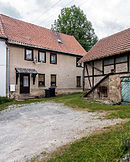
Quittelsdorf 23 50 ° 41 ′ 24 ″ N, 11 ° 11 ′ 56 ″ E |
Homestead | |

|
Quittelsdorf 31 50 ° 41 ′ 23 ″ N, 11 ° 11 ′ 49 ″ E |
Homestead |
Rottenbach
- Individual monuments
| image | location | Official name | description |
|---|---|---|---|

|
Rudolstädter Strasse 50 ° 41 ′ 18 ″ N, 11 ° 9 ′ 53 ″ E |
Full barrier / part of the entity "Oberweißbacher Berg- und Schwarzatalbahn railway line" | |

|
At the station 3 platform 50 ° 41 ′ 23 ″ N, 11 ° 10 ′ 20 ″ E |
Track / part of the entity "Oberweißbacher Berg- und Schwarzatalbahn railway line" | |

|
At the station 3, Schwarzatalbahn junction 50 ° 41 ′ 21 ″ N, 11 ° 10 ′ 4 ″ E |
Track / part of the entity "Oberweißbacher Berg- und Schwarzatalbahn railway line" | |

|
At Kirchplatz 50 ° 41 ′ 21 ″ N, 11 ° 9 ′ 50 ″ E |
Church with equipment | |

|
At the station 3 50 ° 41 ′ 19 ″ N, 11 ° 9 ′ 54 ″ E |
Signal box building / part of the entity "Oberweißbacher Berg- und Schwarzatalbahn" | |

|
At the station 3 50 ° 41 ′ 21 ″ N, 11 ° 10 ′ 12 ″ E |
Rottenbach station / part of the entity "Oberweißbacher Berg- und Schwarzatalbahn" | |

|
Bechstedter Weg 50 ° 41 ′ 17 ″ N, 11 ° 9 ′ 54 ″ E |
Memorial stone "Path of suffering of the Buchenwald prisoners" | |

|
Rudolstädter Strasse 2 50 ° 41 ′ 22 ″ N, 11 ° 10 ′ 24 ″ E |
Former Railway house with toilet building / part of the collective "Oberweißbacher Berg- und Schwarzatalbahn railway line" | |

|
Rudolstädter Strasse 4 50 ° 41 ′ 22 ″ N, 11 ° 10 ′ 23 ″ E |
Former Railway house with toilet building / part of the collective "Oberweißbacher Berg- und Schwarzatalbahn railway line" | |

|
Rudolstädter Strasse 8 50 ° 41 ′ 21 ″ N, 11 ° 10 ′ 21 ″ E |
barn | |

|
Rudolstädter Strasse 14 50 ° 41 ′ 20 ″ N, 11 ° 10 ′ 17 ″ E |
Homestead | |
|
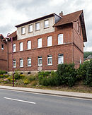
Rudolstädter Strasse 24 and 26 50 ° 41 ′ 19 ″ N, 11 ° 10 ′ 12 ″ E |
Two former railway workers' houses, each with a toilet building / part of the collective "Oberweißbacher Berg- und Schwarzatalbahn railway line" | |

|
Rudolstädter Strasse 28 50 ° 41 ′ 19 ″ N, 11 ° 10 ′ 10 ″ E |
Former Workers' house / part of the entity "Oberweißbacher Berg- und Schwarzatalbahn railway line" | |
|
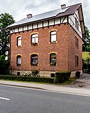
Rudolstädter Strasse 30 50 ° 41 ′ 19 ″ N, 11 ° 10 ′ 9 ″ E |
Former Workers' house / part of the entity "Oberweißbacher Berg- und Schwarzatalbahn railway line" | |

|
Rudolstädter Strasse 60 50 ° 41 ′ 14 ″ N, 11 ° 9 ′ 38 ″ E |
Residential building |
Solsdorf
- Individual monuments
| image | location | Official name | description |
|---|---|---|---|

|
On the southern outskirts 50 ° 42 ′ 46 ″ N, 11 ° 9 ′ 42 ″ E |
Former Warehouse of the Raiffeisen cooperative | |

|
Bergsporn, center of the village 50 ° 42 ′ 51 ″ N, 11 ° 9 ′ 41 ″ E |
Church with equipment | |

|
Solsdorf 8 50 ° 42 ′ 59 ″ N, 11 ° 9 ′ 43 ″ E |
Residential building | |

|
Solsdorf 58 50 ° 42 ′ 58 ″ N, 11 ° 9 ′ 41 ″ E |
Homestead |
Stork village
- Individual monuments
| image | location | Official name | description |
|---|---|---|---|

|
Storchsdorf 3 50 ° 41 ′ 52 ″ N, 11 ° 9 ′ 51 ″ E |
Homestead | |
|
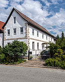
Storchsdorf 10 50 ° 41 ′ 53 ″ N, 11 ° 9 ′ 53 ″ E |
Residential building |
Thälendorf
- Individual monuments
| image | location | Official name | description |
|---|---|---|---|

|
Hillside location on the eastern outskirts 50 ° 43 ′ 1 ″ N, 11 ° 11 ′ 58 ″ E |
Church with equipment | |

|
Thälendorf 12 50 ° 43 ′ 4 ″ N, 11 ° 11 ′ 49 ″ E |
Thälendorf Manor | |

|
Thälendorf 13 50 ° 43 ′ 4 ″ N, 11 ° 11 ′ 51 ″ E |
Homestead | The remains of the former property |

|
Thälendorf 19 50 ° 43 ′ 3 ″ N, 11 ° 11 ′ 55 ″ E |
Homestead | |

|
Thälendorf 21 50 ° 43 ′ 2 ″ N, 11 ° 11 ′ 57 ″ E |
Homestead | |

|
Thälendorf 23 50 ° 43 ′ 2 ″ N, 11 ° 12 ′ 0 ″ E |
Former Rectory | |

|
Thälendorf 25 50 ° 43 ′ 0 ″ N, 11 ° 11 ′ 55 ″ E |
Homestead with a large barn | |

|
Thälendorf 28 50 ° 43 ′ 0 ″ N, 11 ° 11 ′ 52 ″ E |
Guest house with dance hall |
Unterhain
- Individual monuments
| image | location | Official name | description |
|---|---|---|---|

|
Unterhain 2 | Residential building |
Unterköditz
- Individual monuments
| image | location | Official name | description |
|---|---|---|---|

|
Level crossing at the former Köditzberg station in the direction of Allendorf 50 ° 40 ′ 19 ″ N, 11 ° 9 ′ 15 ″ E |
Track / part of the entity "Oberweißbacher Berg- und Schwarzatalbahn railway line" | |

|
Level crossing at the former Köditzberg station in the direction of Rottenbach 50 ° 40 ′ 20 ″ N, 11 ° 9 ′ 16 ″ E |
Track / part of the entity "Oberweißbacher Berg- und Schwarzatalbahn railway line" | |

|
At the western exit of the town 50 ° 40 ′ 14 ″ N, 11 ° 8 ′ 20 ″ E |
Church and belfry |
Unterschöbling
- Individual monuments
| image | location | Official name | description |
|---|---|---|---|

|
Hillside location on the northern outskirts 50 ° 39 '9 "N, 11 ° 6' 40" E |
Church with furnishings, bell house, former cemetery and enclosure | Unterschöbling village church |

|
Below the church 50 ° 39 ′ 8 ″ N, 11 ° 6 ′ 39 ″ E |
Former school | |

|
Unterschöbling 5 50 ° 39 ′ 6 ″ N, 11 ° 6 ′ 38 ″ E |
Residential building | |

|
Unterschöbling 24 50 ° 39 ′ 4 ″ N, 11 ° 6 ′ 35 ″ E |
Homestead |
Web links
Commons : Cultural heritage monuments in Königsee-Rottenbach - Collection of images, videos and audio files
- Thuringian State Office for Monument Preservation: List of monuments of the district of Saalfeld-Rudolstadt (PDF; 632 kB)


