List of cultural monuments in Rudolstadt
The list of cultural monuments in Rudolstadt lists all the cultural monuments of the Thuringian city of Rudolstadt (Saalfeld-Rudolstadt district) and its districts (as of February 12, 2013).
Rudolstadt
Monument ensemble
| image | Street and house number | Monument designation | comment |
|---|---|---|---|
 |
Core city 50 ° 43 ′ 14 ″ N, 11 ° 20 ′ 24 ″ E |
Monument ensemble "core town Rudolstadt" | |
 |
Am Saaldamm 50 ° 43 ′ 7 ″ N, 11 ° 20 ′ 19 ″ E |
Monument ensemble "Am Saaldamm 3, 5, 7, 9 with OdF 1a and 3" | |
 |
Anger 50 ° 43 ′ 6 ″ N, 11 ° 20 ′ 10 ″ E |
Monument ensemble "Anger" with Theater Rudolstadt, artistic director, rehearsal house and technology (Boucher), theater restaurant | |
 |
August-Bebel-Strasse 13-41 50 ° 43 ′ 15 ″ N, 11 ° 19 ′ 58 ″ E |
Monument ensemble “August-Bebel-Straße” 13–41 (odd numbers) with Kreuzstraße 2 | |
 |
Large Meadow 2 50 ° 42 ′ 59 ″ N, 11 ° 20 ′ 28 ″ E |
Monument ensemble folklore museum "Thuringian farmhouses" | |
 |
Heinrich-Heine-Park 50 ° 43 ′ 0 ″ N, 11 ° 20 ′ 22 ″ E |
"Heinrich-Heine-Park" monument ensemble | |
 |
Pushkinstrasse 50 ° 43 ′ 6 ″ N, 11 ° 19 ′ 54 ″ E |
Monument ensemble "Alexander-Puschkin-Straße" 1–7, 4–10 with Schwarzburger Chaussee 11 | |
 |
Schwarzburger Chaussee 32-48 50 ° 42 ′ 59 ″ N, 11 ° 19 ′ 30 ″ E |
Multi-family houses including open spaces, plants and enclosures |
Individual features A – C
| image | Street and house number | Monument designation | comment |
|---|---|---|---|
 |
Albert-Lindner-Strasse 50 ° 43 ′ 8 ″ N, 11 ° 20 ′ 8 ″ E |
Schiller memorial stone | |
 |
Albert-Lindner-Strasse 1 50 ° 43 ′ 6 ″ N, 11 ° 20 ′ 9 ″ E |
Theater building / part of the "Anger" monument ensemble | Rudolstadt Theater |
 |
Alte Straße 1 50 ° 43 ′ 12 ″ N, 11 ° 20 ′ 11 ″ E |
Residential building / part of the monument ensemble "Kernstadt Rudolstadt" | |
 |
Alte Straße 3 50 ° 43 ′ 12 ″ N, 11 ° 20 ′ 11 ″ E |
Residential building / part of the monument ensemble "Kernstadt Rudolstadt" | |
 |
Alte Straße 5 50 ° 43 ′ 12 ″ N, 11 ° 20 ′ 11 ″ E |
Residential building / part of the monument ensemble "Kernstadt Rudolstadt" | |
 |
Alte Straße 6 50 ° 43 ′ 13 ″ N, 11 ° 20 ′ 12 ″ E |
Residential building with plank ceiling / part of the monument ensemble "Kernstadt Rudolstadt" | |
 |
Alte Straße 21 50 ° 43 ′ 14 ″ N, 11 ° 20 ′ 11 ″ E |
Residential building / part of the monument ensemble "Kernstadt Rudolstadt" | |
 |
Alte Straße 23 50 ° 43 ′ 14 ″ N, 11 ° 20 ′ 11 ″ E |
Residential building / part of the monument ensemble "Kernstadt Rudolstadt" | |
 |
Am Anger 3 50 ° 43 ′ 10 ″ N, 11 ° 20 ′ 12 ″ E |
Residential building / part of the monument ensemble "Kernstadt Rudolstadt" | |
 |
Am Anger 5 50 ° 43 ′ 10 ″ N, 11 ° 20 ′ 12 ″ E |
Residential building / part of the monument ensemble "Kernstadt Rudolstadt" | |
| On the embankment |
Sandstone column ??? | It is questionable whether this cultural monument still exists, the responsible UDSB SLF was asked in writing, but does not provide any information. | |
 |
At the gate 50 ° 43 ′ 18 ″ N, 11 ° 20 ′ 34 ″ O |
Crater vase / part of the monument ensemble "Kernstadt Rudolstadt" | |
 |
At gate 1 50 ° 43 ′ 17 ″ N, 11 ° 20 ′ 36 ″ O |
Residential building / part of the monument ensemble "Kernstadt Rudolstadt" | |
 |
At gate 2 50 ° 43 '17 "N, 11 ° 20' 34" O |
Rectory (residential building and rupture) and enclosure / part of the monument ensemble "Rudolstadt core town" | |
 |
On the Pörze 1/3 50 ° 43 ′ 27 ″ N, 11 ° 20 ′ 23 ″ E |
Residential complex of the Heimstätten settlement | |
 |
On the Pörze 38 50 ° 43 ′ 34 ″ N, 11 ° 20 ′ 19 ″ E |
Former Pörzbrauerei: main building (formerly with restaurant, No. 38) | |
 |
On the Pörze 40 50 ° 43 ′ 35 ″ N, 11 ° 20 ′ 17 ″ E |
Former Pörzbrauerei: summer restaurant including a beer garden with grate and enclosure | |
 |
On the Pörze 45 50 ° 43 ′ 32 ″ N, 11 ° 20 ′ 17 ″ E |
Former Pörzbrauerei: Remisen, warehouse and residential buildings | |
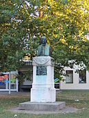 |
Anger 50 ° 43 ′ 6 ″ N, 11 ° 20 ′ 14 ″ E |
Anton summer memorial | |
 |
Anger 1 50 ° 43 ′ 8 ″ N, 11 ° 20 ′ 13 ″ E |
"Boucher" - rehearsal house of the Rudolstadt Theater / part of the "Anger" monument ensemble | |
 |
Anger 4 50 ° 43 ′ 5 ″ N, 11 ° 20 ′ 12 ″ E |
"Park-Restaurant" restaurant | |
 |
Anger 11 50 ° 43 ′ 7 ″ N, 11 ° 20 ′ 10 ″ E |
Former Pörzbierhalle - artistic director of the Rudolstadt Theater / part of the “Anger” monument ensemble | |
 |
Angerstrasse 50 ° 43 ′ 12 ″ N, 11 ° 20 ′ 14 ″ E |
Güntherbrunnen | |
 |
Anton-Sommer-Strasse 1 50 ° 43 ′ 9 ″ N, 11 ° 20 ′ 7 ″ E |
Residential and commercial building (city pharmacy) / part of the monument ensemble "Kernstadt Rudolstadt" | |
 |
Anton-Sommer-Strasse 19 50 ° 43 ′ 9 ″ N, 11 ° 20 ′ 18 ″ E |
Residential building / part of the monument ensemble "Kernstadt Rudolstadt" | |
 |
Anton-Sommer-Strasse 21 50 ° 43 ′ 9 ″ N, 11 ° 20 ′ 19 ″ E |
Residential and commercial building / part of the monument ensemble "Kernstadt Rudolstadt" | |
 |
Anton-Sommer-Strasse 25 50 ° 43 ′ 9 ″ N, 11 ° 20 ′ 20 ″ E |
Residential and commercial building / part of the monument ensemble "Kernstadt Rudolstadt" | |
 |
Anton-Sommer-Strasse 45 50 ° 43 ′ 9 ″ N, 11 ° 20 ′ 31 ″ E |
Residential building with side and rear buildings / memorial plaque for Bertold Sigismund / part of the monument ensemble "Kernstadt Rudolstadt" | |
 |
Anton-Sommer-Strasse 51 50 ° 43 ′ 10 ″ N, 11 ° 20 ′ 33 ″ E |
Residential building with side building / part of the monument ensemble "Kernstadt Rudolstadt" | |
 |
August-Bebel-Strasse 1a 50 ° 43 ′ 5 ″ N, 11 ° 20 ′ 1 ″ E |
Administration building (police inspection) | |
 |
August-Bebel-Strasse 4 50 ° 43 ′ 13 ″ N, 11 ° 19 ′ 59 ″ E |
Villa with hall extension (art and auction house) | |
 |
August-Bebel-Strasse 4a 50 ° 43 ′ 14 ″ N, 11 ° 19 ′ 59 ″ E |
Residential house (formerly "Lengefeldsches Gartenhaus") | |
 |
August-Bebel-Strasse 5/7 50 ° 43 ′ 6 ″ N, 11 ° 19 ′ 59 ″ E |
Residential building | |
 |
August-Bebel-Strasse 13 50 ° 43 ′ 10 ″ N, 11 ° 19 ′ 59 ″ E |
Residential building / part of the monument ensemble "August-Bebel-Straße" | |
 |
August-Bebel-Strasse 17 50 ° 43 ′ 11 ″ N, 11 ° 19 ′ 58 ″ E |
Residential building / part of the monument ensemble "August-Bebel-Straße" | |
 |
August-Bebel-Strasse 19 50 ° 43 ′ 12 ″ N, 11 ° 19 ′ 58 ″ E |
Residential building / part of the monument ensemble "August-Bebel-Straße" | |
 |
August-Bebel-Strasse 21 50 ° 43 ′ 12 ″ N, 11 ° 19 ′ 58 ″ E |
Residential building / part of the monument ensemble "August-Bebel-Straße" | |
 |
August-Bebel-Strasse 23 50 ° 43 ′ 13 ″ N, 11 ° 19 ′ 58 ″ E |
Residential building / part of the monument ensemble "August-Bebel-Straße" | |
 |
August-Bebel-Strasse 27 50 ° 43 ′ 14 ″ N, 11 ° 19 ′ 58 ″ E |
Residential building / part of the monument ensemble "August-Bebel-Straße" | |
 |
August-Bebel-Strasse 29 50 ° 43 ′ 14 ″ N, 11 ° 19 ′ 58 ″ E |
Residential building / part of the monument ensemble "August-Bebel-Straße" | |
 |
August-Bebel-Strasse 31 50 ° 43 ′ 15 ″ N, 11 ° 19 ′ 58 ″ E |
Residential and commercial building / part of the “August-Bebel-Straße” monument ensemble | |
 |
August-Bebel-Strasse 33 50 ° 43 ′ 17 ″ N, 11 ° 19 ′ 57 ″ E |
Residential building / part of the monument ensemble "August-Bebel-Straße" | |
 |
August-Bebel-Strasse 39 50 ° 43 ′ 18 ″ N, 11 ° 19 ′ 57 ″ E |
Residential building / part of the monument ensemble "August-Bebel-Straße" | |

|
Bayreuther Platz 4 50 ° 43 ′ 1 ″ N, 11 ° 19 ′ 25 ″ E |
Former Barracks - "Friedrich Schiller" regular school | |

|
Berthold-Rein-Strasse 16 50 ° 43 ′ 15 ″ N, 11 ° 19 ′ 54 ″ E |
Residential building | |

|
Breitscheidstrasse 1e 50 ° 42 ′ 44 ″ N, 11 ° 19 ′ 11 ″ E |
Railway station building / part of the former factory of Friedrich Adolf Richter & Co., Rudolstadt | |
 |
Burgstrasse 1 50 ° 43 ′ 22 ″ N, 11 ° 20 ′ 35 ″ E |
Ludwigsburg (State Audit Office) | Ludwigsburg Palace, built between 1734 and 1741, is today the seat of the Thuringian State Audit Office. |
 |
Burgstrasse 2 50 ° 43 ′ 19 ″ N, 11 ° 20 ′ 37 ″ E |
Residential and commercial building | |
 |
Burgstrasse 3 50 ° 43 ′ 20 ″ N, 11 ° 20 ′ 41 ″ E |
Former District Court | |

|
Caspar-Schulte-Strasse 50 ° 43 ′ 6 ″ N, 11 ° 19 ′ 30 ″ E |
Berthold Sigismund Monument | |

|
Caspar-Schulte-Strasse 1 50 ° 43 ′ 9 ″ N, 11 ° 19 ′ 59 ″ E |
Post office and enclosure | |

|
Caspar-Schulte-Strasse 1a 50 ° 43 ′ 8 ″ N, 11 ° 19 ′ 53 ″ E |
Catholic church and rectory | |

|
Caspar-Schulte-Strasse 5 50 ° 43 ′ 8 ″ N, 11 ° 19 ′ 47 ″ E |
Residential building | |

|
Caspar-Schulte-Strasse 9 50 ° 43 ′ 8 ″ N, 11 ° 19 ′ 45 ″ E |
Residential building | |

|
Caspar-Schulte-Strasse 10 50 ° 43 ′ 9 ″ N, 11 ° 19 ′ 47 ″ E |
Residential building | |
 |
Caspar-Schulte-Strasse 19 50 ° 43 ′ 7 ″ N, 11 ° 19 ′ 37 ″ E |
Multi-storey rental house | |
 |
Caspar-Schulte-Strasse 22 50 ° 43 ′ 9 ″ N, 11 ° 19 ′ 39 ″ E |
Evangelical Church (Luther Church) with furnishings, property and enclosure | Erected in 1906 by Theodor Quentin |
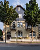 |
Caspar-Schulte-Strasse 35 50 ° 43 ′ 5 ″ N, 11 ° 19 ′ 32 ″ E |
Residential house - Fratzenburg | |
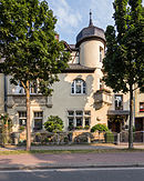 |
Caspar-Schulte-Strasse 37 50 ° 43 ′ 5 ″ N, 11 ° 19 ′ 31 ″ E |
Residential house - onion castle |
Individual features D – L
| image | Street and house number | Monument designation | comment |
|---|---|---|---|
| Debra 50 ° 43 ′ 53 ″ N, 11 ° 21 ′ 13 ″ E |
Debrahof | windmill | |
 |
Debrastrasse 3 50 ° 43 ′ 25 ″ N, 11 ° 20 ′ 34 ″ E |
Middle mill | |

|
Dr.-Wilhelm-Külz-Strasse 2a 50 ° 43 ′ 10 ″ N, 11 ° 19 ′ 49 ″ E |
Residential building | |

|
Dr.-Wilhelm-Külz-Strasse 10 50 ° 43 ′ 13 ″ N, 11 ° 19 ′ 49 ″ E |
Residential building | |

|
Dr.-Wilhelm-Külz-Strasse 16 50 ° 43 ′ 15 ″ N, 11 ° 19 ′ 48 ″ E |
Residential building | |

|
Friedrich-Naumann-Strasse 3 50 ° 43 ′ 16 ″ N, 11 ° 19 ′ 26 ″ E |
House with garden | |

|
Friedrich-Naumann-Strasse 4 / 4a 50 ° 43 ′ 17 ″ N, 11 ° 19 ′ 34 ″ E |
Former Factory owner's villa with outbuildings and gardens | |

|
Friedrich-Naumann-Strasse 5 50 ° 43 ′ 18 ″ N, 11 ° 19 ′ 28 ″ E |
House with garden | |

|
Friedrich-Naumann-Strasse 6 50 ° 43 ′ 17 ″ N, 11 ° 19 ′ 30 ″ E |
House with garden | |

|
Friedrich-Naumann-Strasse 7 50 ° 43 ′ 19 ″ N, 11 ° 19 ′ 29 ″ E |
Residential building | |

|
Gebindstrasse 6 50 ° 43 ′ 15 ″ N, 11 ° 19 ′ 30 ″ E |
Residential building | |

|
Gebindstrasse 8 50 ° 43 ′ 15 ″ N, 11 ° 19 ′ 29 ″ E |
Residential building | |

|
Goethestrasse 55 50 ° 43 ′ 4 ″ N, 11 ° 18 ′ 53 ″ E |
Residential building (former air force casino) | |
 |
Great Avenue 1 50 ° 43 ′ 10 ″ N, 11 ° 20 ′ 5 ″ E |
Sparkasse (former residential building) | |
 |
Great Avenue 8 50 ° 43 ′ 14 ″ N, 11 ° 20 ′ 6 ″ E |
Residential building / part of the monument ensemble "Kernstadt Rudolstadt" | |
 |
Great Avenue 9 50 ° 43 ′ 14 ″ N, 11 ° 20 ′ 5 ″ E |
Residential building | |
 |
Great Avenue 11 50 ° 43 ′ 15 ″ N, 11 ° 20 ′ 3 ″ E |
Villa Ketelhodt | |
 |
Great Avenue 11a 50 ° 43 ′ 14 ″ N, 11 ° 20 ′ 4 ″ E |
Residential building (former annex to No. 11) | |

|
Great Avenue 22 50 ° 43 ′ 18 ″ N, 11 ° 20 ′ 5 ″ E |
Residential building / part of the monument ensemble "Kernstadt Rudolstadt" | |
 |
Große Badergasse 4 50 ° 43 ′ 15 ″ N, 11 ° 20 ′ 30 ″ E |
Residential building / part of the monument ensemble "Kernstadt Rudolstadt" | |
 |
Große Badergasse 16 50 ° 43 ′ 16 ″ N, 11 ° 20 ′ 29 ″ E |
Portal / part of the monument ensemble "Kernstadt Rudolstadt" | |
 |
Große Badergasse 18 50 ° 43 ′ 17 ″ N, 11 ° 20 ′ 29 ″ E |
Residential and commercial building / part of the monument ensemble "Kernstadt Rudolstadt" | |
 |
Heinrich-Heine-Park 50 ° 43 ′ 2 ″ N, 11 ° 20 ′ 21 ″ E |
Memorial of the Rudolstädter Seniors Convent (RSC) including outdoor area / part of the monument ensemble "Heinrich-Heine-Park" | |

|
Behind the wall 50 ° 43 ′ 11 ″ N, 11 ° 20 ′ 28 ″ E |
City wall / part of the monument ensemble "Kernstadt Rudolstadt" | |

|
In Baumgarten 50 ° 43 ′ 30 ″ N, 11 ° 20 ′ 16 ″ E |
Running fountain (between No. 9 and 11) | |

|
In Baumgarten 50 ° 43 ′ 35 ″ N, 11 ° 20 ′ 13 ″ E |
Urn and group of lions | |

|
Im Baumgarten 2–14, 16 50 ° 43 ′ 27 ″ N, 11 ° 20 ′ 21 ″ E |
Heimstätten settlement, Im Baumgarten 2–14.16 / An der Pörze 1.3 (totality) | |

|
Im Baumgarten 3/5 50 ° 43 ′ 28 ″ N, 11 ° 20 ′ 19 ″ E |
Part of the totality of Heimstätten-Siedlung, Im Baumgarten 2–14.16 / An der Pörze 1.3 | |

|
Im Baumgarten 7/9 50 ° 43 ′ 29 ″ N, 11 ° 20 ′ 17 ″ E |
Part of the totality of Heimstätten-Siedlung, Im Baumgarten 2–14.16 / An der Pörze 1.3 | |

|
Im Baumgarten 11/13 50 ° 43 ′ 31 ″ N, 11 ° 20 ′ 16 ″ E |
Part of the totality of Heimstätten-Siedlung, Im Baumgarten 2–14.16 / An der Pörze 1.3 | |

|
Jenaische Strasse 1 50 ° 43 ′ 21 ″ N, 11 ° 20 ′ 46 ″ E |
Bell and inscription | |
 |
Kirchgasse 1 50 ° 43 ′ 17 ″ N, 11 ° 20 ′ 27 ″ E |
Residential building / part of the monument ensemble "Kernstadt Rudolstadt" | |
 |
Kirchgasse 1a 50 ° 43 ′ 17 ″ N, 11 ° 20 ′ 26 ″ E |
Residential building / part of the monument ensemble "Kernstadt Rudolstadt" | |

|
Kirchgasse 10 50 ° 43 ′ 17 ″ N, 11 ° 20 ′ 28 ″ E |
Residential building / part of the monument ensemble "Kernstadt Rudolstadt" | |
 |
Kirchgasse 12 50 ° 43 ′ 17 ″ N, 11 ° 20 ′ 28 ″ E |
Residential building / part of the monument ensemble "Kernstadt Rudolstadt" | |

|
Kirchgasse 14 50 ° 43 ′ 17 ″ N, 11 ° 20 ′ 30 ″ E |
Residential house with courtyard and plot / part of the monument ensemble "Kernstadt Rudolstadt" | |

|
Kirchgasse 16 50 ° 43 ′ 17 ″ N, 11 ° 20 ′ 30 ″ E |
Residential building / part of the monument ensemble "Kernstadt Rudolstadt" | |
 |
Churchyard 50 ° 43 ′ 19 ″ N, 11 ° 20 ′ 35 ″ E |
City church with furnishings / part of the monument ensemble "Kernstadt Rudolstadt" | The town church of St. Andreas is a three-aisled late Gothic hall church with early baroque interior. |
 |
Kirchhof 1 50 ° 43 ′ 18 ″ N, 11 ° 20 ′ 33 ″ E |
Cumbach rectory / part of the monument ensemble "Rudolstadt core town" | |
 |
Kirchhof 3 50 ° 43 ′ 18 "N, 11 ° 20 ′ 35" E |
Residential and administrative building / part of the monument ensemble "Kernstadt Rudolstadt" | |
 |
Kleine Allee 9 50 ° 43 ′ 13 ″ N, 11 ° 19 ′ 56 ″ E |
Residential building | |

|
Kleine Allee 13 50 ° 43 ′ 15 ″ N, 11 ° 19 ′ 55 ″ E |
Residential building | |
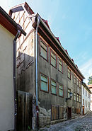 |
Kleine Badergasse 5 50 ° 43 ′ 16 ″ N, 11 ° 20 ′ 31 ″ E |
Residential building / part of the monument ensemble "Kernstadt Rudolstadt" | |

|
Klinghammerstrasse 2 50 ° 43 ′ 4 ″ N, 11 ° 19 ′ 20 ″ E |
Residential building | |

|
Klinghammerstrasse 2b 50 ° 43 ′ 1 ″ N, 11 ° 19 ′ 23 ″ E |
Adjoining building "Friedrich Schiller School" | |
 |
Klinghammerstrasse 8 50 ° 43 ′ 7 ″ N, 11 ° 19 ′ 18 ″ E |
Residential building | |

|
Kreuzstrasse 1 50 ° 43 ′ 14 ″ N, 11 ° 19 ′ 52 ″ E |
Residential building | |

|
Kreuzstrasse 5 50 ° 43 ′ 14 ″ N, 11 ° 19 ′ 51 ″ E |
Residential building | |
|
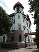
Kreuzstrasse 7 50 ° 43 ′ 14 ″ N, 11 ° 19 ′ 50 ″ E |
Residential building | |

|
Kreuzstrasse 14 50 ° 43 ′ 15 ″ N, 11 ° 19 ′ 49 ″ E |
Residential building | |

|
Lengefeldstrasse 50 ° 43 ′ 23 ″ N, 11 ° 20 ′ 29 ″ E |
Felsenkeller fountain | |

|
Lengefeldstrasse 1 50 ° 43 ′ 21 ″ N, 11 ° 20 ′ 33 ″ E |
Stadtbad | |

|
Lengefeldstrasse 1 50 ° 43 ′ 21 ″ N, 11 ° 20 ′ 33 ″ E |
"Heyßenhof" (residential building) | |
 |
Ludwigstrasse 48 50 ° 43 ′ 18 ″ N, 11 ° 20 ′ 37 ″ E |
Residential and commercial building | |
|
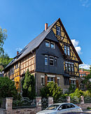
Lutherstrasse 14 50 ° 43 ′ 12 ″ N, 11 ° 19 ′ 34 ″ E |
Villa with enclosure |
Individual monuments M – Sa
| image | Street and house number | Monument designation | comment |
|---|---|---|---|
|
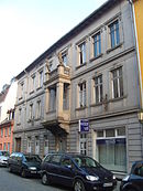
Lackgasse 11 50 ° 43 ′ 15 ″ N, 11 ° 20 ′ 17 ″ E |
Residential and commercial building / part of the monument ensemble "Kernstadt Rudolstadt" | |

|
Market 50 ° 43 ′ 14 "N, 11 ° 20 ′ 24" E |
Market fountain / part of the "Rudolstadt core town" monument ensemble | |

|
Markt 1 50 ° 43 ′ 13 ″ N, 11 ° 20 ′ 22 ″ E |
Residential and commercial building / part of the monument ensemble "Kernstadt Rudolstadt" | |

|
Market 2 50 ° 43 ′ 14 ″ N, 11 ° 20 ′ 22 ″ E |
Residential and commercial building / part of the monument ensemble "Kernstadt Rudolstadt" | |

|
Markt 5 50 ° 43 ′ 15 ″ N, 11 ° 20 ′ 22 ″ E |
Hall of the hotel "Zum Löwen" / part of the monument ensemble "Kernstadt Rudolstadt" | |
 |
Markt 7 50 ° 43 ′ 15 ″ N, 11 ° 20 ′ 24 ″ E |
New town hall / part of the monument ensemble "Kernstadt Rudolstadt" | |

|
Markt 8 50 ° 43 ′ 15 ″ N, 11 ° 20 ′ 26 ″ E |
Basement former residential and commercial building / part of the monument ensemble "Kernstadt Rudolstadt" | |

|
Markt 9 50 ° 43 ′ 14 ″ N, 11 ° 20 ′ 26 ″ E |
Residential and commercial building ("Tuchmacherhaus") / part of the monument ensemble
"Core city Rudolstadt" |
|
|
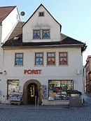
Markt 14 50 ° 43 ′ 13 ″ N, 11 ° 20 ′ 26 ″ E |
Residential and commercial building with portal / part of the monument ensemble "Kernstadt Rudolstadt" | |

|
Markt 17 50 ° 43 ′ 12 ″ N, 11 ° 20 ′ 23 ″ E |
Guest and rest house "Adler" with hall building Mauerstraße 2 / part of the monument ensemble "Kernstadt Rudolstadt" | |

|
Markt 18 50 ° 43 ′ 12 ″ N, 11 ° 20 ′ 22 ″ E |
Residential and commercial building / part of the monument ensemble "Kernstadt Rudolstadt" | |

|
Marktstrasse 8 50 ° 43 ′ 15 ″ N, 11 ° 20 ′ 37 ″ E |
Residential building / part of the monument ensemble "Kernstadt Rudolstadt" | |

|
Marktstrasse 15 50 ° 43 ′ 14 ″ N, 11 ° 20 ′ 34 ″ E |
Residential building / part of the monument ensemble "Kernstadt Rudolstadt" | |

|
Marktstrasse 18 50 ° 43 ′ 15 ″ N, 11 ° 20 ′ 35 ″ E |
Portal / part of the monument ensemble "Kernstadt Rudolstadt" | |

|
Marktstrasse 30 50 ° 43 ′ 14 ″ N, 11 ° 20 ′ 30 ″ E |
Residential and commercial building / part of the monument ensemble "Kernstadt Rudolstadt" | |

|
Marktstrasse 35 50 ° 43 ′ 12 ″ N, 11 ° 20 ′ 19 ″ E |
Residential and commercial building / part of the monument ensemble "Kernstadt Rudolstadt" | |

|
Marktstrasse 45 50 ° 43 ′ 12 ″ N, 11 ° 20 ′ 16 ″ E |
Residential and commercial building / part of the monument ensemble "Kernstadt Rudolstadt" | |

|
Marktstrasse 48 50 ° 43 ′ 13 ″ N, 11 ° 20 ′ 19 ″ E |
Residential and commercial building / part of the monument ensemble "Kernstadt Rudolstadt" | |
 |
Marktstrasse 54 50 ° 43 ′ 13 ″ N, 11 ° 20 ′ 15 ″ E |
District court / part of the monument ensemble "Kernstadt Rudolstadt" | |
 |
Marktstrasse 54 50 ° 43 ′ 13 ″ N, 11 ° 20 ′ 16 ″ E |
Fountain at the district court / part of the monument ensemble "Kernstadt Rudolstadt" | |
 |
Marktstrasse 56 50 ° 43 ′ 12 ″ N, 11 ° 20 ′ 13 ″ E |
Detention center | |
|
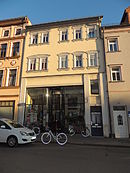
Marktstrasse 57 50 ° 43 ′ 11 ″ N, 11 ° 20 ′ 11 ″ E |
Residential and commercial building | |
|
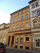
Marktstrasse 58 50 ° 43 ′ 11 ″ N, 11 ° 20 ′ 11 ″ E |
Residential and commercial building / part of the monument ensemble "Kernstadt Rudolstadt" | |

|
Marktstrasse 61 50 ° 43 ′ 11 ″ N, 11 ° 20 ′ 10 ″ E |
Residential and commercial building | |

|
Marktstrasse 63 50 ° 43 ′ 11 ″ N, 11 ° 20 ′ 10 ″ E |
Residential and commercial building | |

|
Marktstrasse 64 50 ° 43 ′ 11 ″ N, 11 ° 20 ′ 6 ″ E |
Residential building | |

|
Marktstrasse 68 50 ° 43 ′ 10 ″ N, 11 ° 20 ′ 3 ″ E |
Residential and commercial building | |

|
Marktstrasse 83 50 ° 43 ′ 8 ″ N, 11 ° 20 ′ 1 ″ E |
Administration building | |

|
Mauerstrasse 50 ° 43 ′ 10 ″ N, 11 ° 20 ′ 23 ″ E |
Hall of the inn "Zum Adler" / part of the monument ensemble "Kernstadt Rudolstadt" | |

|
Mauerstrasse 15 50 ° 43 ′ 10 ″ N, 11 ° 20 ′ 21 ″ E |
Residential and guest house | |

|
Mauerstrasse 19 50 ° 43 ′ 10 ″ N, 11 ° 20 ′ 20 ″ E |
Residential and commercial building | |

|
Mörlaer Strasse 2 50 ° 43 ′ 8 ″ N, 11 ° 19 ′ 27 ″ E |
Former Military hospital | |

|
Mörlaer Strasse 6 50 ° 43 ′ 8 ″ N, 11 ° 19 ′ 23 ″ E |
Residential house with garden and enclosure | |

|
Mörlaer Strasse 8b 50 ° 43 ′ 12 ″ N, 11 ° 19 ′ 20 ″ E |
"Feste Burg" villa and mausoleum | |

|
Mühlgasse 17 50 ° 43 ′ 16 ″ N, 11 ° 20 ′ 45 ″ E |
Under mill | |

|
Neumarkt 1 50 ° 43 ′ 14 ″ N, 11 ° 20 ′ 13 ″ E |
Residential building / part of the monument ensemble "Kernstadt Rudolstadt" | |

|
Neumarkt 6 50 ° 43 ′ 15 ″ N, 11 ° 20 ′ 13 ″ E |
Residential building / part of the monument ensemble "Kernstadt Rudolstadt" | |
 |
Otto-Nuschke-Strasse 2 50 ° 43 ′ 3 ″ N, 11 ° 19 ′ 54 ″ E |
Residential building | |

|
Otto-Nuschke-Strasse 7 50 ° 43 ′ 4 ″ N, 11 ° 19 ′ 49 ″ E |
Residential building | |

|
Otto-Nuschke-Strasse 12 50 ° 43 ′ 7 ″ N, 11 ° 19 ′ 50 ″ E |
Residential building | |

|
Place of the Victims of Fascism 50 ° 43 ′ 7 ″ N, 11 ° 20 ′ 17 ″ E |
Memorial for the victims of fascism | |

|
Place of the Victims of Fascism 50 ° 43 ′ 7 ″ N, 11 ° 20 ′ 20 ″ E |
Four poets memorial stone | |

|
Pushkinstrasse 1 50 ° 43 ′ 6 ″ N, 11 ° 19 ′ 55 ″ E |
Residential building / part of the monument ensemble "Alexander-Puschkin-Straße" | |

|
Pushkinstrasse 4 50 ° 43 ′ 5 ″ N, 11 ° 19 ′ 54 ″ E |
Residential building / part of the monument ensemble "Alexander-Puschkin-Straße" | |

|
Pushkinstrasse 7 50 ° 43 ′ 4 ″ N, 11 ° 19 ′ 57 ″ E |
Former Villa (today restaurant and residential building) / part of the monument ensemble "Alexander-Puschkin-Straße" | |

|
Ratsgasse 1 50 ° 43 ′ 15 ″ N, 11 ° 20 ′ 25 ″ E |
Town hall / part of the monument ensemble "Kernstadt Rudolstadt" | |

|
Ratsgasse 2 50 ° 43 ′ 15 ″ N, 11 ° 20 ′ 26 ″ E |
Basement former residential and commercial building / part of the monument ensemble "Kernstadt Rudolstadt" | |

|
Ratsgasse 3 50 ° 43 ′ 16 ″ N, 11 ° 20 ′ 25 ″ E |
Residential building / part of the monument ensemble "Kernstadt Rudolstadt" | |

|
Ratsgasse 4 50 ° 43 ′ 15 ″ N, 11 ° 20 ′ 26 ″ E |
Residential building / part of the monument ensemble "Kernstadt Rudolstadt" | |

|
Ratsgasse 5 50 ° 43 ′ 16 ″ N, 11 ° 20 ′ 25 ″ E |
Residential and commercial building / part of the monument ensemble "Kernstadt Rudolstadt" | |

|
Ratsgasse 7 50 ° 43 ′ 16 ″ N, 11 ° 20 ′ 25 ″ E |
Residential building / part of the monument ensemble "Kernstadt Rudolstadt" | |

|
Ratsgasse 8 50 ° 43 ′ 16 ″ N, 11 ° 20 ′ 26 ″ E |
Residential and commercial building / part of the monument ensemble "Kernstadt Rudolstadt" | |

|
Ratsgasse 10 50 ° 43 ′ 17 ″ N, 11 ° 20 ′ 26 ″ E |
portal | |

|
Richard-Wagner-Strasse 1 50 ° 43 ′ 7 ″ N, 11 ° 19 ′ 15 ″ E |
House with garden | |
 |
Saalgasse 2 50 ° 43 ′ 11 ″ N, 11 ° 20 ′ 25 ″ E |
Residential building / part of the monument ensemble "Kernstadt Rudolstadt" | |
 |
Saalgasse 3 50 ° 43 ′ 12 ″ N, 11 ° 20 ′ 26 ″ E |
Residential building / part of the monument ensemble "Kernstadt Rudolstadt" | |
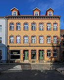 |
Saalgasse 4 50 ° 43 ′ 11 ″ N, 11 ° 20 ′ 26 ″ E |
Residential building / part of the monument ensemble "Kernstadt Rudolstadt" |
Individual monuments Sch – W
| image | Street and house number | Monument designation | comment |
|---|---|---|---|
 |
Schillerstrasse 4 50 ° 43 ′ 12 ″ N, 11 ° 20 ′ 9 ″ E |
Residential building / part of the monument ensemble "Kernstadt Rudolstadt" | |
 |
Schillerstrasse 10 50 ° 43 ′ 13 ″ N, 11 ° 20 ′ 8 ″ E |
Residential building / part of the monument ensemble "Kernstadt Rudolstadt" | |

|
Schillerstrasse 21 50 ° 43 ′ 15 ″ N, 11 ° 20 ′ 7 ″ E |
Residential building / part of the monument ensemble "Kernstadt Rudolstadt" | |

|
Schillerstrasse 22 50 ° 43 ′ 14 ″ N, 11 ° 20 ′ 8 ″ E |
Residential building / part of the monument ensemble "Kernstadt Rudolstadt" | |

|
Schillerstrasse 25 50 ° 43 ′ 16 ″ N, 11 ° 20 ′ 7 ″ E |
Residential house with garden and tea house / part of the monument ensemble "Kernstadt Rudolstadt" | The Schillerhaus Museum is the place where Goethe and Schiller first met. |

|
Schillerstrasse 27 50 ° 43 ′ 17 ″ N, 11 ° 20 ′ 7 ″ E |
Residential building / part of the monument ensemble "Kernstadt Rudolstadt" | |

|
Schillerstrasse 29 50 ° 43 ′ 17 ″ N, 11 ° 20 ′ 7 ″ E |
Residential building / part of the monument ensemble "Kernstadt Rudolstadt" | |

|
Schillerstrasse 30 50 ° 43 ′ 16 ″ N, 11 ° 20 ′ 8 ″ E |
Residential building / part of the monument ensemble "Kernstadt Rudolstadt" | |

|
Schillerstrasse 31 50 ° 43 ′ 18 ″ N, 11 ° 20 ′ 6 ″ E |
Residential building / part of the monument ensemble "Kernstadt Rudolstadt" | |

|
Schillerstrasse 36 50 ° 43 ′ 17 ″ N, 11 ° 20 ′ 8 ″ E |
Residential building / part of the monument ensemble "Kernstadt Rudolstadt" | |

|
Schillerstrasse 37 50 ° 43 ′ 19 ″ N, 11 ° 20 ′ 6 ″ E |
Residential building / part of the monument ensemble "Kernstadt Rudolstadt" | |
 |
Schillerstrasse 41 50 ° 43 ′ 20 ″ N, 11 ° 20 ′ 6 ″ E |
Residential and commercial building / part of the monument ensemble "Kernstadt Rudolstadt" | |

|
Schillingstrasse 7 50 ° 42 ′ 55 ″ N, 11 ° 19 ′ 15 ″ E |
Residential building | |

|
Castle entrance I 50 ° 43 ′ 21 ″ N, 11 ° 20 ′ 11 ″ E |
Laufbrunnen / part of the monument ensemble "Kernstadt Rudolstadt" | |

|
Castle entrance I 2 50 ° 43 ′ 21 ″ N, 11 ° 20 ′ 11 ″ E |
Residential building / part of the monument ensemble "Kernstadt Rudolstadt" | |

|
Castle entrance II 50 ° 43 ′ 18 ″ N, 11 ° 20 ′ 15 ″ E |
Laufbrunnen / part of the monument ensemble "Kernstadt Rudolstadt" | |

|
Castle entrance II 5 50 ° 43 ′ 20 ″ N, 11 ° 20 ′ 14 ″ E |
Residential building / part of the monument ensemble "Kernstadt Rudolstadt" | |

|
Castle entrance II 6 50 ° 43 ′ 20 ″ N, 11 ° 20 ′ 15 ″ E |
Residential building / part of the monument ensemble "Kernstadt Rudolstadt" | |
 |
Castle entrance II 7 50 ° 43 ′ 19 ″ N, 11 ° 20 ′ 16 ″ E |
Residential building / part of the monument ensemble "Kernstadt Rudolstadt" | |
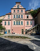 |
Castle entrance IV 3 50 ° 43 ′ 19 ″ N, 11 ° 20 ′ 20 ″ E |
Residential building / part of the monument ensemble "Kernstadt Rudolstadt" | |

|
Castle entrance IV 5 50 ° 43 ′ 19 ″ N, 11 ° 20 ′ 22 ″ E |
Residential building / part of the monument ensemble "Kernstadt Rudolstadt" | |

|
Castle entrance V 2 50 ° 43 ′ 18 ″ N, 11 ° 20 ′ 24 ″ E |
Residential building / part of the monument ensemble "Kernstadt Rudolstadt" | |

|
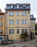
Castle entrance VI 50 ° 43 ′ 17 ″ N, 11 ° 20 ′ 29 ″ E |
Laufbrunnen / part of the monument ensemble "Kernstadt Rudolstadt" | |
 |
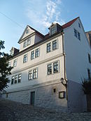
Castle entrance VI 1 50 ° 43 ′ 18 ″ N, 11 ° 20 ′ 29 ″ E |
Residential building / part of the monument ensemble "Kernstadt Rudolstadt" | |
|
Castle entrance VI 4 50 ° 43 ′ 19 ″ N, 11 ° 20 ′ 29 ″ E |
Residential building / part of the monument ensemble "Kernstadt Rudolstadt" | |
 |
Castle District 1–5 50 ° 43 ′ 22 "N, 11 ° 20 ′ 16" E |
Heidecksburg - castle and park, running fountain, riding hall, temple of horrors, sound house, cannon house, castle café, castle terrace | |

|
Castle District 6a – c 50 ° 43 ′ 26 ″ N, 11 ° 20 ′ 16 ″ E |
Residential house - former carriage house of Heidecksburg Castle | |

|
Castle District 7-9 50 ° 43 ′ 26 "N, 11 ° 20 ′ 10" E |
Jägerhof | |

|
Castle District 10 50 ° 43 ′ 28 ″ N, 11 ° 20 ′ 9 ″ E |
Residential building (former tube house) | |

|
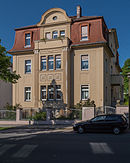
Schlossstrasse 50 ° 43 ′ 24 ″ N, 11 ° 19 ′ 57 ″ E |
Waterworks | |
|
Schlossstrasse 13 50 ° 43 ′ 6 ″ N, 11 ° 19 ′ 38 ″ E |
Residential building | |

|
Schlossstrasse 15 50 ° 43 ′ 9 ″ N, 11 ° 19 ′ 37 ″ E |
Residential building | |

|
Schlossstrasse 17 50 ° 43 ′ 10 ″ N, 11 ° 19 ′ 36 ″ E |
Residential house with garden and enclosure | |

|
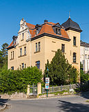
Schlossstrasse 23 50 ° 43 ′ 15 ″ N, 11 ° 19 ′ 35 ″ E |
Residential building | |
|
Schlossstrasse 25 50 ° 43 ′ 17 ″ N, 11 ° 19 ′ 37 ″ E |
Residential building | |

|
Schlossstrasse 35 50 ° 43 ′ 23 ″ N, 11 ° 19 ′ 53 ″ E |
Villa Montana with land and fencing | |
 |
Schulplatz 8 50 ° 43 ′ 16 ″ N, 11 ° 20 ′ 32 ″ E |
Residential and commercial building / part of the monument ensemble "Kernstadt Rudolstadt" | |

|
School area 10 50 ° 43 ′ 18 ″ N, 11 ° 20 ′ 32 ″ E |
Residential building / part of the monument ensemble "Kernstadt Rudolstadt" | |
 |
School area 13 50 ° 43 ′ 16 ″ N, 11 ° 20 ′ 33 ″ E |
City library / part of the monument ensemble "Kernstadt Rudolstadt" | |
 |
Schwarzburger Chaussee 12 50 ° 43 ′ 5 ″ N, 11 ° 19 ′ 44 ″ E |
Official building (district office) | |

|
Schwarzburger Chaussee 31 50 ° 43 ′ 1 ″ N, 11 ° 19 ′ 41 ″ E |
Residential house, garden shed and garden property with enclosure | |

|
Schwarzburger Chaussee 59/61 50 ° 42 ′ 47 ″ N, 11 ° 19 ′ 9 ″ E |
Factory building / part of the former factory Friedrich Adolf Richter & Co., Rudolstadt ( anchor stone construction kit production ) | |

|
Schwarzburger Chaussee 72 50 ° 42 ′ 53 ″ N, 11 ° 19 ′ 18 ″ E |
Residential and commercial building with workshop building | |
 |
Schwarzburger Chaussee 74 50 ° 42 ′ 51 ″ N, 11 ° 19 ′ 11 ″ E |
Richter's villa, park and enclosure | Built in 1886 by Friedrich Adolf Richter . |

|
Schwarzburger Chaussee 76-82 50 ° 42 ′ 49 ″ N, 11 ° 19 ′ 9 ″ E |
Part of the former factory yard / part of the former factory Friedrich Adolf Richter & Co., Rudolstadt | |

|
Schwarzburger Chaussee 76a 50 ° 42 ′ 50 ″ N, 11 ° 19 ′ 9 ″ E |
Former Boiler and machine house / part of the former Friedrich Adolf Richter & Co. factory, Rudolstadt | |

|
Schwarzburger Chaussee 78 50 ° 42 ′ 49 ″ N, 11 ° 19 ′ 8 ″ E |
Kontorhaus / part of the former factory of Friedrich Adolf Richter & Co., Rudolstadt | |

|
Schwarzburger Chaussee 80 50 ° 42 ′ 51 ″ N, 11 ° 19 ′ 5 ″ E |
Factory building II / part of the former factory Friedrich Adolf Richter & Co., Rudolstadt | |

|
Schwarzburger Chaussee 82 50 ° 42 ′ 49 ″ N, 11 ° 19 ′ 7 ″ E |
Factory building I / part of the former factory Friedrich Adolf Richter & Co., Rudolstadt | |

|
Stiftsgasse 2 50 ° 43 ′ 17 ″ N, 11 ° 20 ′ 25 ″ E |
Old Town Hall - auxiliary building / part of the monument ensemble "Kernstadt Rudolstadt" | |

|
Stiftsgasse 2 50 ° 43 ′ 18 ″ N, 11 ° 20 ′ 26 ″ E |
Old Town Hall | |
 |
Stiftsgasse 4 50 ° 43 ′ 17 ″ N, 11 ° 20 ′ 25 ″ E |
Residential and commercial building / part of the monument ensemble "Kernstadt Rudolstadt" | |
 |
Stiftsgasse 13 50 ° 43 ′ 17 ″ N, 11 ° 20 ′ 19 ″ E |
Residential building / part of the monument ensemble "Kernstadt Rudolstadt" | |
 |
Stiftsgasse 21 50 ° 43 ′ 17 ″ N, 11 ° 20 ′ 16 ″ E |
Bernhardinenstift (Handwerkerhof) / part of the monument ensemble "Kernstadt Rudolstadt" | |
 |
Stiftsgasse 23 50 ° 43 ′ 17 ″ N, 11 ° 20 ′ 16 ″ E |
Commercial building / part of the monument ensemble "Kernstadt Rudolstadt" | |
 |
Stiftsgasse 32 50 ° 43 ′ 18 ″ N, 11 ° 20 ′ 17 ″ E |
Residential building / part of the monument ensemble "Kernstadt Rudolstadt" | |
 |
Stiftsgasse 34 50 ° 43 ′ 18 ″ N, 11 ° 20 ′ 17 ″ E |
Residential building / part of the monument ensemble "Kernstadt Rudolstadt" | |
 |
Stiftsgasse 36 50 ° 43 ′ 18 ″ N, 11 ° 20 ′ 16 ″ E |
Residential house and outbuildings / part of the monument ensemble "Kernstadt Rudolstadt" | |
 |
Stiftsgasse 40 50 ° 43 ′ 19 ″ N, 11 ° 20 ′ 15 ″ E |
Residential building / part of the monument ensemble "Kernstadt Rudolstadt" | |
 |
Stiftsgasse 42 50 ° 43 ′ 19 ″ N, 11 ° 20 ′ 14 ″ E |
Residential building / part of the monument ensemble "Kernstadt Rudolstadt" | |

|
Strumpfgasse 21 50 ° 43 ′ 11 ″ N, 11 ° 20 ′ 27 ″ E |
former brewery / part of the monument ensemble "Kernstadt Rudolstadt" | |

|
Theodor-Neubauer-Strasse 31 50 ° 42 ′ 54 ″ N, 11 ° 19 ′ 7 ″ E |
Palm house (gatehouse) / part of the former factory of Friedrich Adolf Richter & Co., Rudolstadt | |

|
Theodor-Neubauer-Strasse 33 50 ° 42 ′ 53 ″ N, 11 ° 19 ′ 6 ″ E |
Printing / part of the former factory of Friedrich Adolf Richter & Co., Rudolstadt | |

|
Theodor-Neubauer-Strasse 35 50 ° 42 ′ 53 ″ N, 11 ° 19 ′ 7 ″ E |
Residential house with outbuildings / part of the former factory Friedrich Adolf Richter & Co., Rudolstadt | |
| Theodor-Neubauer-Strasse 37 50 ° 42 ′ 51 ″ N, 11 ° 19 ′ 7 ″ E |
Joinery / part of the former factory of Friedrich Adolf Richter & Co., Rudolstadt | ||
| Theodor-Neubauer-Strasse 39 50 ° 42 ′ 50 ″ N, 11 ° 19 ′ 5 ″ E |
Cardboard box building / part of the former Friedrich Adolf Richter & Co. factory, Rudolstadt | ||
 |
Unterm Hain 12 50 ° 43 ′ 24 ″ N, 11 ° 19 ′ 48 ″ E |
Residential house with gardens | |

|
Unterm Hain 13 50 ° 43 ′ 23 ″ N, 11 ° 19 ′ 45 ″ E |
Residential house with gardens | |
 |
Vorwerkgasse 2 50 ° 43 ′ 13 ″ N, 11 ° 20 ′ 17 ″ E |
Residential and commercial building / part of the monument ensemble "Kernstadt Rudolstadt" | |
 |
Vorwerkgasse 4 50 ° 43 ′ 13 ″ N, 11 ° 20 ′ 16 ″ E |
Residential and commercial building / part of the monument ensemble "Kernstadt Rudolstadt" | |
 |
Vorwerkgasse 13 50 ° 43 ′ 18 ″ N, 11 ° 20 ′ 14 ″ E |
Residential and commercial building / part of the monument ensemble "Kernstadt Rudolstadt" | |

|
Weimar Straße 50 ° 43 ′ 59 ″ N, 11 ° 20 ′ 7 ″ E |
Nordfriedhof: celebration hall | |

|
Weimar Street 50 ° 43 ′ 55 ″ N, 11 ° 20 ′ 3 ″ E |
Nordfriedhof: tombstone Anton Sommer | |

|
Weimar Straße 50 ° 44 ′ 0 ″ N, 11 ° 20 ′ 1 ″ E |
Nordfriedhof: Cemetery of honor for 82 former Soviet forced laborers | |

|
Weimar Straße 10 and 10a 50 ° 43 ′ 44 ″ N, 11 ° 20 ′ 10 ″ E |
3 buildings of the former Schäfer & Vater porcelain factory, Rudolstadt: House 2 (originally a production and residential building / with factory owner's apartment), House 6 (originally a production building / with a factory clock and bell), House 12 (originally with an office, model room and rental apartments) | |

|
Weinbergstrasse 1a 50 ° 43 ′ 20 ″ N, 11 ° 20 ′ 1 ″ E |
high school | |

|
Weinbergstrasse 2a 50 ° 43 ′ 22 ″ N, 11 ° 20 ′ 4 ″ E |
Residential building | |

|
Weinbergstrasse 6 50 ° 43 ′ 21 ″ N, 11 ° 19 ′ 57 ″ E |
Residential building including side and rear buildings, garden and courtyard | |

|
Weinbergstrasse 10 50 ° 43 ′ 18 ″ N, 11 ° 19 ′ 51 ″ E |
Residential house with outbuildings | |
|
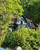
Weinbergstrasse 12 50 ° 43 ′ 18 ″ N, 11 ° 19 ′ 48 ″ E |
Residential house and gardens | |

|
Weinbergstrasse 14 50 ° 43 ′ 16 ″ N, 11 ° 19 ′ 46 ″ E |
Villa with land and enclosure (entity) | |

|
Weinbergstrasse 22 50 ° 43 ′ 11 ″ N, 11 ° 19 ′ 40 ″ E |
Residential building |
Ammelstädt
Individual monuments
| image | designation | location | Dating | description | ID |
|---|---|---|---|---|---|
 |
Inn with outbuildings | Ammelstädt, Ammelstädt 1 (map) |
|
Breitenheerda
Individual monuments
| image | designation | location | Dating | description | ID |
|---|---|---|---|---|---|
 More pictures |
Church with equipment | Breitenheerda (map) |
1895-1897 | The Breitenheerda village church was built at the end of the 19th century on the foundation walls of a previous building in neo-Gothic style. |
|
 |
Homestead | Breitenheerda, Am Nussbaum 1 (map) |
|
||
 |
Homestead | Breitenheerda, Kranichfelder Strasse 25 (map) |
|
||
 |
Homestead | Breitenheerda, Kranichfelder Strasse 31 (map) |
|
||
 |
Tännich hunting lodge | Breitenheerda, Tännich 1 (map) |
The castle in Tännich was sold by the owner at the beginning of the 20th century and has had an eventful history since then. |
|
Cumbach
Individual monuments
| image | Street and house number | Monument designation | comment |
|---|---|---|---|
 |
Marienturm 1 50 ° 42 ′ 27 ″ N, 11 ° 21 ′ 45 ″ E |
Marienturm and Becker mausoleum | |

|
At the Brauhaus 50 ° 42 ′ 34 ″ N, 11 ° 20 ′ 46 ″ E |
Gate drive and property wall (former Edelhof) | |
| Am Brauhaus 1 50 ° 42 ′ 35 ″ N, 11 ° 20 ′ 47 ″ E |
Restaurant and hall building "St. Hubertus " | ||
 |
Am Gänsebach 39 50 ° 42 ′ 38 ″ N, 11 ° 20 ′ 48 ″ E |
Farmhouse and yard gate | |

|
Am Gänsebach 41 50 ° 42 ′ 36 ″ N, 11 ° 20 ′ 48 ″ E |
Homestead | |
|
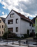
Am Gänsebach 42 50 ° 42 ′ 37 ″ N, 11 ° 20 ′ 47 ″ E |
barn | |

|
At Plan 2 50 ° 42 ′ 37 ″ N, 11 ° 20 ′ 36 ″ E |
Orangery with gate, natural stone wall and former tea house | Remains of the former Cumbach Castle |

|
At the clay pit 50 ° 42 ′ 30 ″ N, 11 ° 20 ′ 37 ″ E |
Former tea house | |

|
Cottastrasse 41 50 ° 42 ′ 38 ″ N, 11 ° 20 ′ 7 ″ E |
Main building of the State Police School Thuringia (Building 11) | |

|
Kirchweg 1 50 ° 42 ′ 38 ″ N, 11 ° 20 ′ 46 ″ E |
Homestead | |

|
Kirchweg 2 50 ° 42 ′ 38 ″ N, 11 ° 20 ′ 45 ″ E |
barn | |

|
Cross travel 50 ° 42 ′ 38 "N, 11 ° 20 ′ 43" O |
Church with furnishings and churchyard |
Eichfeld
Individual monuments
| image | Street and house number | Monument designation | comment |
|---|---|---|---|

|
At pond 4 50 ° 43 ′ 3 ″ N, 11 ° 16 ′ 25 ″ E |
barn | |

|
At the pond 8 50 ° 43 ′ 3 ″ N, 11 ° 16 ′ 24 ″ E |
Homestead | |

|
At the pond 6 50 ° 43 ′ 2 ″ N, 11 ° 16 ′ 24 ″ E |
Homestead | |

|
Dorfplatz 2 50 ° 43 ′ 5 ″ N, 11 ° 16 ′ 25 ″ E |
Homestead | |

|
Main Street 12 50 ° 43 ′ 6 ″ N, 11 ° 16 ′ 27 ″ E |
Courtyard | |

|
Main Street 32 50 ° 43 ′ 5 ″ N, 11 ° 16 ′ 20 ″ E |
Residential building | |

|
Hauptstrasse 34 50 ° 43 ′ 5 ″ N, 11 ° 16 ′ 19 ″ E |
Residential building | |

|
Zum Schmelitz 1 50 ° 43 ′ 5 ″ N, 11 ° 16 ′ 27 ″ O |
Village blacksmiths | |

|
Zum Schmelitz 8 50 ° 43 ′ 4 ″ N, 11 ° 16 ′ 25 ″ O |
Homestead | |

|
Zum Schmelitz 43 50 ° 43 ′ 4 ″ N, 11 ° 16 ′ 27 ″ O |
Bell house | |

|
Zum Schmelitz 44 50 ° 43 ′ 4 ″ N, 11 ° 16 ′ 28 ″ O |
Church with furnishings and churchyard |
Eschdorf
Individual monuments
| image | designation | location | Dating | description | ID |
|---|---|---|---|---|---|
 More pictures |
Eschdorf, Eschdorf (map) |
1860/61 | The Eschdorf Church was built in 1860/61 on the same site as a dilapidated previous building. |
|
|
 |
Homestead | Eschdorf, Eschdorf 2 (map) |
|
Geitersdorf
Individual monuments
| image | designation | location | Dating | description | ID |
|---|---|---|---|---|---|
 More pictures |
Church with equipment | Geitersdorf, Geitersdorf (Map) |
17th century | The church dates from the 17th century and stands on a hill. |
|
Groschwitz
Individual monuments
| image | Street and house number | Monument designation | comment |
|---|---|---|---|

|
Groschwitz 1 50 ° 44 ′ 6 ″ N, 11 ° 14 ′ 47 ″ E |
Former domain |
Heap field
Individual monuments
| image | designation | location | Dating | description | ID |
|---|---|---|---|---|---|
 More pictures |
Church with equipment | Haufeld, Haufeld 12 (map) |
10/11 century | The Haufelder village church St. Christophorus has a central church tower, which was given its current shape in 1762. The original church was in 10/11. It was built in the 18th century as a fortified church. |
|
 |
Homestead | Haufeld, Haufeld 13 (map) |
|
||
 |
Homestead | Haufeld, Haufeld 14 (map) |
|
||
 |
Homestead | Haufeld, Haufeld 27 (map) |
|
||
 |
Homestead | Haufeld, Haufeld 29 (map) |
|
||
 |
Homestead | Haufeld, Haufeld 30 (map) |
|
||
 |
Homestead | Haufeld, Haufeld 32 (map) |
|
Heilsberg
Individual monuments
| image | designation | location | Dating | description | ID |
|---|---|---|---|---|---|
 More pictures |
Church with equipment | Heilsberg (map) |
before 1718 | The tower of the Protestant village church St. Bonifatius was renewed in 1718, the nave in 1764. |
|
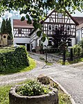 |
Residential stable house | Heilsberg, Am Dorfplatz 7 (map) |
|
||
 |
Homestead | Heilsberg, Borngasse 1 (map) |
|
||
 |
Heilsberger mill | Heilsberg, Heilsberger Mühle 1 (map) |
|
||
 |
Former Well | Heilsberg, Milbitzer Strasse 2 (map) |
|
||
 |
Homestead | Heilsberg, Milbitzer Strasse 12 (map) |
|
Keilhau
Individual monuments
| image | Street and house number | Monument designation | comment |
|---|---|---|---|

|
North of the village on the edge of the forest 50 ° 42 ′ 58 ″ N, 11 ° 14 ′ 59 ″ E |
Histor. graveyard | |

|
Muschelkalkhang northeast of Großgölitz 50 ° 42 ′ 32 ″ N, 11 ° 13 ′ 51 ″ E |
Baropurm | |

|
Albert-Gerst-Strasse 1 50 ° 42 ′ 50 ″ N, 11 ° 15 ′ 0 ″ E |
villa | |

|
Albert-Gerst-Strasse 7 50 ° 42 ′ 45 ″ N, 11 ° 14 ′ 51 ″ E |
villa | |

|
Albert-Gerst-Strasse 8 50 ° 42 ′ 47 ″ N, 11 ° 14 ′ 55 ″ E |
Church with furnishings and churchyard | |
| Albert-Gerst-Strasse 9 |
Homestead | It is questionable whether this cultural monument still exists, the responsible UDSB SLF was asked in writing and orally, but does not provide any information. | |

|
At Kolm 50 ° 42 ′ 50 ″ N, 11 ° 14 ′ 42 ″ E |
Memorial stone to Middendorf, Froebel and Langethal | |

|
Robert-Birkner-Strasse 50 ° 42 ′ 49 ″ N, 11 ° 14 ′ 55 ″ E |
Froebel memorial / part of the totality of the Froebel School (formerly the General German Educational Institution) | |
| Robert-Birkner-Strasse |
Barop memorial (1881) - south of the dining room / part of the Froebel School (formerly the General German Educational Institute) | It is questionable whether this cultural monument still exists, the Froebel School as well as the responsible UDSB SLF were asked in writing, but do not provide any information. | |

|
Robert-Birkner-Strasse 50 ° 42 ′ 50 ″ N, 11 ° 14 ′ 49 ″ E |
Barop memorial (1912) - west of the dining room / part of the Froebel School (former General German Educational Institution) | |

|
Robert-Birkner-Strasse 50 ° 42 ′ 49 ″ N, 11 ° 14 ′ 53 ″ E |
Wächter-Brunnen (1927) - between the lower and upper houses / part of the whole of the Froebel School (formerly the General German Educational Institution) | |

|
Robert-Birkner-Strasse 50 ° 42 ′ 49 ″ N, 11 ° 14 ′ 53 ″ E |
Paths, open spaces and plants belonging to the Froebel School / component of the aggregate of the Froebel School (formerly the General German Educational Institute) | |

|
Robert-Birkner-Strasse 1 50 ° 42 ′ 50 ″ N, 11 ° 14 ′ 58 ″ E |
Residential building | |

|
Robert-Birkner-Strasse 2 50 ° 42 ′ 51 ″ N, 11 ° 14 ′ 59 ″ E |
Residential building (kindergarten) | |

|
Robert-Birkner-Strasse 4 50 ° 42 ′ 50 ″ N, 11 ° 14 ′ 58 ″ E |
Courtyard | |

|
Robert-Birkner-Strasse 6 50 ° 42 ′ 51 ″ N, 11 ° 14 ′ 56 ″ E |
Small farm | |

|
Robert-Birkner-Strasse 15 50 ° 42 ′ 48 ″ N, 11 ° 14 ′ 55 ″ E |
Residential house with barn | |
| Robert-Birkner-Strasse 17 |
So-called. Red House / component of the totality of the Froebel School (formerly the General German Educational Institution) | It is questionable whether this cultural monument still exists, the Froebel School as well as the responsible UDSB SLF were asked in writing, but do not provide any information. | |

|
Robert-Birkner-Strasse 19 50 ° 42 ′ 49 ″ N, 11 ° 14 ′ 54 ″ E |
Gym / component of the whole Froebel School (former General German Educational Institution) | |

|
Robert-Birkner-Strasse 21 50 ° 42 ′ 49 ″ N, 11 ° 14 ′ 52 ″ E |
So-called. Upper house with dining room / part of the totality of the Froebel School (former General German Educational Institution) | |

|
Robert-Birkner-Strasse 23 50 ° 42 ′ 50 ″ N, 11 ° 14 ′ 53 ″ E |
New school / component of the totality of the Froebel School (former General German Educational Institution) | |
|
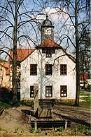
Robert-Birkner-Strasse 25 50 ° 42 ′ 49 ″ N, 11 ° 14 ′ 54 ″ E |
Old school, so-called lower house / part of the totality of the Froebel School (formerly the General German Educational Institution) |
Lichstedt
Individual monuments
| image | Street and house number | Monument designation | comment |
|---|---|---|---|

|
On the village green 50 ° 43 ′ 49 ″ N, 11 ° 15 ′ 36 ″ E |
Church with furnishings and churchyard | |

|
North of the village on Herrenstrasse 50 ° 44 ′ 13 ″ N, 11 ° 15 ′ 36 ″ E |
Musensitz (relic of the former Ketelhodt'schen parks) | |

|
Churchyard 50 ° 43 ′ 48 ″ N, 11 ° 15 ′ 35 ″ E |
Grave site for three beech forest prisoners | |

|
Lichstedt 6 50 ° 43 '50 "N, 11 ° 15' 37" E |
Homestead / part of residential building | |

|
Lichstedt 17 50 ° 43 ′ 49 ″ N, 11 ° 15 ′ 40 ″ E |
Homestead | |

|
Lichstedt 19 50 ° 43 ′ 48 ″ N, 11 ° 15 ′ 41 ″ E |
Homestead |
Milbitz
Individual monuments
| image | designation | location | Dating | description | ID |
|---|---|---|---|---|---|
 |
Garden shed | Milbitz, hillside location on the northern outskirts (map) |
|
||
 More pictures |
Church with furnishings and historical tombstones | Milbitz, Milbitz bei Teichel (map) |
1696 | The Milbitzer Church was built in 1696 in place of a previous building. |
|
 |
Homestead | Milbitz, Milbitz at Teichel 4 (map) |
|
||
 |
Homestead | Milbitz, Milbitz at Teichel 5 (map) |
|
||
 |
Homestead | Milbitz, Milbitz at Teichel 7 (map) |
|
||
 |
Residential building | Milbitz, Milbitz bei Teichel 13 (map) |
|
||
 |
Gate system | Milbitz, Milbitz bei Teichel 16 (map) |
|
||
 |
Residential building | Milbitz, Milbitz bei Teichel 19 (map) |
|
Mörla
Individual monuments
| image | Street and house number | Monument designation | comment |
|---|---|---|---|
 |
Cemetery 50 ° 43 ′ 22 ″ N, 11 ° 18 ′ 42 ″ E |
Ernst Wollong burial site | |
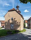 |
Mörla 50 ° 43 ′ 24 ″ N, 11 ° 18 ′ 25 ″ E |
Church with equipment | |
 |
Mörla 2 50 ° 43 ′ 22 ″ N, 11 ° 18 ′ 29 ″ E |
Homestead | |
 |
Mörla 11 50 ° 43 ′ 25 ″ N, 11 ° 18 ′ 23 ″ E |
Homestead | |
 |
Mörla 20 50 ° 43 ′ 26 ″ N, 11 ° 18 ′ 26 ″ E |
Homestead |
Oberpreilipp
Monument ensemble
| image | Street and house number | Monument designation | comment |
|---|---|---|---|

|
Oberpreilipp 1–16 50 ° 41 ′ 49 ″ N, 11 ° 20 ′ 44 ″ E |
Monument ensemble "Ortskern Oberpreilipp" (No. 1–5 and 12–16) |
Individual monuments
| image | Street and house number | Monument designation | comment |
|---|---|---|---|

|
Hillside location on the south-eastern outskirts 50 ° 41 ′ 49 "N, 11 ° 20 ′ 47" E |
Church with furnishings and cemetery with terracing and fencing | |

|
Oberpreilipp 4 50 ° 41 ′ 48 ″ N, 11 ° 20 ′ 45 ″ E |
Homestead / part of the monument ensemble "Ortskern Oberpreilipp" | |

|
Oberpreilipp 5 50 ° 41 ′ 48 ″ N, 11 ° 20 ′ 44 ″ E |
Homestead / part of the monument ensemble "Ortskern Oberpreilipp" | |

|
Oberpreilipp 21 50 ° 41 ′ 50 ″ N, 11 ° 20 ′ 48 ″ E |
Homestead |
Plant Wirbach
Individual monuments
| image | Street and house number | Monument designation | comment |
|---|---|---|---|

|
Plant Wirbach 50 ° 44 ′ 13 ″ N, 11 ° 19 ′ 38 ″ E |
Church with equipment | |

|
Plant Wirbach 15 50 ° 44 ′ 9 ″ N, 11 ° 19 ′ 38 ″ E |
House and barn | |

|
Plant Wirbach 20/21 50 ° 44 ′ 11 ″ N, 11 ° 19 ′ 36 ″ E |
Homestead | |

|
Plant Wirbach 27 50 ° 44 ′ 13 ″ N, 11 ° 19 ′ 33 ″ E |
Homestead | The building was demolished. |

|
Plant Wirbach 29 50 ° 44 ′ 8 ″ N, 11 ° 19 ′ 29 ″ E |
"Feldschlösschen" house and barns |
Remda
Individual monuments
| image | designation | location | Dating | description | ID |
|---|---|---|---|---|---|
 More pictures |
Church with equipment | Remda, Altremda (map) |
1893 | The Protestant village church Altremda was built in 1893 in place of a previous church. |
|
 |
Homestead | Remda, Altremda 6 (map) |
|
||
 More pictures |
Church with equipment | Remda (map) |
1744 | The Remda town church was completely rebuilt after a town fire in 1744. In 1888 the church received a Christ triptych from the painter Edmund Herger . |
|
 More pictures |
Former city wall | Remda |
|
||
 |
Homestead | Remda, Altremdaer Strasse 1 (map) |
|
||
 |
Homestead | Remda, Brandstatt 4 (map) |
|
||
 More pictures |
Church with equipment | Remda, Kirchremda (map) |
before 1756 | The Kirchremda village church was first mentioned in 1756. Parts and fittings of the church are partly much older, so that there was probably a previous building. |
|
 |
Fountain (market fountain) | Remda, market (map) |
|
||
 |
Upper (old) cemetery with tombstones | Remda, Mühlenweg (map) |
|
||
 |
State Primary and regular school | Remda, Rudolstädter Strasse 7 (map) |
|
||
 |
City wall (section) | Remda, Rudolstädter Strasse 9 (map) |
|
||
 |
Memorial stone "Death March of the Buchenwald prisoners" | Remda, Sundremdaer Strasse | 1985 | A death march stele erected in 1985 in the GDR district of Gera commemorates the column of prisoners passing through Remda, coming from the subcamp Ohrdruf S III / Jonastal via Stadtilm towards Rudolstadt . The inscription on the granite ashlar reads “In memory of the death march of the prisoners of Buchenwald concentration camp in 1945”, and a red triangle is placed under this text. |
|
 |
Homestead | Remda, Sundremdaer Strasse 7 (map) |
|
Schaala
Individual monuments
| image | Street and house number | Monument designation | comment |
|---|---|---|---|

|
Am Schaalbach 3 50 ° 42 ′ 57 ″ N, 11 ° 17 ′ 37 ″ E |
Homestead | |

|
Am Schaalbach 8 50 ° 42 ′ 57 ″ N, 11 ° 17 ′ 42 ″ E |
Homestead and barn | |

|
Am Schaalbach 9 50 ° 42 ′ 58 ″ N, 11 ° 17 ′ 38 ″ E |
Homestead | |

|
At the church 50 ° 42 ′ 54 ″ N, 11 ° 17 ′ 37 ″ E |
Church with furnishings, churchyard and defensive wall | |

|
Erfurter Straße 29 50 ° 42 ′ 56 ″ N, 11 ° 17 ′ 43 ″ E |
Industrial building with a former restaurant | |

|
Erfurter Straße 34 50 ° 42 ′ 57 ″ N, 11 ° 17 ′ 43 ″ E |
Residential building | |

|
Erfurter Straße 42 50 ° 42 ′ 55 ″ N, 11 ° 17 ′ 40 ″ E |
Homestead | |

|
Erfurter Straße 46 50 ° 42 ′ 56 ″ N, 11 ° 17 ′ 37 ″ E |
Homestead with enclosure and gate system | |

|
Erfurter Straße 50 50 ° 42 ′ 55 ″ N, 11 ° 17 ′ 35 ″ E |
Homestead | |

|
Erfurter Straße 52 50 ° 42 ′ 55 ″ N, 11 ° 17 ′ 33 ″ E |
Homestead | |

|
Erfurter Straße 62 50 ° 42 ′ 55 ″ N, 11 ° 17 ′ 29 ″ E |
Residential building |
Schwarza
Monument ensemble
| image | Street and house number | Monument designation | comment |
|---|---|---|---|
 |
Schwarzburger- Humboldtstrasse 50 ° 41 ′ 13 ″ N, 11 ° 18 ′ 54 ″ E |
Monument ensemble Protestant church, parsonage, so-called white school, so-called red school as well as associated outbuildings, monuments and land |
Individual monuments
| image | Street and house number | Monument designation | comment |
|---|---|---|---|

|
On the southern outskirts 50 ° 40 ′ 46 ″ N, 11 ° 19 ′ 6 ″ E |
Bridge structure over the Saalfeld-Erfurt railway line (1892) between railway kilometers 42.2 and 42.3 | |
| The Schwarza outdoor pool was 50 m east of the train station, the area was redesigned - now building land. |
Wave machine of the outdoor pool, most recently in the former Schwarza man-made fiber combine | The wave machine was dismantled after the outdoor pool was closed and stored away from home. | |

|
Breitscheidstrasse 50 ° 41 ′ 24 ″ N, 11 ° 19 ′ 46 ″ E |
Facade reliefs of the former rayon factory (demolition of the building in 1999) | |

|
Breitscheidstrasse 97 50 ° 41 ′ 51 ″ N, 11 ° 19 ′ 48 ″ E |
Institute (TITK) with outbuildings, terraces and a small fountain with animal sculptures | |
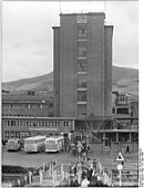
|
Breitscheidstrasse 103 50 ° 41 ′ 33 ″ N, 11 ° 19 ′ 50 ″ E |
High-rise (production building of the former CFK) | |

|
Breitscheidstrasse 148 50 ° 41 ′ 30 ″ N, 11 ° 19 ′ 45 ″ E |
Forum 1 (former KONSUM bakery, warehouse and administration building) | |

|
Breitscheidstrasse 152 50 ° 41 ′ 27 ″ N, 11 ° 19 ′ 45 ″ E |
Forum 3 | |

|
Friedrich-Engels-Strasse 13 50 ° 41 ′ 19 ″ N, 11 ° 19 ′ 39 ″ E |
Residential building (villa) | |

|
Humboldtstrasse 50 ° 41 ′ 12 ″ N, 11 ° 18 ′ 55 ″ E |
Memorial stone for the death march of the Buchenwald prisoners | |

|
Humboldtstrasse 2 50 ° 41 ′ 12 ″ N, 11 ° 18 ′ 54 ″ E |
So-called. "White School" / part of the monument ensemble | |

|
Humboldtstrasse 3 50 ° 41 ′ 12 ″ N, 11 ° 18 ′ 54 ″ E |
Residential and commercial building | |

|
Humboldtstrasse 4 50 ° 41 ′ 14 ″ N, 11 ° 18 ′ 51 ″ E |
Homestead rest (Unterer Siedelhof) | |
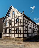
|
Humboldtstrasse 5 50 ° 41 ′ 12 ″ N, 11 ° 18 ′ 53 ″ E |
Homestead | |

|
Humboldtstrasse 15 50 ° 41 ′ 13 ″ N, 11 ° 18 ′ 51 ″ E |
Homestead (in connection with Humboldtstrasse 17) | |

|
Humboldtstrasse 17 50 ° 41 ′ 13 ″ N, 11 ° 18 ′ 51 ″ E |
Homestead (in connection with Humboldtstrasse 15) | |

|
Humboldtstrasse 27 50 ° 41 ′ 14 ″ N, 11 ° 18 ′ 48 ″ E |
Homestead | |

|
Humboldtstrasse 39 50 ° 41 ′ 14 ″ N, 11 ° 18 ′ 50 ″ E |
Homestead | |

|
Kämmeritze 50 ° 40 ′ 18 ″ N, 11 ° 19 ′ 18 ″ O |
State emblem (sovereign stone) of the principality of Schwarzburg-Rudolstadt on the B 85 between Schwarza and Wöhlsdorf | |

|
Short way 50 ° 41 ′ 13 ″ N, 11 ° 19 ′ 17 ″ E |
Half-timbered house of the former Richter's factory (Darre) | |

|
Saalfelder Straße 3 50 ° 41 ′ 10 ″ N, 11 ° 18 ′ 57 ″ E |
Homestead | |

|
Saalfelder Straße 20 50 ° 41 ′ 7 ″ N, 11 ° 18 ′ 58 ″ E |
barn | |

|
Schwarzburger Strasse 57 50 ° 41 ′ 16 ″ N, 11 ° 19 ′ 7 ″ E |
Nestler Mill | |
 |
Schwarzburger Strasse 62 50 ° 41 ′ 17 ″ N, 11 ° 19 ′ 2 ″ E |
“Goldener Löwe” inn with hall and heraldic plaque | |

|
Schwarzburger Strasse 64 50 ° 41 ′ 17 ″ N, 11 ° 19 ′ 1 ″ E |
Residential building | |

|
Schwarzburger Strasse 66 50 ° 41 ′ 17 ″ N, 11 ° 19 ′ 1 ″ E |
Homestead | |

|
Schwarzburger Strasse 79 50 ° 41 ′ 12 ″ N, 11 ° 18 ′ 57 ″ E |
Middle Siedelhof | |

|
Schwarzburger Strasse 80 50 ° 41 ′ 13 ″ N, 11 ° 18 ′ 55 ″ E |
Church with equipment / part of a monument ensemble | |

|
Schwarzburger Strasse 82 50 ° 41 ′ 13 ″ N, 11 ° 18 ′ 54 ″ E |
Rectory / part of the monument ensemble | |

|
Werner-Seelenbinder-Strasse 11 50 ° 41 ′ 16 ″ N, 11 ° 19 ′ 17 ″ E |
Residential building |
Sundremda
Individual monuments
| image | designation | location | Dating | description | ID |
|---|---|---|---|---|---|
 |
Church with furnishings, cemetery and enclosure | Sundremda (map) |
1740 | The Protestant village church Sundremda was built in 1740. A previous church was mentioned as early as 1367. The preserved tower probably belonged to a former monastery. |
|
 |
Homestead | Sundremda, Ehrensteiner Weg 6 (map) |
|
Teichel
Individual monuments
| image | designation | location | Dating | description | ID |
|---|---|---|---|---|---|
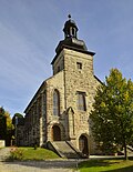 More pictures |
Church with equipment | Teichel (card) |
1438, 1448, 1848/49 | The oldest part of the Teichel town church is the tower, consecrated in 1438. The church was rebuilt in 1848/49. In 2013 the church celebrated the 575th anniversary. |
|
 |
town hall | Teichel, Am Markt 1 (map) |
|
||
 |
Residential building | Teichel, Weimarian Strasse 17 (map) |
|
||
 |
Homestead | Teichel, Weimarian Strasse 59 (map) |
|
Teichröda
Monument ensemble
| image | designation | location | Dating | description | ID |
|---|---|---|---|---|---|
 |
Monument ensemble "local situation Teichröda" | Teichröda | The location of Teichrödas is under protection as a monument ensemble. |
|
Individual monuments
| image | designation | location | Dating | description | ID |
|---|---|---|---|---|---|
 |
Grave site for 14 murdered Buchenwald prisoners | Teichröda (map) |
1945 | Grave site for fourteen concentration camp inmates who were killed on the evacuation march from Buchenwald concentration camp towards Bavaria on April 9, 1945 by American low-level aircraft fire at the entrance to Teichröda. They were buried elsewhere, and a few weeks later they were reburied at their current location on the village green. In 1965 the wooden cross was replaced by a memorial stone with the inscription “14 anti-fascists from the Buchenwald concentration camp rest here. They died on April 9, 1945 by American air fire. ”Replaced. |
|
 More pictures |
Church with equipment | Teichröda (map) |
The church is part of the monument ensemble "Ortlage Teichröda" |
|
|
 |
Residential building | Teichröda, Erfurter Straße 12 (map) |
The residential building is part of the monument ensemble "Ortlage Teichröda" |
|
|
 |
Mill homestead | Teichröda, Erfurter Straße 19 (map) |
The mill farm is part of the monument ensemble "Ortlage Teichröda" |
|
|
| Homestead | Teichröda, Erfurter Strasse 29 (map) |
The homestead is part of the monument ensemble "Ortlage Teichröda" |
|
||
 |
Former Mill | Teichröda, Erfurter Strasse 33 (map) |
The former mill is part of the monument ensemble "Ortlage Teichröda" |
|
|
 |
Homestead | Teichröda, Hopfgartenstrasse 1 (map) |
The homestead is part of the monument ensemble "Ortlage Teichröda" |
|
|
 |
Rectory | Teichröda, Kupferstrasse 4 (map) |
The rectory is part of the monument ensemble "Ortlage Teichröda" |
|
|
 |
Residential building | Teichröda, Zum Tal 3 (map) |
The residential building is part of the monument ensemble "Ortlage Teichröda" |
|
Treppendorf
Individual monuments
| image | designation | location | Dating | description | ID |
|---|---|---|---|---|---|
 More pictures |
Church with furnishings, cemetery and enclosure | Treppendorf (map) |
A pilgrimage church in Treppendorf was mentioned for the first time in 874. The current village church of St. Marien was badly destroyed towards the end of the Second World War. |
|
|
 |
Door run | Treppendorf, Treppendorf 20 (map) |
|
||
 |
Homestead | Treppendorf, Treppendorf 27 (map) |
|
||
 |
Homestead | Treppendorf, Treppendorf 30 (map) |
|
||
 |
Homestead | Treppendorf, Treppendorf 31 (map) |
|
Lower price lip
Individual monuments
| image | Street and house number | Monument designation | comment |
|---|---|---|---|

|
Unterpreilipp 13 50 ° 41 ′ 36 ″ N, 11 ° 20 ′ 22 ″ E |
Homestead | |

|
Unterpreilipp 26 50 ° 41 ′ 31 ″ N, 11 ° 20 ′ 22 ″ E |
Homestead (half-timbered house) |
Volkstedt
Individual monuments
| image | Street and house number | Monument designation | comment |
|---|---|---|---|

|
Breitscheidstrasse 50 ° 42 ′ 23 ″ N, 11 ° 19 ′ 26 ″ E |
Church with equipment | |

|
Breitscheidstrasse 22 50 ° 42 ′ 41 ″ N, 11 ° 19 ′ 7 ″ E |
Villa with park and enclosure | |

|
Breitscheidstrasse 58-62 50 ° 42 ′ 28 ″ N, 11 ° 19 ′ 20 ″ E |
Memorial stone "Death March of the Buchenwald prisoners" | |

|
Macheleidtstrasse 4 50 ° 42 ′ 27 ″ N, 11 ° 19 ′ 26 ″ E |
Kiln and remains of the former Macheleitschen estate | |

|
Schillershöhe 50 ° 42 ′ 27 ″ N, 11 ° 19 ′ 48 ″ E |
Schiller monument | |

|
Zeigerheimer Berg 50 ° 42 ′ 16 ″ N, 11 ° 18 ′ 23 ″ E |
Geschwister-Scholl-Tower |
Web links
Commons : Cultural monuments in Rudolstadt - collection of images, videos and audio files
- Thuringian State Office for Monument Preservation: List of monuments of the district of Saalfeld-Rudolstadt (PDF; 632 kB)
Individual evidence
- ^ Richtersche Villa , Rudolstadt.
- ↑ Heike Enzian The Richtersche Villa in Rudolstadt is again in the hands of the heirs. Ostthüringer Zeitung, May 13, 2011.
- ↑ Monika Kahl: Memorials for the Victims of National Socialism. A documentation , Chapter Thuringia , Volume II, pp. 870f, Bonn, 2000, ISBN 3-89331-391-5 ( online )
- ↑ Monika Kahl: Memorials for the Victims of National Socialism. A documentation , Chapter Thuringia , Volume II, p. 887, Bonn, 2000, ISBN 3-89331-391-5 ( online )


