List of cultural monuments in Nordhausen
The list of cultural monuments in Nordhausen includes the cultural monuments of the Thuringian city of Nordhausen recorded as ensembles and cultural monuments , which were recorded by the Thuringian State Office for Monument Preservation and Archeology as architectural and art monuments in the area of the city. The list shown here was published in April 2009 as part of the zoning plan of the city of Nordhausen. There are no possible cultural monuments in Buchholz .
Ensembles according to Section 2 (2) ThürDSchG
City of Nordhausen
| image | designation | location | Dating | description | ID |
|---|---|---|---|---|---|
| Altendorf | Altendorf, Altendorfer Kirchgasse, Am Alten Tore, Bingerhof, Rosengasse, Schärfgasse |
|
|||
| Historical old city | Bäckerstraße 15–21 / Barfüßerstraße / Domstraße / Dr.-Külz-Straße / Georgengasse 1 and 2 / Gumpertstraße / Kranichstraße 11-20 / Pfaffengasse / Poststraße 5, 6, 6a, 6b, 7 / Waisenstraße, water staircase |
|
|||
| Bahnhofstrasse |
|
||||
| historical cellar | Bäckerstrasse / Domstrasse / Gumpertstrasse / Kranichstrasse |
|
|||
| Residential complex | Bochumer Str. 44, 46, 48, 50, 52, 54a, 54b, 54c, / Yorkstrasse 1, 1a, 1b, 1c / Hardenbergstrasse 1, 3, 5, 7 / Hesseröder Strasse 27, 29a, 29b, 29c |
|
|||
| Castel Sant'Angelo |
|
||||
| Frankenstrasse 1–8 |
|
||||
| Grimmelallee 31-37 |
|
||||
| Hesseröder Strasse 4, 6, 8, 10, 12, 14, 16, 18, 20, 22, 24, 26 and Kurz Strasse 1 |
|
||||
| Hohensteiner Strasse |
|
||||
| Hohensteiner Strasse |
|
||||
| Hohensteiner Strasse 10, 11, 12, 13, 14, 15, 16, 17, 18 and Grimmelallee 13, 14, 14a |
|
||||
| Jüdenstrasse |
|
||||
| Royal court |
|
||||
| Kranichstrasse |
|
||||
| Lutherplatz |
|
||||
| Steinweg | Market / Castel Sant'Angelo |
|
|||
| Oscar-Cohn-Strasse 1–35, Wernigeroder Strasse 1–4, Wertherstrasse 4–6, 8–10, Predigerstrasse |
|
||||
| Thüringer Strasse 1, 2, 3, 4, 5, 6, 7, 8, 31, 32, 33, 34, 35, 36, 37, 38 |
|
||||
| Wendenstrasse |
|
||||
| Wilhelm-Nebelung-Strasse 24–32 |
|
Hochstedt
| image | designation | location | Dating | description | ID |
|---|---|---|---|---|---|
| Günzeröder Str. (Dorfstrasse) 12-19 |
|
Petersdorf
| image | designation | location | Dating | description | ID |
|---|---|---|---|---|---|
| Churchyard and school | Hauptstrasse 1 | with church, belfry, memorial for the fallen, old school, school barn |
|
Rudigsdorf
| image | designation | location | Dating | description | ID |
|---|---|---|---|---|---|
| Location | Nos. 2-19, 19 a, and b, 20-28 |
|
Salza
| image | designation | location | Dating | description | ID |
|---|---|---|---|---|---|
| Gallery in the Kohnstein |
|
City fortifications
| image | designation | location | Dating | description | ID |
|---|---|---|---|---|---|
| historical city fortifications | City wall including Judenturm on Petersberg and Zwinger in Töpferstrasse |
|
Cultural monuments according to districts Section 2 (1) ThürDSchG
City of Nordhausen
| image | designation | location | Dating | description | ID |
|---|---|---|---|---|---|
 More pictures |
Altendorf Church | Altendorfer Kirchgasse | Church of the former Cistercian nunnery, with furnishings |
|
|
 More pictures |
St. Blasii Church | Blasiikirchplatz | with equipment |
|
|
 More pictures |
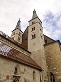
Dom | Domstrasse 17 and 18 | with furnishings including a cloister with architecture and image fragments, as well as provost cellar and stone cross |
|
|
 More pictures |
Justus Jonas Church | Hüpedenweg (map) |
with equipment |
|
|
 More pictures |
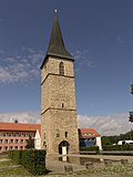
St. Peter's Church | Petersberg | Tower preserved, church gone |
|
|
 More pictures |
Frauenberg Church | Sangerhäuser Strasse 19 (map) |
ruin |
|
| image | designation | location | Dating | description | ID |
|---|---|---|---|---|---|
| Residential building | Albert-Träger-Strasse 5 (map) |
|
|||
| Residential building | Albert-Träger-Strasse 36 | former guest house "Kaiserberg" |
|
||
| Residential building | Alexander Pushkin Street 7 (map) |
|
|||
| Water management building | 11-13 Alexander Pushkin Street |
|
|||
| Residential building | Alexander Pushkin Street 16 (map) |
|
|||
| hospital | Alexander Pushkin Street 17 (map) |
Child psychiatry |
|
||
| Residential building | 19 Alexander Pushkin Street (map) |
|
|||
| Residential building | Alexander Pushkin Street 20 (map) |
|
|||
| Residential building | Alexander Pushkin Street 21 (map) |
|
|||
| Residential building | Alexander Pushkin Street 24 (map) |
|
|||
| Residential building | Alexander Pushkin Street 25 (map) |
|
|||
| Residential building | Alexander-Pushkin-Strasse 26 / 26a (map) |
|
|||
| Residential building | Alexander Pushkin Street 28 (map) |
Youth welfare work |
|
||
 |
Meyenburg museum with park | Alexander Pushkin Street 31 (map) |
|
||
| urban courtyard | Altendorf 1 (map) |
Former brewery with cellar - Mecklenburgs Hof |
|
||
| Residential building | Altendorf 10 (map) |
|
|||
| Residential and commercial building | Altendorf 23 (map) |
|
|||
 |
urban courtyard | Altendorf 24 (map) |
Big Dipper, former brewery |
|
|
| urban courtyard | Altendorf 27 (map) |
|
|||
| urban courtyard | Altendorf 28 (map) |
former Pape malt factory |
|
||
| urban courtyard | Altendorf 29 (map) |
former distillery |
|
||
 |
urban courtyard | Altendorf 30 (map) |
Fam. Franke property with lawn, demolished in February 2017 |
|
|
| urban courtyard | Altendorf 33 (map) |
|
|||
| Residential and commercial building | Altendorf 41 (map) |
|
|||
| Residential house with courtyard wing | Altendorf 46 (map) |
|
|||
 |
urban courtyard | Altendorf 49 (map) |
|
||
| urban courtyard | Altendorf 50 (map) |
|
|||
 |
urban courtyard | Altendorf 55 (map) |
Bochum house |
|
|
| Residential building | Altendorfer Kirchgasse 2 (map) |
former rectory |
|
||
 |
Residential building | Altendorfer Kirchgasse 3/4 (map) |
Water management |
|
|
| Residential house - upper water art | Altendorfer Kirchgasse 5 (map) |
|
|||
| former sharpening mill | Am Alten Tor 7 (map) |
large industrial courtyard with residential and commercial buildings |
|
||
| District Court | Am Alten Tor 8 (map) |
former Carl Bonhardt wine wholesaler |
|
||
| Residential building | Am Alten Tor 18 (map) |
|
|||
| Roland fountain | At the Hagen |
|
|||
| Wiekhaus | At the Hagen | Half-timbered building on the city wall |
|
||
| Arnoldheim | Ammerberg 28 (map) |
|
|||
| Jewish community cemetery | Ammerberg 19 (map) |
|
|||
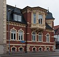 |
Residential building | Arnoldstrasse 8 (map) |
|
||
 |
Residential building | Arnoldstrasse 9 |
|
||
 |
Residential building | Arnoldstrasse 9a |
|
||
 |
Residential building | Arnoldstrasse 10 (map) |
|
||
| Residential building | August-Bebel-Platz 19a |
|
|||
| Residential building | August-Bebel-Platz 20 (map) |
|
|||
| Residential building | August-Bebel-Platz 21 (map) |
|
|||
| Residential building | August-Bebel-Platz 23 (map) |
|
|||
| Residential building | August-Bebel-Platz 24 (map) |
|
|||
| Residential building | August-Bebel-Platz 25 (map) |
|
|||
| Residential building | Bäckerstraße 14 (map) |
|
|||
| urban courtyard | Backerstraße 18 (map) |
|
|||
| Residential building | Backerstraße 19 (map) |
|
|||
 |
urban courtyard | Bäckerstraße 20 (map) |
|
||
| urban courtyard | Backerstraße 21 (map) |
see Poststr. 6a |
|
||
| Residential building | Bahnhofsplatz 1 (map) |
|
|||
| Residential building | Bahnhofsplatz 1 (map) |
|
|||
| Residential building | Bahnhofsplatz 3a |
|
|||
 |
Central Station | Station area | with reception building and platform 1 roofing |
|
|
 |
HSB | Station area | Harzquerbahn station building with platform and roof |
|
|
| Signal box | Station area | in Wertherstr./Wertherstr. 14th |
|
||
| Freight station and depot | Station area | with coal gantry crane, locomotives and wagons |
|
||
 |
former clubhouse of the railway workers | Station area | with signal box NW and NB, engine shed, water tower |
|
|
| Residential building | Bahnhofstrasse 7 (map) |
|
|||
| Residential building | Bahnhofstrasse 7a |
|
|||
| Residential building | Bahnhofstrasse 9 (map) |
|
|||
| Residential building | Bahnhofstrasse 10 (map) |
|
|||
| Residential building | Bahnhofstrasse 10a |
|
|||
| Residential building | Bahnhofstrasse 11 (map) |
|
|||
| Residential building | Bahnhofstrasse 17 (map) |
|
|||
| Residential building | Bahnhofstrasse 18 (map) |
|
|||
| Residential building | Bahnhofstrasse 19 (map) |
|
|||
| Residential building | Bahnhofstrasse 19b |
|
|||
| Department store | Bahnhofstrasse 20 (map) |
|
|||
| Rectory of St. Blasii | Barfüßerstraße 1 (map) |
|
|||
 |
Residential and commercial building with courtyard building | Barfüßerstraße 3 (map) |
Paper business |
|
|
 |
Residential and commercial building | Barfüßerstraße 4 (map) |
Old town cellar restaurant |
|
|
 |
Residential and commercial building | Barfüßerstraße 5 (map) |
former Schrader dairy |
|
|
 |
urban courtyard | Barfüßerstraße 6 (map) |
"Museum Flohburg" |
|
|
 |
Residential building | Barfüßerstraße 12 (map) |
now restaurant "Felix" |
|
|
 |
Residential building | Barfüßerstraße 13 (map) |
now restaurant "Felix" |
|
|
| urban courtyard | Barfüßerstraße 23 (map) |
|
|||
| urban courtyard | Barfüßerstraße 28 (map) |
Mücke former Müller |
|
||
| urban courtyard | Barfüßerstraße 29 (map) |
Ice cream parlor new ensemble |
|
||
 |
urban courtyard | Barfüßerstraße 37 (map) |
with memorial plaque for Wallroth, Höfer Brunnen |
|
|
| Courtyard / residential complex | Bingerhof |
|
|||
| Humboldt Gymnasium | Blasiistrasse 2 |
|
|||
 |
Residential building with gas station area | Bochumer Strasse 1 |
|
||
| Administrative building | Bochumer Strasse 22 (map) |
former office |
|
||
| Altentor station with signal box | Bochumer Strasse 124 (map) |
|
|||
| former air force barracks | Darrweg 42 (map) |
Thür. Police headquarters |
|
||
| Residential building | Domstrasse 9 (map) |
|
|||
 |
Residential house with outbuildings |
Domstrasse 12 (map) |
|
||
| Diesterwegschule– Humboldt Gymnasium | Domstrasse 15 (map) |
|
|||
| urban courtyard | Domstrasse 20a / 21 | former Masonic Lodge |
|
||
 |
Finkenburg | Domstrasse 23 (map) |
|
||
| Administrative building - AOK | Dr.-Külz-Strasse 1 (map) |
|
|||
| Plaque | Dr.-Külz-Strasse 1 (map) |
|
|||
| urban courtyard | Dr.-Wilhelm-Külz-Strasse 3 (map) |
former music school |
|
||
| urban courtyard | Dr.-Külz-Strasse 4 (map) |
|
|||
 |
Old post office building | Dr.-Külz-Straße 7, Königshof 6/7 (map) |
1877–1878 Floor plan August Kind (Reichspostamt), draft architect Leitlof, Berlin. Execution builder chamberlain. |
|
|
| Walkenrieder Hof | Dr.-Külz-Strasse 8 (map) |
|
|||
 |
Elisabeth Fountain | Elisabethstrasse | with cast iron column |
|
|
 More pictures |
Siechenhof | Freiherr-vom-Stein-Strasse 1 (map) |
with Cyriaci chapel, as well as stone crosses and milestone |
|
|
 |
Residential and commercial building | Freiherr-vom-Stein-Strasse 3 (map) |
|
||
| Residential building see Bochumer Str. 2 | Freiherr-vom-Stein-Strasse 15a |
|
|||
| Residential building | Freiherr-vom-Stein-Strasse 25 (map) |
|
|||
| Residential building | Freiherr-vom-Stein-Strasse 28 (map) |
|
|||
| Storage building and grain silo | Freiherr-vom-Stein-Strasse 31 (map) |
|
|||
| Residential building | Freiherr-vom-Stein-Strasse 46 (map) |
|
|||
| Residential building | Freiherr-vom-Stein-Strasse 48 (map) |
|
|||
| Residential and administrative building of the former Harzer Stielwerke | Freiherr-vom-Stein-Strasse 54 (map) |
|
|||
| Factory halls of the Schmidt and Kranz company | Friedrichstrasse |
|
|||
| Residential building | Friedrich-Naumann-Strasse 3 (map) |
|
|||
| Residential building | Friedrich-Naumann-Strasse 14 (map) |
|
|||
| Residential building | Friedrich-Naumann-Strasse 17 (map) |
|
|||
| Residential complex | Friedrich-Naumann-Strasse 18, Johann-Sebastian-Bach-Strasse 5, Stolberger Strasse 68, 70 |
|
|||
| Residential building | Friedrich-Naumann-Strasse 23 (map) |
|
|||
| War memorial | Enclosure |
|
|||
| Monument pillar | Enclosure |
|
|||
| Scoop man | Enclosure |
|
|||
| Sound halls | Enclosure space 2 |
|
|||
| Residential building | Geiersberg 4 (map) |
|
|||
| Residential building | Geiersberg 5 (map) |
|
|||
| Residential building | Geiersberg 6 (map) |
|
|||
 |
Lindenhof | Geiersberg 10 (map) |
Villa with outbuildings and park area |
|
|
| Villa with garden | Geiersberg 12 (map) |
|
|||
 |
Gatehouse at the Spendenkirchhof | Georgengasse 5 (map) |
|
||
| Ruins of the former Franciscan monastery | Georgengasse |
|
|||
| employment exchange | Gerhardt-Hauptmann-Strasse 3 (map) |
former Hanewacker, residential building, office and production building |
|
||
| Residential house with outbuildings | Geschwister-Scholl-Strasse 1 (map) |
|
|||
| Residential building | Geschwister-Scholl-Strasse 5 (map) |
|
|||
| Residential building | Geschwister-Scholl-Strasse 10 (map) |
|
|||
| Residential house with outbuilding - kindergarten | Geschwister-Scholl-Strasse 11 (map) |
|
|||
| Residential building | Geschwister-Scholl-Strasse 12 (map) |
|
|||
| Residential building | Geschwister-Scholl-Strasse 14 (map) |
|
|||
| Residential building | Geschwister-Scholl-Strasse 15 (map) |
|
|||
| Residential building | Geschwister-Scholl-Strasse 22 (map) |
|
|||
| former gasworks | Geseniusstrasse 8 (map) |
Villa and workshop building |
|
||
 More pictures |
former infirmary with Cyriaci chapel | Geseniusstrasse 17a |
|
||
| Calibration office | Geseniusstrasse 28 (map) |
|
|||
| Residential building | Grimmel 17 (map) |
|
|||
| Residential building | Grimmelallee 1 (map) |
|
|||
| Residential and administrative buildings | Grimmelallee 1a |
|
|||
| Chewing tobacco factory Grimm & Triepel with residential and commercial building | Grimmelallee 1b |
|
|||
| Residential building | Grimmelallee 7 (map) |
|
|||
| Residential building | Grimmelallee 9 (map) |
|
|||
| Residential building | Grimmelallee 10 (map) |
|
|||
 |
former distillery | Grimmelallee 11 (map) |
|
||
| Residential building | Grimmelallee 12 (map) |
|
|||
| Residential building | Grimmelallee 20 (map) |
|
|||
| Residential building | Grimmelallee 21 (map) |
|
|||
| Residential and commercial building | Grimmelallee 22 (map) |
|
|||
 |
court House | Grimmelallee 23 (map) |
|
||
| Residential building | Grimmelallee 24 (map) |
|
|||
| Residential building | Grimmelallee 25 (map) |
|
|||
| Residential building | Grimmelallee 27 (map) |
|
|||
| Factory courtyard with residential building | Grimmelallee 28 (map) |
"Harzer Mining Light" |
|
||
| Residential building | Grimmelallee 29 (map) |
|
|||
| Residential building | Grimmelallee 30 (map) |
|
|||
 |
Residential building | Grimmelallee 34 a / b |
|
||
| Stadtbad "Badehaus" | Grimmelallee 40 (map) |
|
|||
| Shaft construction | Grimmelallee 44-46 | Administration building and industrial hall |
|
||
| Residential building | Grimmelallee 50 (map) |
|
|||
| House - stands empty | Gumpertstrasse 1 (map) |
|
|||
 |
Residential building | Gumpertstrasse 6 (map) |
|
||
| Residential building | Gumpertstrasse 8 (map) |
|
|||
| Duplex | Heinrich-Zille-Strasse 1/3 (map) |
|
|||
| Duplex | Heinrich-Zille-Strasse 4/5 |
|
|||
| Bridge over the Zorge | Hesseröder Strasse | with bridge house, stairs, advertising column and open space design |
|
||
| Residential and commercial building | Hesseröder Strasse 25 (map) |
|
|||
| kindergarten | Hohensteinerstraße 17 (map) |
|
|||
| Villa and park | Hohenrode 1 (map) |
|
|||
| Stone cross | Recovery bar |
|
|||
| Factory building with residential building | Johannistreppe 1 (map) |
|
|||
| Residential complex | Johann-Sebastian-Bach-Strasse 5, 7, 9 |
|
|||
| Residential building | Karolingerstraße 61 (map) |
|
|||
| Bank building | Käthe-Kollwitz-Strasse 1 (map) |
|
|||
| Residential building | Käthe-Kollwitz-Strasse 14/15 (map) |
|
|||
| Granary | Kasseler Landstrasse | Raiffeisen-Baumarkt demolition application pending |
|
||
| Residential building | Köllingstrasse 1 (map) |
|
|||
| Residential building | Köllingstrasse 1 (map) |
|
|||
| Residential building | Köllingstrasse 13 (map) |
|
|||
| old post office building | Königshof 6/7 (map) |
s. Dr. Wilhelm- Külz- Str. 7 |
|
||
 |
Townhouse | Kornmarkt 5 (map) |
Residential building |
|
|
| Mill | Kohnsteinweg 8/9 (map) |
|
|||
| House - stands empty | Kranichstrasse 15 (map) |
|
|||
| Cellar of the former cathedral brewery | Kranichstrasse 15 (map) |
|
|||
| Residential building | Kützingstrasse 1 (map) |
|
|||
| Residential building | Kützingstrasse 1a |
|
|||
| Residential building | Kützingstrasse 3 (map) |
|
|||
| Residential building | Kützingstrasse 4 (map) |
|
|||
 |
Town hall with Roland | Market 1 (map) |
Copy, original in the New Town Hall |
|
|
 |
new town hall | Market 15 (map) |
|
||
| Residential building | Meyenburgstrasse 7 (map) |
|
|||
| Kaisermühle with outbuildings | Mühlhof 1 (map) |
|
|||
| Residential building | Oskar-Cohn-Strasse 3 (map) |
|
|||
| Rothleimmühle | Parkallee 1 (map) |
|
|||
 |
Chausseehaus | Parkallee 11 (map) |
and customs house or customs post called |
|
|
| Residential building | Parkallee 17 (map) |
|
|||
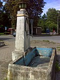 |
Horse fountain | Park avenue |
|
||
| urban courtyard | Pfaffengasse 1 (map) |
Fam. Schwinn |
|
||
| urban courtyard | Pfaffengasse 9 (map) |
Fam. Rinke |
|
||
| Residential building | Poststrasse 6 (map) |
formerly "anchor" |
|
||
| Poststrasse 6a and b | see Bäckerstr. 21st |
|
|||
| Residential building | Poststrasse 7 (map) |
Fa. Gunst |
|
||
| Fountain of Neptune | promenade |
|
|||
| City terrace | Rautenstrasse 15 (map) |
|
|||
| Residential building | Riemannstrasse 1a |
|
|||
| Residential building | Riemannstrasse 9 (map) |
|
|||
| Residential building | Riemannstrasse 10 (map) |
|
|||
| Residential building | Riemannstrasse 11 (map) |
|
|||
| Residential building | Riemannstrasse 12 (map) |
|
|||
| Residential building | Riemannstrasse 13 (map) |
|
|||
| Residential building | Riemannstrasse 15 (map) |
|
|||
| Residential building | Riemannstrasse 17 (map) |
|
|||
| Clinic building and memorial tombstone | Riemannstrasse 18 (map) |
|
|||
| Residential building | Riemannstrasse 19 (map) |
|
|||
| Courthouse | Rudolf-Breitscheid-Strasse 6 (map) |
|
|||
| War memorial | Rudolf-Breitscheid-Strasse |
|
|||
| Fountain | Sangerhäuserstraße | from 1754, reconstructed in 1974 |
|
||
| gym | Sangerhäuserstraße | Mural on the gable wall |
|
||
| Residential houses with outbuildings | Schärfgasse 3 (map) |
|
|||
| Residential building | Schröterstrasse 1 (map) |
|
|||
| Residential building | Schröterstrasse 3/4 (map) |
|
|||
| Residential building | Schröterstrasse 8 (map) |
|
|||
| Residential building | Spiegelstrasse 12 (map) |
|
|||
| Residential building | Spiegelstrasse 19/20 (map) |
|
|||
| Memorial plaque and memorial stone | city Park |
|
|||
| Memorial stele for the OdF - plastic | Stolbergerstrasse 67 (map) |
|
|||
| see Friedrich-Naumann-Str. | Stolbergerstrasse 68, 70 |
|
|||
| Main cemetery | Stresemannring 50 (map) |
with administration buildings at the main entrance, entrance gate, celebration hall, with crematorium |
|
||
| Bridge over the Zorge | Sundhäuserstrasse |
|
|||
| House, cinema | Töpferstrasse 1a / b / c |
|
|||
| Industrial halls from Schmidt, Kranz and Co. | Uferstrasse 1 (map) |
|
|||
| Memorial stone for Ida Vogler Seele 1825-1908 | Embankment |
|
|||
| Residential house with garden and plaque for Käthe Kollwitz | In front of Hagentor 1 (map) |
|
|||
| Residential building | Waisenstrasse 4 (map) |
|
|||
| Residential building | Waisenstrasse 5 (map) |
|
|||
| urban courtyard | Waisenstrasse 6 (map) |
|
|||
| Administration building | Waisenstrasse 7 (map) |
former orphanage |
|
||
| Residential building | Wallrothstrasse 1 (map) |
|
|||
| Residential house with plaque for shopkeepers | Wallrothstrasse 4 (map) |
|
|||
| Residential building | Wallrothstrasse 5 (map) |
|
|||
| Rectory with bell house | Wallrothstrasse 26 (map) |
|
|||
| former state educational institute | Weinberghof / vineyard | Nordhausen University of Applied Sciences |
|
||
| Herdergymnasium | Wiedigsburg 7 (map) |
|
|||
| Watch tower | Wild stick |
|
|||
| Bronze sculpture in front of the Käthe-Kollwitz School | Wilhelm-Nebelung-Strasse |
|
|||
| Residential building | Wilhelm-Nebelung-Strasse 10 (map) |
|
|||
| Thomas Mann Club | Wilhelm-Nebelung-Strasse 39 (map) |
Clubhouse |
|
||
| Residential building | Wilhelm-Nebelung-Strasse 43 |
|
Bielen
| image | designation | location | Dating | description | ID |
|---|---|---|---|---|---|
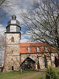 More pictures |
Church of St. Martin and John | with equipment |
|
||
 |
Rectory | Lindenplatz 93 |
|
||
 |
Local government | Cold alley 80 a |
|
||
 |
Courtyard | Anger 26 |
|
||
 |
Courtyard | Anger 27 |
|
||
 |
Courtyard | Anger 28 |
|
||
 |
Courtyard | Anger 36 |
|
||
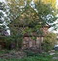 |
Half-timbered house | Right pant leg 9 (pant leg 6) |
|
||
| Outbuildings | Trouser leg 14 |
|
|||
 |
Courtyard | Kleine Gasse 48 |
|
||
 |
Gasthof "Zur Schenke" | Long Lane 89 |
|
||
 |
Courtyard | Bielscher Plan 3 (Plan 65) |
|
||
| former manor house | No. 80 |
|
Talk
| image | designation | location | Dating | description | ID |
|---|---|---|---|---|---|
 More pictures |
Church of St. John with equipment | Rosenberg |
|
||
| Syringe house | south of the church, Rosenberg |
|
|||
| Courtyard | Am Herreder Bach 4 (Hauptstrasse 4) |
|
|||
| Courtyard | opposite Hauptstraße 4 |
|
|||
| Courtyard | Rosenberg 8 (Kirchstrasse 8) |
|
|||
| Courtyard | Sundgasse 1 |
|
|||
| Courtyard | Sundgasse 2 |
|
|||
| Courtyard | Sundgasse 4 |
|
|||
| Courtyard | In front of the village 3 |
|
|||
| Courtyard | In front of the village 9 |
|
Hesserode
| image | designation | location | Dating | description | ID |
|---|---|---|---|---|---|
| Village church |
|
||||
| Rectory | Steep 1 |
|
Hochstedt
| image | designation | location | Dating | description | ID |
|---|---|---|---|---|---|
| former forge | Günzeröder Str. 24 |
|
|||
| former school | Dorfstrasse 10 (Ortsstrasse 10) |
|
Hörningen
| image | designation | location | Dating | description | ID |
|---|---|---|---|---|---|
 More pictures |
Church with equipment | Teichstrasse |
|
||
| Courtyard | Teichstrasse 32 (Hauptstrasse No. 7) |
|
|||
| Courtyard | Teichstrasse 37 Hauptstrasse No. 11 |
|
|||
| Courtyard | Main street No. 13 |
|
|||
| Courtyard | To Stöckerberg 2 (Dorfstrasse No. 25) |
|
|||
| Courtyard | To Stöckerberg 4 (Dorfstrasse No. 26) |
|
|||
| Residential building | To Stöckerberg 8 (Dorfstrasse No. 33a) |
|
Krimderode
| image | designation | location | Dating | description | ID |
|---|---|---|---|---|---|
 More pictures |
Church of St. Nicolai with furnishings | At the castle |
|
||
| Swiss house | At Hofberg 1 |
|
|||
| Gothic cellar | At the castle 4 |
|
|||
| (Am Kohnstein) Mittelbau-Dora Memorial | Kohnsteinweg 20 |
|
|||
| Residential house & mill | Kohnsteinweg 08 | so-called Schnabelsburg |
|
||
| Shaft furnace | Kohnsteinweg 11 | formerly Steuerlein company |
|
||
| Rampart | Kohnsteinweg |
|
|||
| Stone cross | Kohnsteinweg |
|
|||
| Lime kiln | Harzstrasse 16 (Nordhäuser Str.) | Rolandstrasse 1a and 1b (formerly Steuerlein) |
|
||
| Residential and office buildings | Harzstrasse 58 (Nordhäuser Strasse 3) | Former home of the younger Jericho mill |
|
||
| Gravesite of 3 Yugoslav concentration camp prisoners | Rüdigsdorfer Strasse |
|
Leimbach
| image | designation | location | Dating | description | ID |
|---|---|---|---|---|---|
 More pictures |
Church of St. Martin with furnishings | Leopoldweg |
|
||
| Courtyard | Brauhausstrasse (brewery) 3 |
|
|||
| Residential building | Willi-Schmidt-Strasse 4 (Hauptstrasse 9) |
|
|||
| Courtyard | Alte Bauernstrasse 20 (Hauptstrasse 12) |
|
|||
| Courtyard | Alte Bauernstrasse 19 (Hauptstrasse 19) |
|
|||
| Courtyard | Alte Bauernstrasse 21 (Hauptstrasse 21) |
|
|||
| Courtyard | Alte Bauernstrasse 23 (Hauptstrasse 23) |
|
|||
| Courtyard | Alte Bauernstrasse 25 (Hauptstrasse 25) |
|
|||
| Rectory | Leopoldsweg 2 (Hauptstrasse 32) |
|
|||
| Residential stable house | Mittelstrasse 3 |
|
|||
| Courtyard | Mittelstrasse 6 |
|
|||
| Courtyard | Ronneberg 6 |
|
|||
| Lower grass mill |
|
Rodishain
| image | designation | location | Dating | description | ID |
|---|---|---|---|---|---|
 More pictures |
Church of St. Philippi and Jacobi with furnishings | Churchyard and enclosure |
|
||
| Rectory (parcel 3 - 38) | Dorfstrasse 27 |
|
Petersdorf
| image | designation | location | Dating | description | ID |
|---|---|---|---|---|---|
 More pictures |
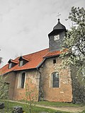
St. Johannis church with furnishings | Corridor 2, parcel 210/3, main street |
|
||
| Former Village school | Main street 1, parcel 213 |
|
|||
| Former School barn | Hauptstrasse 24 (Hauptstrasse 1), hallway 2, parcel 212 |
|
|||
| Guest house with hall | Hauptstrasse 35, parcel 122/1 |
|
|||
| Homestead | Hauptstraße 45, hall 2, parcel 130/1 |
|
Rudigsdorf
| image | designation | location | Dating | description | ID |
|---|---|---|---|---|---|
 More pictures |
Church with equipment | St. Jacobi Way |
|
||
| Courtyard | No. 9 |
|
Salza
| image | designation | location | Dating | description | ID |
|---|---|---|---|---|---|
 More pictures |
Church with equipment | Pfarrstrasse 8 |
|
||
| Rectory | Pfarrstrasse (Kirchplatz 01) |
|
|||
| Residential building | Kirchstrasse 05 |
|
|||
| former smelter | Hut square | later inn "To the blooming linden tree" |
|
Stone bridges
| image | designation | location | Dating | description | ID |
|---|---|---|---|---|---|
| Cemetery with enclosure and war memorial | Steinbrücker Ring | Church with equipment |
|
||
| Residential house with outbuildings | Steinbrücker Ring 29 (Kirchgasse 7) |
|
|||
| Homestead | Schenkplatz 9 |
|
Steigerthal
| image | designation | location | Dating | description | ID |
|---|---|---|---|---|---|
 More pictures |
Church with equipment |
|
|||
| Residential building | Alte Dorfstrasse 33 (Dorfstrasse 1) |
|
|||
| Residential building | On the tip 1 (Dorfstrasse 18) |
|
|||
| Residential building | Alte Dorfstrasse 17 (Dorfstrasse 24) |
|
|||
| Residential building with gate entrance | Alte Dorfstrasse 15 (Dorfstrasse 25) |
|
|||
| Residential building | Alte Dorfstrasse 1 (Dorfstrasse 30) |
|
|||
| Residential building | Backstrasse 5 (Dorfstrasse 68) |
|
Stempeda
| image | designation | location | Dating | description | ID |
|---|---|---|---|---|---|
| Churchyard and enclosure | Church with equipment |
|
|||
| Residential building | Dorfstrasse 28 | (Parcel 2-475 / 236) |
|
||
| Residential building | Dorfstrasse 36 | (Parcel 2 - 173/1) |
|
||
| Residential building | Dorfstrasse 40 | (Parcel 2 - 249/1) |
|
||
| Residential building | Dorfstrasse 6 | (Parcel 2 - 269/1) |
|
Sundhausen
| image | designation | location | Dating | description | ID |
|---|---|---|---|---|---|
 |
Church with equipment | Kirchplatz (map) |
|
||
 |
former manor with farmyard and park | Uthleber Strasse 9–11 (Carlsburger Strasse) (map) |
so-called Carlsburg, called Karlsburg during the GDR era |
|
|
| Courtyard | Rinnestr. 38 (Gutsweg No. 6) |
|
|||
| old rectory | Kirchplatz 12 (main street) |
|
|||
| Residential building | Rinnestr. 26 (Hauptstrasse 4) |
|
|||
| Half-timbered house | Rinnestr. 28 (Hauptstrasse 5) |
|
|||
| Courtyard with an archway | Rinnestr. 44 (Hauptstrasse 9) |
|
|||
| so-called small good | Kiekersgasse |
|
|||
| Courtyard | Schulstrasse 9 |
|
|||
| Bridge over the helmets | 1928 |
|
|||
| Mausoleum of the Schreiber family | graveyard |
|
Movable monument
Sundhausen
| image | designation | location | Dating | description | ID |
|---|---|---|---|---|---|
| NEH 7 hot steam locomotive | "Barnyard" | Boiler no. 25177, built in 1934, Buckau machine factory |
|
Web links
Commons : Kulturdenkmale in Nordhausen - Collection of pictures, videos and audio files