List of streets in Birkigt (Freital)
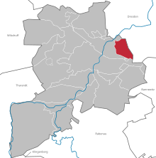
The list of streets in Birkigt contains all named streets of the district Birkigt of the large district town Freital in the district of Saxon Switzerland-Eastern Ore Mountains .
16 streets are named in Birkigt. The street network of the district is influenced, on the one hand, by its hillside location and, on the other hand, by the wind mountain railway, on whose tracks the streets are partly oriented. Some level crossings and underpasses are only open to pedestrians. Important streets in Birkigt are the Coschützer, the Gitterseer and the Bannewitzer Straße. Coschützer Straße connects Potschappel with Coschütz and touches the district of Birkigt in the north. The Gitterseer and Bannewitzer Straße then establish the connection to the town center and connect Birkigt via the “Leisnitz” street, which is not in the Birkigt district, in the direction of Burgk . Via the connection Coschützer Straße – Gitterseer Straße – Bannewitzer Straße the regional traffic Saxon Switzerland-Eastern Ore Mountains operates the bus line C in the city traffic Freital towards Pesterwitz and Kleinnaundorf / Bannewitz .
Legend
The following table gives an overview of the streets and squares in the district as well as some related information. In detail these are:
- Image: Photo of the street.
- Name / Location: Current designation of the street or the place as well as under 'Location' a coordinate link via which the street or the place can be displayed on various map services. The geoposition indicates approximately the middle of the street.
- Name origin: origin or reference of the name.
- Notes: More information on nearby institutions, the history of the street, historical names, cultural monuments, etc.
Street directory
| image | Name / location | Origin of name | Remarks |
|---|---|---|---|
| photos | At the fountain (map) |
||
| Am Geiersgraben (map) |
|||
| Bannewitzer Strasse (map) |
Bannewitz , neighboring community of Freitals in the Saxon Switzerland-Eastern Ore Mountains district | Before it was incorporated into Freital, the street was called Burgker Straße . | |
| Bergmannstrasse (map) |
Bergmann , job title for workers in the mining industry | See also: Bergmannstrasse in Burgk | |
| Birkierter Höhe (map) |
Height in the locality of Birkigt | The street is part of a residential estate consisting of 29 houses that were built between 2011 and 2015. | |
| photos | Blumenstrasse (map) |
On Blumenstrasse there is a memorial stone for the victims of the air raid on Freital and Gittersee on August 24, 1944. | |
| Broad street (map) |
|||
| photos | Coschützer Strasse (map) |
Coschütz , district of the state capital Dresden | See also: Coschützer Straße in Potschappel |
| Finkenmühlenstrasse (map) |
This street used to be divided into Hohe Strasse and Elisabethstrasse . | ||
| photos | Gitterseer Strasse (map) |
Gittersee , district of the state capital Dresden bordering on Birkigt | Before it was incorporated into Freital, Gitterseer Strasse was called Potschappler Strasse . The school building at Gitterseer Strasse 28 and two stables (Gitterseer Strasse 44 and 46) are listed.
See also: Gitterseer Straße in Potschappel |
| Grundweg (map) |
Course in the valley floor of the Birkigtbach | ||
| Kesselgrundweg (map) |
|||
| Little Settlers Road (map) |
Until October 31, 2014 it was only called Siedlerstraße . Since there was a street of the same name in Pesterwitz, the name of the Birkigte street was changed. | ||
| photos | Ludwig-Richter-Strasse (map) |
Ludwig Richter (1803–1884), painter and draftsman | The Ludwig-Richter-Grundschule Birkigt is located on the street. |
| Meiselschachtweg (map) |
Meiselschacht , former mine in Gittersee | ||
| Zschiedger Weg (map) |
Zschiedge , district in the Burgk district of Freital | See also: Zschiedger Weg in Potschappel |
Web links
Individual evidence
- ↑ Jane Jannke: New settlement almost finished. In: Saxon newspaper . August 3, 2015, accessed April 13, 2020 .
