List of listed objects in St. Pölten-Spratzern
The list of listed objects in St. Pölten-Spratzern contains the 11 listed , immovable objects in the St. Pölten district of Spratzern .
Monuments
| photo | monument | Location | description | Metadata |
|---|---|---|---|---|

|
Wegkapelle ObjektID : 29523 |
KG location : Pummersdorf |
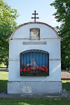
The Wegkapelle in the center of Pummersdorf is a brick building with a wide, segment-arched opening. The year 1780 can be read in the plaster under the triangular gable. |
ObjectID : 29523 Status: § 2a Status of the BDA list: 2020-02-29 Name: Wegkapelle GstNr .: 13 Wegkapelle Pummersdorf |

|
Pestmarterl ObjectID : 29437 |
Aquilin Hacker-Straße KG location : Spratzern |
The Pestmarterl in Hiesberger Park is a broad, rounded pillar and is dated to the early 17th century. In addition to a copy of the Pietà group of figures from around 1415, there are three small niches with wall paintings. These show Christophorus and the mercy seat . The third representation was no longer recognizable, but was apparently replaced by a Floriani representation. The Marterl was moved to its current location in 1983. |
ObjectID : 29437 Status: § 2a Status of the BDA list: 2020-02-29 Name: Pestmarterl GstNr .: 767/30 Pestmarterl Spratzern |

|
Catholic parish church hl. Theresia of the Child of Jesus ObjectID : 29430 |
Location KG: Spratzern |
Due to the strong population growth, it was decided in 1931 to set up a separate parish in addition to the Mariahilfkapelle. Hans Zita and Otto Schottenberger won the architectural competition for the new parish church, and construction was completed in July 1932. With its clear lines, the church is assigned to the New Objectivity style . |
ObjectID : 29430 Status: § 2a Status of the BDA list: 2020-02-29 Name: Catholic parish church hl. Theresia of the Child Jesus GstNr .: .334 Parish Church Spratzern |

|
Parish home ObjectID : 29431 |
Eisenbahnerstraße 4 KG location : Spratzern |
Today's parish home was built at the same time as the adjacent parish church in 1932 as a Caritas home for youth welfare; the architect was Klemens Flossmann . |
ObjectID : 29431 Status: § 2a Status of the BDA list: 2020-02-29 Name: Pfarrheim GstNr .: .336 Pfarrheim Spratzern |

|
Bronze Age settlement Spratzern-Nord ObjektID : 130092 since 2013 |
Dürnauergasse location KG: Spratzern |
North of the West Autobahn , a new parking lot was planned for the VAZ St. Pölten in 2012 ; this had become necessary due to the new construction of the freight train bypass of the Westbahn and the associated loss of a large part of the parking spaces. During the construction-accompanying excavations, an extensive Bronze Age settlement with multi-aisled house floor plans was found on 50,000 m² . Because it was used as a parking lot, the find could be left in situ . |
ObjektID : 130092 Status : Notification Status of the BDA list: 2020-02-29 Name: Bronze Age settlement Spratzern-Nord GstNr .: 622/1; 629/2 |

|
Hotel / Pension Schwaighof / north wing ObjectID : 26391 |
Josefstrasse 123, 125 KG location : Spratzern |
The Schwaighof was built as a farmyard in the 12th century and destroyed during the second Turkish siege of Vienna in 1683. The property went to the Augustinian Canons of St. Pölten in 1692 , which then carried out a baroque reconstruction. Jakob Prandtauer and Christian Alexander Oedtl are accepted as sculptors and architects . It has been used as a seminar hotel since 1988. |
ObjectID : 26391 Status : Notification Status of the BDA list: 2020-02-29 Name: Hotel / Pension Schwaighof / Nordtrakt GstNr .: .30 / 2 Schwaighof (St. Pölten) |

|
WIFI ObjectID : 26417 since 2014 |
Mariazeller Straße 97 KG location : Spratzern |
The teaching and workshop building of the Economic Development Institute (WIFI) was built from 1967 to 1972 on behalf of the State Chamber of Commerce for Lower Austria according to plans by Karl Schwanzer . The two- to three-story building is made of three-dimensional exposed concrete . On the north side there are five protruding tracts that form four forecourts, with the easternmost at the main entrance being the largest. The protruding tracts are emphasized by large, brown windows and are connected to one another by octagonal pedestrian bridges. In addition to administrative offices, the building houses 25 workshops, 13 IT rooms and 13 lecture halls as well as part of the New Design University . |
ObjectID : 26417 Status : Notification Status of the BDA list: 2020-02-29 Name: WIFI GstNr .: 724/148 WIFI St. Pölten |

|
Mariahilf Chapel ObjectID : 29432 |
Schuhmeierstrasse 41 KG location : Spratzern |
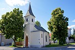
The Mariahilf local chapel was built in 1888 as a branch of the St. Pölten Franciscan Parish. |
ObjectID : 29432 Status: § 2a Status of the BDA list: 2020-02-29 Name: Ortskapelle Mariahilf GstNr .: .53 Ortskapelle Spratzern |

|
School ObjectID : 93237 |
Spratzerner Hauptstrasse 58 Location KG: Spratzern |
The school was built from 1923 to 1925 according to plans by the St. Pölten City Building Office. In the hall of the striking, two-story building there is a plaster relief depicting Johann Heinrich Pestalozzi . |
ObjectID : 93237 Status: § 2a Status of the BDA list: 2020-02-29 Name: School GstNr .: 545/12 |

|
Figure shrine St. Johannes Nepomuk ObjectID : 26533 |
at Stifterstrasse 1 location KG: Spratzern |
The wayside shrine showing Saint John Nepomuk is attributed to Peter Widerin and is dated around 1735. |
ObjectID : 26533 Status: § 2a Status of the BDA list: 2020-02-29 Name: Figurine picture stick hl. Johannes Nepomuk GstNr .: 769/14 |

|
Pump house with well ObjectID : 115292 |
Location KG: Völtendorf |
The pump house was built in 1927 and was in operation for pumping groundwater until 1983. Due to the low productivity, a pressure increase system was installed in the building in 1984 and is still in operation today, the surrounding former water protection area has been converted into a local recreation area. |
ObjectID : 115292 Status: § 2a Status of the BDA list: 2020-02-29 Name: Pump house with fountain GstNr .: 123/1 Pump house Spratzern |
literature
- Thomas Karl among other things: The art monuments of the city of St. Pölten and its incorporated localities. Berger, Horn 1999, ISBN 3-85028-310-0 ( Austrian Art Topography 54).
- Bundesdenkmalamt (Ed.): The art monuments of Austria - Lower Austria south of the Danube, in two parts. Part 1: A – L. Verlag Berger, Horn 2003 ISBN 3-85028-364-X .
Web links
Commons : Listed objects in St. Pölten - collection of images, videos and audio files
Individual evidence
- ↑ a b Lower Austria - immovable and archaeological monuments under monument protection. (PDF), ( CSV ). Federal Monuments Office , as of February 14, 2020.
- ↑ Mag.Nikolaus Hofer (Ed.), 2013: Find reports from Austria Volume 51, Reports 2012, ISSN 0429-8926 , p. 17. ( reading sample )
- ↑ WIFI St. Pölten - general information
- ↑ According to the information board on the property
- ↑ § 2a Monument Protection Act in the legal information system of the Republic of Austria .