List of listed objects in Winzendorf-Muthmannsdorf
The list of listed objects in Winzendorf-Muthmannsdorf contains the 9 listed immovable objects of the municipality of Winzendorf-Muthmannsdorf in the Lower Austrian district of Wiener Neustadt-Land .
Monuments
| photo | monument | Location | description | Metadata |
|---|---|---|---|---|

|
Vicarage ObjectID : 27334 |
Kirchenstrasse 1 KG location : Muthmannsdorf |
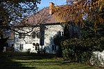
The two-storey building block with a hipped roof was rebuilt after being destroyed in 1683. The flat bay window over consoles on the south-east facade still comes from the late Gothic predecessor building. |
ObjectID : 27334 Status: § 2a Status of the BDA list: 2020-02-29 Name: Pfarrhof GstNr .: .1 Pfarrhof, Muthmannsdorf |

|
Catholic parish church hll. Peter and Paul ObjectID: 27332 |
Kirchenstrasse 2 KG location : Muthmannsdorf |
A sacred building with a Romanesque choir square between a baroque nave in the west and a Gothic choir (1419) in the east. In 1939 wall paintings from the 13th century were discovered and uncovered. |
ObjectID: 27332 Status: § 2a Status of the BDA list: 2020-02-29 Name: Catholic parish church hll. Peter and Paul GstNr .: .3; 1798/1 St. Peter im Moos (Muthmannsdorf) |

|
Residential building, former school ObjectID : 27333 |
Kirchenstrasse 2 KG location : Muthmannsdorf |
The single-storey rectangular building with a hipped roof dates from 1783. |
ObjectID : 27333 Status: § 2a Status of the BDA list: 2020-02-29 Name: Residential building, former school GstNr .: .2 Former school building, Muthmannsdorf |

|
Hill settlement and barrows Malleiten ObjektID : 71436 |
Malleiten location KG: Muthmannsdorf |
Large number of prehistoric and early historical settlement remains , which are related to the extraction and processing of copper, the greatest flourishing of the settlement in the Hallstatt period , several burial mounds created in the forest areas, numerous finds in the caves of the mountain, Roman stone monuments from the Malleiten are located in the castles Ebreichsdorf and Hernstein . |
ObjektID : 71436 Status : Notification Status of the BDA list: 2020-02-29 Name: Hill settlement and barrows Malleiten GstNr .: 1007; 1008; 1009; 1011; 1014; 1015/1; 1015/2; 1015/3; 1016/1; 1016/2; 1017/1; 1017/2; 1019/1; 1019/2; 1022; 1023; 1024/1; 1024/2; 1015/1; 1025/2; 1026/1; 1016/2; 1027/1; 1027/2; 1018/1; 1028/2; 1029/1; 1029/2; 1030/1; 1030/2; 1031; 1032; 1034/1; 1034/2; 1035; 1036; 1037; 1039; 1040; 1041/1; 1041/2; 1041/3; 1042; 1043; 1044; 1045; 1047/1; 1047/2; 1047/3; 1047/4; 1048; 1049; 1050; 1051; 1051; 1055; 1056; 1057; 1058; 2186/2 |

|
Shrine Object ID: 27335 |
Kirchenstrasse 2 KG location : Muthmannsdorf |
Next to the Church of St. Peter im Moos rises the squat niche pillar with a cross. |
ObjectID : 27335 Status: § 2a Status of the BDA list: 2020-02-29 Name: Bildstock GstNr .: 1798/1 Bildstock, Muthmannsdorf |

|
Schafflermühle ObjectID : 27340 |
Hauptstrasse 2 KG location : Winzendorf |
The substance of the elongated two-storey building dates largely from the 17th century. The entrance, flanked by pillars, was built in the fourth quarter of the 18th century. A grinder from the second half of the 19th century has been preserved inside. |
ObjectID : 27340 Status : Notification Status of the BDA list: 2020-02-29 Name: Schafflermühle GstNr .: .21 / 2 |

|
Kath. Filialkirche Mariae Himmelfahrt ObjectID : 27338 |
Hauptstrasse location KG: Winzendorf |
From the 13th to the 15th century, the hall church, which was redesigned and expanded several times, was built with a choir just closing. In 1885 the detached tower was built in the west. |
ObjectID : 27338 Status: § 2a Status of the BDA list: 2020-02-29 Name: Kath. Filialkirche Mariae Himmelfahrt GstNr .: .11 Filialkirche Mariae Himmelfahrt, Winzendorf |

|
Karner ObjectID : 27339 |
Hauptstrasse location KG: Winzendorf |
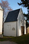
The free-standing, high-proportioned Gothic rectangular building with a gable roof was probably built in the first half of the 14th century. After it was destroyed in 1529, it was rebuilt and turned into the Teufel family grave chapel. |
ObjectID : 27339 Status: § 2a Status of the BDA list: 2020-02-29 Name: Karner GstNr .: .11 Karner, Winzendorf |

|
Emmerberg ruin ObjectID : 27331 |
KG location : Emmerberg |
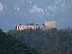
The extensive castle complex was built from 1170 on a rocky ridge at the entrance to the Prosset Gorge . After the destruction, the castle and chapel were rebuilt around 1250/70. Around 1430/50 this Romanesque core castle was largely demolished and replaced by a new late Gothic building; further extensions took place in the 16th and 17th centuries. The castle has been falling into disrepair since around 1760. |
ObjectID : 27331 Status : Notification Status of the BDA list: 2020-02-29 Name: Ruine Emmerberg GstNr .: 77 Burgruine Emmerberg |
literature
- Bundesdenkmalamt (Ed.): Dehio manual. The art monuments of Austria. Lower Austria, south of the Danube , part 2. Berger publishing house, Horn / Vienna 2003, ISBN 3-85028-365-8
Web links
Commons : Listed objects in Winzendorf-Muthmannsdorf - collection of pictures, videos and audio files
Individual evidence
- ↑ a b Lower Austria - immovable and archaeological monuments under monument protection. (PDF), ( CSV ). Federal Monuments Office , as of February 14, 2020.
- ↑ § 2a Monument Protection Act in the legal information system of the Republic of Austria .

