Loison (Chiers)
| Loison | ||
|
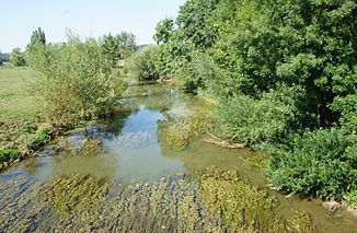
The river at Quincy-Landzécourt |
||
| Data | ||
| Water code | FR : B45-0200 | |
| location | France | |
| River system | Rhine | |
| Drain over | Chiers → Maas → Hollands Diep → North Sea | |
| River basin district | Meuse | |
| source | in Loison 49 ° 18 ′ 33 " N , 5 ° 36 ′ 45" E |
|
| Source height | approx. 221 m | |
| muzzle | below Quincy-Landzécourt in the Chiers coordinates: 49 ° 30 ′ 21 ″ N , 5 ° 17 ′ 23 ″ E 49 ° 30 ′ 21 ″ N , 5 ° 17 ′ 23 ″ E |
|
| Mouth height | approx. 176 m | |
| Height difference | approx. 45 m | |
| Bottom slope | approx. 0.85 ‰ | |
| length | 53 km | |
| Catchment area | 357 km² | |
| Drain at the mouth |
MQ |
3.98 m³ / s |
| Left tributaries | Thinte | |
The Loison is a river in France that runs in the Grand Est region .
geography
course
The Loison rises in the municipality of Loison , drains generally in a north-westerly direction and flows into the Chiers as a left tributary after 53 kilometers below Quincy-Landzécourt . On its way, the Loison crosses the Meuse department and briefly touches the neighboring Meurthe-et-Moselle department .
Places on the river
- Loison
- Billy-sous-Mangiennes
- Mangiennes
- Merles-sur-Loison
- Jametz
- Juvigny-sur-Loison
- Quincy-Landzécourt
Web links
- Débits caractéristiques le Loison (French; PDF file; 15 kB)
