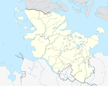
Pötenitzer Wiek

Coordinates: 53 ° 56 ′ 51 ″ N , 10 ° 53 ′ 45 ″ E
The Untertrave , the Pötenitzer Wiek and the adjoining Dassower See together form an approx. 40 km² mesohaline inner coastal water in Schleswig-Holstein on the border with Mecklenburg-Western Pomerania , which is also called the Traveförde , but combines characteristics of different water formations. The water surface belongs to the whole area of the Hanseatic City of Lübeck , the eastern banks to Mecklenburg-Western Pomerania.
Geography and geology
The salt content, which is between 5 g / kg and 10 g / kg, indicates frequent inflows of seawater from the Lübeck Bay , which means that this area of water south of Travemünde also represents a sea bay. That the salt content is significantly lower than in the Lübeck Bay (PSU in February 2005 near Boltenhagen on the surface 16.8 g / kg and in the depth 19.5 g / kg) and even than in the Unterwarnow (10.4–10.8 g / kg), emphasizes the character as the mouth area ( estuary ) of the Trave and Stepenitz . While salinities of over 9 g / kg were measured near the bottom of the water, they are mostly low on the surface. The Untertrave and its tributaries are also qualified as "brackish water-influenced tributaries".
Created by glacial erosion during the Pomeranian Ice Advance of the Vistula Ice Age , this coastal water can be viewed as a fjord of shallow depth. One also speaks of Traveförde .
The Priwall as a spit hook , which separates the Pötenitzer Wiek from the Lübeck Bay and only leaves the narrow "Trave mouth" open as a sea channel , gives the large water area the character of a lagoon .
Biotope and nature conservation
Despite its function as a waterway, the Untertrave is an important habitat for water birds and as such is classified according to Natura 2000 . Pötenitzer Wiek and Dassower See are even more important than natural areas. Boat traffic is subject to restrictions on the Pötenitzer Wiek. The banks are rich in bushes and reeds, there are even small salt marshes . The south bank of the Priwall as well as the water area, islands and banks of the 8 km² Dassower See are under nature protection .
Former sea airfield
Up until the Second World War, the Pötenitzer Wiek was the runway for seaplanes at the Lufthansa airport, which was then located on the Priwall . While the airport on the Priwall with some buildings is still clearly recognizable today and the main building has been used again as the Schleswig-Holstein Seaman's School since 1952, the ruins of the Luftzeugamt See or Luftzeugamt Pötenitz , which was built for military use in the 1930s Largely overgrown by nature and difficult to make out. The name comes from the Mecklenburg town of Pötenitz , which has belonged to the city of Dassow since 2004 . The old pier can still be seen on the east bank of the Wiek in aerial photographs or at low tide.
literature
- Harald Krause: Wiek and Wikinger - origin and development of shipping and maritime terms used by seafarers in the extended Baltic Sea area . In: Bull and Griffin . Sheets on cultural and regional history in Mecklenburg-Western Pomerania , year 19, Schwerin 2009, pp. 10–21. Table: The German Wieken.
Web links
- Protected area and biotope network system Schleswig-Holstein (PDF) (183 kB)
- Uwe Selig, Dirk Schories & Hendrik Schubert: Report on the research project: "Testing the classification approach Mecklenburg-Western Pomerania (inner coastal waters) under the conditions of Schleswig-Holstein and extending the approach to the outer coast" Coastal water classification of the German Baltic Sea according to EU WFD, Part B : Inner coastal waters of Schleswig-Holstein (PDF) (833 kB)
- Hanseatic City of Lübeck: Protected area southern Priwall
- Landscape framework plan for the Ostholstein district and the Hanseatic City of Lübeck (2003) (PDF file; 1.74 MB)
- Bird sanctuary Traveförde in the Schleswig-Holstein Environmental and Agricultural Atlas
Individual evidence
- ↑ Page no longer available , search in web archives:
