Magma Geopark

The Magma Geopark is a geopark on the southwestern tip of Norway , southeast of the port city of Stavanger . It is one of two geoparks in Norway that have been included in both the European Geoparks Network and the Global Network of National Geoparks . The year of recording was 2010.
location
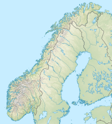
The Magma Geopark extends over an area of 2329 km² over the municipalities Bjerkreim , Eigersund , Lund and Sokndal in the province Rogaland and the municipality Flekkefjord in the province Vest-Agder .
geology
The Geopark is located in the extreme southwest of the Baltic Shield . Its subsurface consists of Proterozoic metamorphic and, above all, igneous rocks. Intrusions dominate here , which are largely composed of anorthosite i. w. S. exist and together form the largest such occurrence in Europe . Regional geologically , this part of the Baltic Shield is known as the Rogaland Anorthosite Province . Anorthosite is relatively rare as a rock in the earth's crust , but is a major component of the moon's crust .
In the Proterozoic, today's Scandinavia was part of a relatively small supercontinent that had formed in a series of collisions between even smaller continents. Another collision of this type took place around 1 billion years ago, affecting the part of the lithosphere that now forms the southwest of the Baltic Shield, the so-called Svekonorvegids . This collision created a high mountain range , in the depths of which magma penetrated and solidified there into large rock bodies, including the Rogaland anorthosites. In the course of hundreds of millions of years, the high mountains were completely removed and the intrusions exposed. The landscape or the relief that characterizes the region today was only created in the last few millions of years with the help of glaciers and inland ice .
Tourism
The Magma Geopark, which is comprehensively developed in terms of transport, offers numerous opportunities for geo and landscape tourism hikes and visits to important places of the national cultural heritage of Norway, including archaeological sites (e.g. Viking graves), architectural and technical monuments (including old mines), as well as for recreational sports activities such as bike rides, climbing and kayaking.
Web links
- Magma Geopark (Official Website)
- Magma Geopark on the European Geoparks Network website
- Magma Geopark on the Global Geoparks Network website
Individual evidence
- ↑ JD Barnichon, H. Havenith, B. Hoffer, R. Charlier, D. Jongmans, JC Duchesne: The deformation of the Egersund – Ogna anorthosite massif, south Norway: finite-element modeling of diapirism. Tectonophysics. Vol. 103, No. 1-4, 1999, pp. 109-130, doi : 10.1016 / S0040-1951 (98) 00247-9 (alternative full text access : ORBi ).
Coordinates: 58 ° 27 ′ 0 ″ N , 6 ° 0 ′ 0 ″ E

