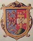
Marianske Hory
| Marianske Hory | ||||
|---|---|---|---|---|
|
||||
| Basic data | ||||
| State : |
|
|||
| Region : | Moravskoslezský kraj | |||
| District : | Ostrava-město | |||
| Municipality : | Ostrava | |||
| Geographic location : | 49 ° 50 ' N , 18 ° 15' E | |||
| Height: | 214 m nm | |||
| Residents : | 11,879 (March 1, 2001) | |||
| Postal code : | 709 00 | |||
| License plate : | T | |||
| traffic | ||||
| Street: | Bohumín - Příbor | |||
| Railway connection: | Břeclav – Ostrava hl.n. | |||
| Next international airport : | Ostrava Airport | |||
Mariánské Hory , until 1901 Lhotka u Moravské Ostravy , formerly Čertova Lhota (German Marienberg , until 1901 Ellgoth , formerly Teufelsdorf ) is a district of the city of Ostrava in the Czech Republic . It belongs to the Mariánské Hory a Hulváky district and is located three kilometers west of the city center of Ostrava.
geography
Mariánské Hory is located on the right side of the Oder opposite the confluence of the Opava on Černý potok. State road 58 leads through the village from Bohumín to Ostrava Airport and arterial road 479 from the city center to Poruba. Mariánské Hory is located on the railway line from Břeclav to Ostrava hlavní nádraží ( Central Station ). The “Ostrava-Mariánské Hory” railway station is located at the industrial area.
Neighboring districts are Lhotka in the north, Přívoz in the north-east, Moravská Ostrava in the east, Vítkovice in the south-east, Hulváky in the south, Nová Ves in the south-west, Třebovice in the west and Hošťálkovice in the north-west.
history
Originally located on the pond landscape of the Oder meadows, the village emerged at the end of the 13th century. The place was first mentioned in a document in 1367 in connection with the episcopal feudal man Herscho de Teufflsdorf as Teufelsdorf . From 1380 the Czech name form Czrtowalhota was also used. Until 1426 the noble owners of the village changed frequently, then the place was sold to citizens of Moravian Ostrau. After the occupation of the Hochwald dominion , the Hussite leader Jan Čapek ze Sán Čertova Lhota acquired along with Ostrava. In 1444 the bishopric Olomouc regained the property. The residents of the place lived mainly from fishing and agriculture, to the north were large fish ponds in the Oder meadows. In 1539 Bishop Stanislaus Thurzo left the village in exchange for an annual delivery of carp and pike to the city of Mährisch Ostrau.
During the Swedish occupation of the city during the Thirty Years' War in 1642, Teufelsdorf had to bear 14% of the 15,000 guilders incurred in military costs. The place names Diaboli villa and Čertova Lhotka were also used up to the 17th century , after which the new name Ellgoth or Lhotka became common . After the Silesian division, Ellgoth, located on Moravian territory, was from 1742 on the Prussian border, which was drawn here along the Oder and Oppa . In 1834 the village had 209 inhabitants. Until the abolition of patrimonial Ellgoth remained part of Mährisch Ostrau.
In 1847, the Kaiser-Ferdinands-Nordbahn began operating north of the village on the main route from Vienna to Krakow. Almost three kilometers to the northeast, the Mährisch Ostrau-Privoz train station was built in an open field. From 1850 Ellgoth / Lhotka formed a municipality in the Mistek district . In 1880 there were 472 people in the community. During this time, industrialization began. The ponds on the Oder were drained and a coking plant was built in the corridors of Ellgoth. This was followed by brickworks, a machine factory, iron foundry and a spirit refinery, for which workers' settlements were built. In the 1890s Ellgoth was assigned to the district of Mährisch Ostrau. In 1890 Ellgoth already had 1154 inhabitants. Ten years later, the village had become a working class suburb with a population of 7,571. In 1900 the community tried to change its name. Instead of Ellgoth bei Ostrau / Lhotka u Moravské Ostravy , it should first be called Ostravská Lhotka . Finally, the community decided on Mariánské Hory / Marienberg , named after the Virgin Mary and the coal and iron ore mining that characterize the place. In 1901 the name was changed. On April 1, 1907, Emperor Franz Joseph I. elevated Mariánské Hory / Marienberg to a town. Mayor of the city was from 1906 to 1910 the doctor Jan May, who in 1902 founded the miners' sanatorium Lázně Skalka near Čeladná .
In January 1919, after the establishment of Czechoslovakia, the city council resigned and the official business was decayed by a commission until 1924. In 1921 the population was 95% Czech. In 1924 Mariánské Hory was incorporated into Moravian Ostrava as part of the plans to create a "Great Ostrava". Since 1990, the district together with Hulváky has made up the Mariánské Hory a Hulváky district . In 1991 the district had 13,594 inhabitants. In 2001 Mariánské Hory consisted of 717 apartment buildings, in which 11879 people lived.
Attractions
- Neo-Baroque parish church of the Virgin Mary Queen, built 1905–1908, the painting of the Archangel Michael on the side altar is by Luděk Marold , the main altar painting by Joža Uprka
- Lady Chapel, built in 1877
Personalities
- Otmar Mácha (1922–2006), Czech composer


