Markbach (Bavarian Schwarzach)
| Markbach | ||
|
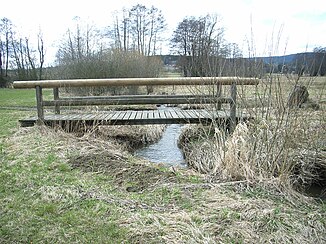
Markbach near its confluence with the Bavarian Schwarzach |
||
| Data | ||
| Water code | DE : 146242 | |
| location |
Upper Palatinate Forest
|
|
| River system | Danube | |
| Drain over | Bavarian Schwarzach → Schwarzach (Naab) → Naab → Danube → Black Sea | |
| source | South-east slope of Signalberg 49 ° 27 ′ 40 ″ N , 12 ° 32 ′ 36 ″ E |
|
| Source height | approx. 789 m | |
| muzzle | east of Krausenöd in the Bavarian Schwarzach Coordinates: 49 ° 26 '47 " N , 12 ° 35' 58" E 49 ° 26 '47 " N , 12 ° 35' 58" E |
|
| Mouth height | approx. 493 m | |
| Height difference | approx. 296 m | |
| Bottom slope | approx. 52 ‰ | |
| length | 5.7 km | |
| Catchment area | 7.34 km² | |
| Left tributaries | wire | |
| Communities | Tiefenbach (Upper Palatinate) | |
The Markbach is a 5.7 km long right tributary of the Bavarian Schwarzach in the Cham district in Upper Palatinate in Bavaria . It rises in the Markbrunnen on the south- eastern slope of the Signalberg and flows east of Krausenöd into the Bavarian Schwarzach.
course
The Markbach rises in the Markbrunnen at a height of 789 m on the southeast slope of the Signalberg. From its source it turns directly to the east. It flows exactly on the border between the district of Schwandorf in the north and the district of Cham in the south. After about 800 meters it picks up a small stream from the right.
About 200 meters further on, a slightly longer stream flows from the left. At this point, about 200 m northwest of the Schönbrunn Chapel, the Markbach changes its direction of flow and swings to the southeast. Here he leaves the district boundary. It forms a deeply cut valley in the southeast direction. Shortly before the Schönbrunn Chapel it takes on another stream coming from the left. It flows in the valley below the Schönbrunn Chapel, where it is fed from the abundant spring there, the Schönbrunnen. After another 200 meters he picks up the water from the Ferchenbrunnen, which flows into him from the left.
About 1.5 km to the southeast, the Markbach reaches the scattered settlement of Neumühle. Here it turns again in an easterly direction. Shortly after Neumühle, the only named side stream, the Draht, flows from the left. It rises in the Lohwiese, flows through the settlement Draht and flows south of Draht into the Markbach.
The Markbach flows further east to Hannesriedermühle , where it turns back to the southeast. Now its valley, which has become flatter and flatter, changes into wide, almost flat wet meadows - the Markbachaue, a biotope. The Markbachaue was acquired by the Upper Bavarian Forest Nature Park , LBV district group Cham. Aurochs were settled in the Markbachaue for landscape maintenance, which they should keep open through extensive grazing. It was hoped that these and other measures to protect the Markbachaue would also lead to a repopulation of the Markbach by the river pearl mussel . The Markbach flows strongly meandering through the Markbachaue and flows east of Krausenöd into the Bavarian Schwarzach.
Tributaries
From the source to the mouth. Selection.
Particularly in its upper reaches, the Markbach is mainly fed from the left and rarely from the right by several small unnamed streams.
The two clear and productive springs Schönbrunnen and Ferchenbrunnen, both from the left, are prominent. The Schönbrunnen spring is even said to have healing properties. In any case, she has enjoyed great veneration among the population for a long time, which is expressed in a chapel built near her and several annual pilgrimages.
- the creek wire from the left, south of the wire settlement.
Individual evidence
- ↑ a b c Course and catchment area of the Markbach
- ↑ a b Length and catchment area according to: Directory of creek and river areas in Bavaria - Naab river area, page 117 of the Bavarian State Office for the Environment, as of 2016 (PDF; 4.0 MB)
