Minamikyushu
| Minamikyushu-shi 南 九 州市 |
||
|---|---|---|
| Geographical location in Japan | ||
|
|
||
| Region : | Kyushu | |
| Prefecture : | Kagoshima | |
| Coordinates : | 31 ° 23 ' N , 130 ° 27' E | |
| Basic data | ||
| Surface: | 357.85 km² | |
| Residents : | 33,891 (October 1, 2019) |
|
| Population density : | 95 inhabitants per km² | |
| Community key : | 46223-3 | |
| Symbols | ||
| Flag / coat of arms: | ||
| town hall | ||
| Address : |
Minamikyūshū City Hall 6204 Kōri, Chiran-chō Minamikyūshū -shi Kagoshima 897-0392 |
|
| Website URL: | http://www.city.minamikyushu.lg.jp/ | |
| Location of Minamikyūshūs in Kagoshima Prefecture | ||
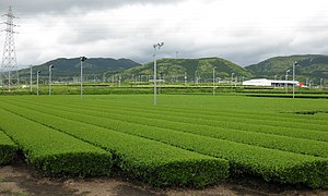
Minamikyūshū ( Japanese 南 九 州市 , - shi ) is a city in Kagoshima Prefecture on the Satsuma Peninsula in Japan .
history
Minamikyūshū was founded on December 1, 2007 from the union of the Chō Chiran ( 知 覧 町 , -chō ) and Kawanabe ( 川 辺 町 , -chō ) of the district of Kawanabe , and Ei ( 頴 娃 町 , -chō ) of the district of Ibusuki . Both districts were then dissolved.
traffic
- Train:
- JR Ibusuki-Makurazaki Line : to Makurazaki or Kagoshima
Neighboring cities and communities
Web links
Commons : Minamikyūshū - collection of pictures, videos and audio files


