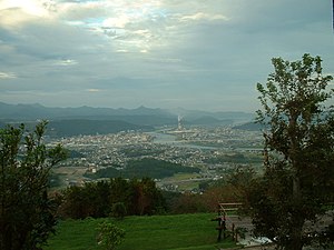
Satsumasendai
| Satsuma-Sendai-shi 薩摩川 内 市 |
||
|---|---|---|
| Geographical location in Japan | ||
|
|
||
| Region : | Kyushu | |
| Prefecture : | Kagoshima | |
| Coordinates : | 31 ° 49 ′ N , 130 ° 18 ′ E | |
| Basic data | ||
| Surface: | 683.50 km² | |
| Residents : | 93.009 (October 1, 2019) |
|
| Population density : | 136 inhabitants per km² | |
| Community key : | 46215-2 | |
| Symbols | ||
| Flag / coat of arms: | ||
| Tree : | Ilex rotunda | |
| Flower : | Splendor lily | |
| Bird : | Zosterops japonicus | |
| River fish: | Plecoglossus altivelis altivelis | |
| Sea fish: | Spratelloides gracilis | |
| town hall | ||
| Address : |
Satsuma-Sendai City Hall 3 - 22 , Kanda-chō Satsuma-Sendai -shi Kagoshima 895-8650 |
|
| Website URL: | http://www.city.satsumasendai.kagoshima.jp/ | |
| Location Satsuma-Sendais in Kagoshima Prefecture | ||
Satsumasendai ( Japanese 薩摩川 内 市 , - shi ) is a city in Kagoshima Prefecture in Japan .
history
When Satsuma Province was founded in 702, this was the seat of the provincial government.
Today's Satsuma-Sendai community was created on October 12, 2004 from the amalgamation of Sendai , Hiwaki , Iriki , Tōgō Kedōin , and the villages of Kami-Koshikijima , Shimo-Koshikijima , Sato and Kashima of the Koshikijima Islands .
traffic
- Streets:
- National road 3 : to Kitakyushu or Kagoshima
- National roads 267, 328, 504
- Train:
- JR Kyushu Shinkansen : Satsuma-Sendai Station
- JR Kagoshima Main Line : to Kokura or Kagoshima
Town twinning
Neighboring cities and communities
Web links
Commons : Satsumasendai - collection of images, videos and audio files
Individual evidence
- ↑ 薩摩 国 の 成立 . Kagoshima Prefecture, accessed August 29, 2016 (Japanese).


