Minamisatsuma
| Minamisatsuma-shi 南 さ つ ま 市 |
||
|---|---|---|
| Geographical location in Japan | ||
|
|
||
| Region : | Kyushu | |
| Prefecture : | Kagoshima | |
| Coordinates : | 31 ° 25 ′ N , 130 ° 19 ′ E | |
| Basic data | ||
| Surface: | 283.30 km² | |
| Residents : | 33,262 (October 1, 2019) |
|
| Population density : | 117 inhabitants per km² | |
| Community key : | 46220-9 | |
| Symbols | ||
| Flag / coat of arms: | ||
| Tree : | Large-leaved stone slice | |
| Flower : | Farfugium japonicum | |
| town hall | ||
| Address : |
Minamisatsuma City Hall in 2648 Kawabata, Kaseda Minamisatsuma -shi Kagoshima 897-8501 |
|
| Website URL: | http://www.city.minamisatsuma.lg.jp/ | |
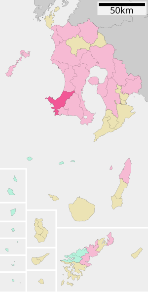
| Location of Minamisatsumas in Kagoshima Prefecture | ||
Minamisatsuma ( Japanese 南 さ つ ま 市 , - shi , literally: "South Satsuma ") is a city in Kagoshima Prefecture on the Satsuma Peninsula .
history
Minamisatsuma was formed on November 7, 2005 from the union of the city of Kaseda ( 加 世 田 市 , -shi ), and the communities of Bōnotsu ( 坊 津 町 , -chō ), Kasasa ( 笠 沙 町 , -chō ) and Ōura ( 大 浦 町 , -chō ) of Kawanabe County and Kimpō ( 金峰 町 , -chō ) of Hioki County. The latter district was then dissolved.
traffic
- Streets:
- National road 226, 270
Sports
Minamisatsuma Stadium was renamed "Yuya Osako Stadium" after Osako Yuya in June 2019 .
Neighboring cities and communities
Individual evidence
- ↑ Stadium in Japan named after Yuya Osako Message on Kreiszeitung.de , accessed on June 20, 2019
Web links
Commons : Minamisatsuma - collection of pictures, videos and audio files


