Modruš
| Modruš | ||
|
|
||
| Basic data | ||
|---|---|---|
| State : |
|
|
| County : |
|
|
| Height : | 400 m. i. J. | |
| Residents : | 600 (2008) | |
| Telephone code : | (+385) 047 | |
| Postal code : | 47303 | |
| License plate : | 1st floor | |
| Structure and administration | ||
| Community type : | Village | |
| Website : | ||

Modruš [ mˈɔdruʃ ] is a village in Croatia that played an important role in the country's earlier history.
geography
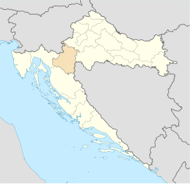
The place is located south in the municipality of Josipdol on a trade route that was important in antiquity, which connected the continental inland via a salt road (later also known as the Josephine Road ) from Karlovac to Senj on the coast. Geographically it belongs to the Lika region and administratively to the Karlovac County .
history
Modruš was founded around the year 820 as a fortress town. In 1193 the Hungarian-Croatian King Bela II left the town and the Modruš Castle , later called Tržan Castle, and the land belonging to it , to Dujam I’s 3rd son, Bartol II, Prince of Krk . Modruš remained in the possession of the Frankopans until the middle of the 16th century.
In 1493 the bishop Christophorus moved the seat of the diocese from Modruš to Novi Vinodolski on the occasion of the battle in the field of Krbava .
In the Kingdom of Croatia and Slavonia , the place gave its name to the Modruš-Rijeka county, whose county seat was in nearby Ogulin .
Web links
- Official homepage (Croatian)
