Moosgraben (Danube)
|
Moosgraben Spitalbach |
||
|
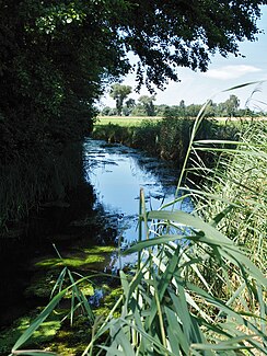
Close to Gartenstraße in Straubing |
||
| Data | ||
| Water code | EN : 1572 | |
| location | Bavaria | |
| River system | Danube | |
| Drain over | Danube → Black Sea | |
| source | north of Rinkam 48 ° 53 ′ 40 ″ N , 12 ° 30 ′ 26 ″ E |
|
| Source height | over 320 m above sea level NN | |
| muzzle | in Straubing in the Danube Coordinates: 48 ° 53 ′ 8 ″ N , 12 ° 34 ′ 15 ″ E 48 ° 53 ′ 8 ″ N , 12 ° 34 ′ 15 ″ E |
|
| Mouth height | approx. 315 m above sea level NN | |
| Height difference | approx. 5 m | |
| Bottom slope | approx. 0.97 ‰ | |
| length | 5.2 km | |
| Catchment area | 14.09 km² | |
| Left tributaries | Kammerlohbach, Kagerser Moosgraben | |
| Right tributaries | Moosmühlbach | |
| Medium-sized cities | Straubing | |
| Communities | Atting | |
The Moosgraben (formerly Spitalbach ) is a five-kilometer long stream in Straubing and in the Straubing-Bogen district in Lower Bavaria , which flows into the Danube from the right at the Straubing pumping station .
course
The course runs roughly to the east, beginning as a straightened drainage ditch in the intensively agricultural areas north of Rinkam and south of Wallmühle Airport, i.e. in the Straubing-Bogen district . After about seven hundred meters you will reach the Straubing area and thus also the Straubing Polder Landscape Protection Area . Here another two kilometers run along farm roads until the first settlements on Gartenstrasse are reached. The Moosgraben now follows this road for two kilometers, still in or on the edge of the nature reserve, to the Powder Tower . This is where the nature reserve ends and the Moosgraben runs through a small park north of the old town fortifications to the pumping station on the Donaudeich.
Tributaries
- Kagerser Moosgraben (left)
- Kammerlohbach (left)
- Moosmühlbach (right)
Sights and buildings
At the mouth of the Moosgraben, the Straubing pumping station, which is a listed building, is located near the Duke's Palace .
Web links
literature
- Topographic map 7141 Straubing , Bayerisches Landesvermessungsamt, Munich 1947
- Martin Sieghart: History and description of the capital Straubing in the Lower Danube District ... 1833, p. 169-170 ( online ).
Individual evidence
- ↑ a b List of brook and river areas in Bavaria - Naab to Isar river area, page 75 of the Bavarian State Office for the Environment, as of 2016 (PDF; 2.8 MB)
- ↑ Martin Sieghart: History and description of the capital Straubing in the Unter-Donau-Kreis ... 1833, p. 169-170 ( online ).
