Moravské Předměstí
| Moravské Předměstí | ||||
|---|---|---|---|---|
|
||||
| Basic data | ||||
| State : |
|
|||
| Region : | Královéhradecký kraj | |||
| District : | Hradec Králové | |||
| Municipality : | Hradec Králové | |||
| Geographic location : | 50 ° 11 ' N , 15 ° 50' E | |||
| Height: | 233 m nm | |||
| Residents : | 5,350 (March 26, 2011) | |||
| Postal code : | 500 06, 500 11, 500 12 | |||
| License plate : | H | |||
| traffic | ||||
| Street: | Nový Hradec Králové - Vysoká nad Labem | |||
| Location of Moravské Předměstí in the Hradec Králové district | ||||

|
||||
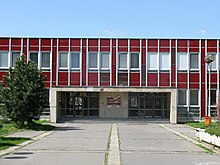
Moravské Předměstí (German Moravian suburb ) is a district of the city of Hradec Králové in the Czech Republic . The prefabricated housing estate is located three kilometers south of the city center of Hradec Králové and belongs to the Okres Hradec Králové .
geography
Moravské Předměstí is located north of Kopec sv. Jana ( Johannesberg , 273 m nm) on the northwest slope of the Třebechovická tabule ( Hohenbrucker Tafel ). The district is almost completely enclosed by the Třebeš district.
Neighboring towns are Lhota pod Strání in the east, Nový Hradec Králové and Kluky in the southeast, Kopec Sv. Jana and Roudnička in the south, Na Mlýnku and Březhrad in the south-west and Třebeš in the north-west.
Demarcation
Moravské Předměstí refers to the extensive new building area that extends south of the city center to Nový Hradec Králové and the Johannesberg. It consists of several prefabricated prefabricated districts , mainly built between the 1970s and 1990s . Only on Brněnská ( Brno Street ) is there older buildings with a few villas and the Petrof company buildings.
The new development area is divided into seven basic settlement units, of which only one - Moravské Předměstí V - forms the Moravské Předměstí district. Moravské Předměstí I, II, III, IV, VI and VII belong (in whole or in part) to Nový Hradec Králové; Moravské Předměstí IV and VII proportionally to Třebeš
history
Until the beginning of the 20th century, the area of the current district was unpopulated farmland between the villages of Třebeš, Kopec Sv. Jana, Lhota pod Strání and Nový Hradec Králové as well as the “City of Brno” excursion. To the north of it, the practice area of the Königgrätz Fortress extended to the Adler and Elbe rivers . In 1908 the first houses were built on the left side of the Adler on Brünner Strasse; the new Moravian suburb was part of the city of Königgrätz, but remained completely insignificant and did not deserve the name suburb . On July 1 and 3, 1910, around 30,000 people watched the landing and take-off of one of the first motor-powered aircraft in Bohemia at the Königgrätz military training area.
In the 1910s, the first ideas for the creation of a new, southern district of Königgrätz emerged. After the First World War, the architect Oldřich Liska took up these and presented concrete plans, which were not implemented. After the Second World War, new plans arose to build a new campus for the Hradec Králové Pedagogical University on the site of the Na Plachtě military training area , but these were abandoned in 1949.
The ideas for building a southern suburb in the 1960s were taken up again. The project submitted by Prague architects Josef Němec and Karel Marhold as part of an urban planning competition was awarded the contract and was implemented in 1967–1968. In the mid-1970s, the Moravské Předměstí V residential area was built. The general designer of the entire new building area with 10,000 apartments was the architect František Křelina. In 1977 the primary school " Milada Horáková " was built, in 1984 the primary school "Mandysova" was completed. On March 1, 1980, the Moravské Předměstí V district was spun off as a new district Moravské Předměstí from the Třebeš district.
After the Velvet Revolution , the further development possibilities of the new building area were severely restricted from an urban planning point of view; In 1990 only 460 small apartments were built. Part of the streets have been renamed; ul. Dimitrova became ul. Palachova, ul. Marxova became třída Edvarda Beneše and ul. Salvadora Allende became ul. Milady Horákové. In 1993 Polyclinic III and the “Las Vegas” shopping center were completed.
On March 3, 1991 the district had 6,785 inhabitants; in the 2001 census, 6,163 people lived in Moravské Předměstí's 185 houses.
Local division
The district Moravské Předměstí consists of the basic settlement unit Moravské Předměstí V.
Moravské Předměstí is the only district of Hradec Králové without its own cadastral district, it is part of the Třebeš cadastral district.
The district is represented by the local self-government commissions ( Komise místní samosprávy ) Moravské Předměstí jih, Moravské Předměstí sever and Moravské Předměstí východ.
Web links
Individual evidence
- ↑ http://www.uir.cz/zsj-casti-obce/047180/Cast-obce-Novy-Hradec-Kralove
- ↑ http://www.uir.cz/zsj-casti-obce/409847/Cast-obce-Trebes
- ↑ https://www.czso.cz/documents/10180/20565661/13810901.pdf/3fde2441-c81b-4a1e-9b94-551e65007f70?version=1.0
- ↑ http://www.uir.cz/zsj/30347/Moravske-Predmesti-V
- ↑ Archived copy ( memento of the original dated February 23, 2017 in the Internet Archive ) Info: The archive link was inserted automatically and has not yet been checked. Please check the original and archive link according to the instructions and then remove this notice.


