Mota Lava
| Mota Lava | ||
|---|---|---|
| Mota Lava | ||
| Waters | Coral sea | |
| Archipelago | Banks Islands | |
| Geographical location | 13 ° 41 ′ 0 ″ S , 167 ° 40 ′ 0 ″ E | |
|
|
||
| surface | 24 km² | |
| Highest elevation | 411 m | |
| Residents | 1451 (2009) 60 inhabitants / km² |
|
| main place | Lahlap | |
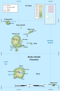
| Banks Islands with Mota Lava | ||
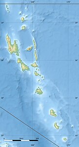
Mota Lava , also Motalava , is an island of the Banks Islands in the north of the Pacific island state of Vanuatu .
It is located northeast of Vanua Lava and, like this, belongs to the Vanuatu province of Torba . Mota Lava is inhabited and even has a small airfield. The 24 km² island consists of at least five basaltic stratovolcanoes and two pyroclastic cones and reaches a height of 411 m above sea level. The neighboring island of Ra, which is also inhabited, is just under 300 meters off the southwest coast . Ra and Mota Lava are surrounded by a common coral reef.
Web links
Commons : Mota Lava - collection of images, videos and audio files
- Mota Lava in the Global Volcanism Program of the Smithsonian Institution (English)
Individual evidence
- ↑ UNEP Islands Directory (English)


