Mutterbach (Blies)
| Mutterbach | ||
|
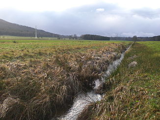
In the valley of the Mutterbach, immediately before the passage under the A 8 |
||
| Data | ||
| Water code | DE : 264236 | |
| location | Saarland | |
| River system | Rhine | |
| Drain over | Blies → Saar → Moselle → Rhine → North Sea | |
| source | 1 km east of Rohrbach 49 ° 17 ′ 8 ″ N , 7 ° 11 ′ 0 ″ E |
|
| Source height | approx. 270 m | |
| muzzle | in Limbach in the Blies Coordinates: 49 ° 18 ′ 54 ″ N , 7 ° 16 ′ 56 ″ E 49 ° 18 ′ 54 ″ N , 7 ° 16 ′ 56 ″ E |
|
| Mouth height | approx. 227 m above sea level NN | |
| Height difference | approx. 43 m | |
| Bottom slope | approx. 5 ‰ | |
| length | 8.6 km | |
| Catchment area | 18.38 km² | |
The Mutterbach is an 8.6 km long right tributary of the Blies in the eastern Saarland , which flows into Limbach . Until the 19th century, the older name Limbach was used for the stream. This name was suppressed in order to dissimilate the name of the stream and settlement. In the 20th century the brook was called the Woog or Mutterbach. Limbach, Eschweilerhof , Abstäberhof and Bayerisch Kohlhof are in the catchment area of the stream .
geography
course
The Mutterbach rises east of Rohrbach about 500 meters southeast of the Steigberg (306 m above sea level), which here represents the watershed between Blies and Saar , at about 270 m above sea level and runs almost in an east-northeast direction before it comes in Limbach from the right flows into the Blies .
On his way there he is accompanied by several traffic routes, first the A 6 , which he crosses from north to south about 2.5 km after its source, then also the former Kaiserstraße or Bundesstraße 40 (now L 119) and the Saarbrücken-Ludwigshafen railway line . After 5.5 km, it crosses the A 8 , which is a hiking barrier, and then flows through the residential development of Limbach.
Tributaries
- Speckenbach ( left )
Usage history

In the Middle Ages, the area belonged to the Wörschweiler monastery and then came to Pfalz-Zweibrücken . In 1564 the geographer Tilemann Stella named numerous larger and smaller ponds in his description and map of the offices of Zweibrücken and Kirkel in the catchment area of the brook. He describes the stream and its five small tributaries:
“The Limpach or Limpacherbach, which runs down through the twentieth and twentieth main ground, has a length of 5900 paces, which is 1 1/4 mile less 100 paces. She rises from many laughter, flows down as common through great gems and usage, but makes much finer weight. Inn these fall: The Eischweiler bächlin is long 1400 paces ... The Eischweiller Born river is long 210 paces ... The Bucholtzer river is long 700 paces ... The flößgen from the cellar wägell is long 540 paces ... The Grunbach is a long 1600 step. "
Of the 13 ponds described by Stella in the catchment area of this stream, the mother stream itself flowed through the following six:
“The uppermost Buchholtzer wagk is 80 paces long and 40 wide ... The lower Buchholtzer wagk is 180 paces long and 50 paces wide, it has two horns ... The lower Eischweiler wagk is 260 paces long and 60 wide, it has two horns ... The Herr Steinfurt is long 420 and 200 steps and 80 wide ... The Apt Steinfurt is long 480 steps and 140 wide ... The Limpacher wagk is long on one and the longest horn 1100 and on the other 464 step. The dam is 300 paces long, its largest width is 600 paces. His bodem brightens up tomorrow. "
All of the ponds mentioned were drained in the 19th century for grassland reclamation; the considerable medieval pond dams are mostly still preserved. The water-rich valley has served as a water supply for the industrial city of Neunkirchen (Saar) since the 20th century . During the territorial and administrative reform in Saarland in 1974 , the valley that until then belonged to Kirkel, as far as it runs north of the A 6, was added to the city of Neunkirchen, which now pumps the water there.
Individual evidence
- ↑ WFD Saarland surface water bodies - target achievement (PDF; 58 kB)
- ↑ Michael Frey : Attempt of a geographical-historical-statistical description of the court district of Zweibrücken in the royal. bayer. Rhine districts, dermal Palatinate , part 4, Speyer 1837, p. 7
- ^ Rolf Spang : The names of the waters of the Saarland. Saarbrücken 1982, ISBN 3-921646-45-6 , p. 212.
- ↑ a b Tilemann Stella: Thorough and thorough description of the baider ambter Zweibrücken and Kirckel, as they were located in 1564 . Editor: Eginhard Scharf. Historischer Verein, Zweibrücken 1993, ISBN 3-924171-15-7 , p. 159.
