Namonuito
| Namonuito | ||
|---|---|---|
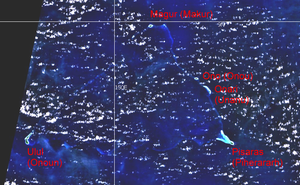
| NASA satellite image with community names inscribed | ||
| Waters | Pacific Ocean | |
| archipelago | Carolines | |
| Geographical location | 8 ° 40 ′ N , 150 ° 0 ′ E | |
|
|
||
| Number of islands | 12 | |
| Main island | Onoun (Ulul) | |
| length | 88 km | |
| width | 52 km | |
| Land area | 4.38 km² | |
| Lagoon area | 1 874.9 km² | |
| total area | 2 267 km² | |
| Residents | 1341 (2000) | |
| Main island of Ulul (Onoun) | ||
Namonuito , also Namonweito , Weito , or Magur Islands , is a large atoll in the northwest of the Chuuk state of the Federated States of Micronesia .
geography
Namonuito is 170 km northwest of the main islands of Chuuk , and 137 km west of Nomwin Atoll in the Hall Islands .
With a total area of 2267 km² (of which 1874.9 km² lagoon area ) it is only surpassed in Micronesia by Kwajalein and Chuuk . The atoll resembles a triangle, with an 82 km long base forming the southern flank. The land area of the total of 12 islands is only 4.38 km². The population at the 2000 census was 1,341.
Large parts of the reef rim have sunk or lie in relatively deep water, which is not an obstacle to shipping, so that the atoll is not perceived as such from close up, especially since there are great distances between individual islands, around 80 km along the southern flank of the atoll and over 50 km along the northwest flank. Most of the islands lie along the northeast flank of the atoll. Entering the lagoon or passing through is therefore not restricted to certain passages, as is typically the case in atolls, but is possible at most points along the ring of atolls.
The main island is Onoun (Ulul) in the southwest, with a land area of 2.54 km² (more than half the land mass of the entire atoll) and a population of 598 (2000). Onoun is the largest community in the atoll.
administration
Administratively, the atoll is divided into five municipalities, out of a total of 40 in the state of Chuuk. These belong to the statistical island region of Oksoritod (northwest).
Individual evidence
- ↑ Page no longer available , search in web archives: Atoll Area, Depth and Rainfall
- ^ Otis W. Freeman, Geography of the Pacific, Wiley 1953
- ↑ 2000 FSM Census of Chuuk State (PDF; 3.6 MB)
Web links
- Benjamin C. Stone: The Flora of Namonuito and the Hall Islands, Department of Botany, University of Hawaii, Manuscript received November 4, 1957 (PDF; 7.9 MB) with a description of the most important individual islands


