Nan Shan
| Nan Shan | ||
|---|---|---|
|
Nan Shan near the county town of Qilian, Qinghai |
||
| Highest peak | . ( 6346 m ) | |
| location | Qinghai , Gansu ( PR China ) | |
|
|
||
| Coordinates | 39 ° 6 ' N , 93 ° 12' E | |
|
Nan Shan at the Buddhist grottoes of Mati Si, Gansu |
||
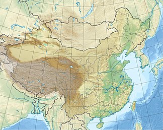
Nan Shan ( Chinese 南山 , Pinyin Nán Shān ) is a mountain range up to 6346 m high in the People's Republic of China ( Asia ) and extends on the border between the provinces of Qinghai and Gansu . It thus represents the transition from the northern edge of the Tibetan high plateau to the desert regions of the Gobi .
The name Nan Shan means "southern mountains", "southern mountains" or "southern mountains" and is explained by the fact that one looked south to these mountains from the old oases of the Silk Road , which was the most important trade connection to West Asia . Curiously, the easternmost chains of these "southern mountains" merge in the south with the Bei Shan ( 北山 , Běi Shān - "the northern mountains"), the "northern mountains", which get their name from the point of view of the settlement centers of the province of Qinghai further south have received.
geography
The high mountains , which mainly consist of the western Altun Shan (also: Altyn Tagh) and the eastern Qilian Shan , are located in the northwestern Chinese Uyghur Autonomous Region of Xinjiang and the provinces of Qinghai and Gansu . In the west, it branches off from Kunlun Shan , which is actually neighboring to the south , and runs in an elongated arc westward through China to around the high mountain lake Qinghai . In the west and north, the northern foothills of the Nan Shan meet the Tarim Basin and thus the Taklamakan desert in the context of the Altun , and the Gobi desert in the east . As part of the Qilian Shan, these meet the Gobi Desert, while the southern foothills there border the Qaidam Basin .
Sulamutag Feng, the highest mountain in the Nan Shan mountain range, is at 6346 m above sea level in the central Altun Shan.
history
The mountains of the highlands and their framing - such as the Himalayas , Kunlun Shan and Nan Shan - were created in the context of the collision of the plates of the Indian subcontinent with the Eurasian plate in the late Tertiary , thereby closing the primeval ocean known as Tethys . Not only was the continental clod raised and thickened, but a smaller continental clod, which had already been "baked" between the two clods, was welded to the adjacent slabs over mountain ridges. The tectonic forces created further cracks and stress fields that led to fractures and depressions ( fracture tectonics ): for example, the Tarim Basin in Xinjiang and the Qaidam Basin south of the Nan Shan, and with them their peripheral mountains, were formed.
literature
- G. Stauch, F. Lehmkuhl (2003): Landscapes on the Silk Road in the 21st Century: The Qilian Shan in Northern China. - Petermanns Geographische Mitteilungen 147 (5): 4–5.
Web links
- Qilian Shan on Peakbagger.com (English)
- Climatological Information (Reference) for Qilian Shan


