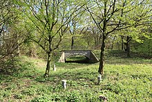
Resser woods nature reserve
|
Resser woods nature reserve
|
||
|
Resser grove from the northeast with Gut Steinhausen |
||
| location | North Rhine-Westphalia , Germany | |
| surface | 31.5 ha | |
| Identifier | HER-004 | |
| Geographical location | 51 ° 33 ' N , 7 ° 8' E | |
|
|
||
The nature reserve Resser Wäldchen is a 31.5 hectare nature reserve in the two independent Ruhr area cities of Herne and Gelsenkirchen . Legally, there are two areas that are administered separately, but are directly adjacent and have the same name. The Herne area (NSG identification HER-004) has an area of 28.5 hectares and has existed since 2000. The Gelsenkirchen area to the west (identification GE-018) is significantly smaller with 3.0 hectares and has existed since 2006.
The Resser grove is almost entirely made up of deciduous forest, predominantly hornbeam and pedunculate oak forest , partly with pedunculate oaks. Approximately in the middle of the area there are two ponds.
location
The nature reserve is located in the districts of Wanne-Eickel (Herne) and Bismarck (Gelsenkirchen). It is bounded in the north by the Emscher , in the east by Gut Steinhausen (formerly Haus Hörstgen) and by Wiedehopfstrasse. The southern border is roughly the B 226 , which is called Dorstener Strasse in the Herner area and Willy-Brandt-Allee in the Gelsenkirchen area; The Rhine-Herne Canal runs south of the federal road . In the city of Herne, the southern border follows the historic Gahlener Kohlenweg , whose curved course also takes into account a meander of the historic Emscher. The western edge of the nature reserve is formed by the dry stream of the Fleithe or the Fleutebach, a former tributary of the Emscher, which was straightened in this area in the 20th century, relocated to the north and diked. Some older drainage ditches leading to the Fleithe can also be seen in the area.
The Gelsenkirchen district of Resser Mark is to the northwest of the nature reserve . Its name refers - in the sense of the original Buer -Bauerschaften corner Resse and Surresse (see. Resse ) associated Mark - to the forest and heath landscape that until in the field of industrialization was a large area. Both the Resser Mark forest area in the district of the same name and the Resser woods were part of the historic Resser Mark, which included other areas that are now built on.
See also
Web links
- Nature reserve "Resser Wäldchen" (HER-004) in the specialist information system of the State Office for Nature, Environment and Consumer Protection in North Rhine-Westphalia
- Nature reserve "Resser Wäldchen" (GE-018) in the specialist information system of the State Office for Nature, Environment and Consumer Protection in North Rhine-Westphalia
Individual evidence
- ↑ a b c Topographical Information Management, Cologne District Government, Department GEObasis NRW ( information )


