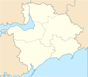
Novooleksiyivka (Prymorsk)
| Novooleksiyivka | ||
| Новоолексіївка | ||

|
|
|
| Basic data | ||
|---|---|---|
| Oblast : | Zaporizhia Oblast | |
| Rajon : | Prymorsk Raion | |
| Height : | 24 m | |
| Area : | 3.736 km² | |
| Residents : | 687 (2001) | |
| Population density : | 184 inhabitants per km² | |
| Postcodes : | 72140 | |
| Area code : | +380 6137 | |
| Geographic location : | 46 ° 48 ' N , 36 ° 12' E | |
| Administrative structure : | 5 villages | |
| Address: | вул. Громака буд. 30 72 140 с. Новоолексіївка |
|
| Website : | official website of the municipal council (Ukrainian) | |
| Statistical information | ||
|
|
||
Novooleksijiwka ( Ukrainian Новоолексіївка ; Russian Новоалексеевка Novoaleksejewka ) is a village in the south of the Ukrainian Oblast of Zaporizhia with 687 inhabitants (2001).
history
The village was founded in 1861 on the site of a former Nogai - Tatar aul by settlers from Mykolaivka in the Berdyansk district and from villages in the Kharkov , Voronezh and Chernigov governorates . The Prussian naturalist Peter Simon Pallas already pointed out the high iron content in the ore of the area at the turn of the 18th and 19th centuries. From 1876 ore was mined here and in 1893 a Belgian-Russian company was founded here to develop the area. The ore extracted from a quarry was transported in carts and to the railway stations in Jelysavetivka ( ⊙ ) and Melitopol until the First World War .
local community
Nowooleksijiwka since August 27, 2017, the administrative center of the 206.9 square kilometers of rural community ( Новоолексіївська сільська об'єднана територіальна громада Nowooleksijiwska silska objednana terytorialna hromada ) in Rajon Prymorsk , with more than 2,300 inhabitants (1 January 2018) to the still the villages of Losuwatka ( Лозуватка , ⊙ ) with about 700 inhabitants Manujliwka ( Мануйлівка , ⊙ ) with about 600 inhabitants Petrivka ( Петрівка , ⊙ ) with about 800 inhabitants Kalyniwka ( Калинівка , ⊙ ) with about 80 inhabitants.
Geographical location
The village is located in the steppe zone at a height of 24 m on the middle course of the Losuwatka ( Лозуватка ), a 78 km long tributary to the Sea of Azov , 19 km northwest of the Prymorsk district center and 170 km southeast of the Zaporizhia Oblast center . Territorial road T – 08–21 runs east of the village .
Web links
- Website of the former municipal council on rada.info (Ukrainian)
Individual evidence
- ↑ a b local website on the official website of the Verkhovna Rada ; accessed on September 11, 2019 (Ukrainian)
- ↑ history Nowooleksijiwka in the history of the towns and villages of the Ukrainian SSR ; accessed on September 11, 2019 (Ukrainian)
- ↑ Investment passport on the official website of the municipality; accessed on September 11, 2019 (Ukrainian)
- ↑ official website of the rural community ; accessed on September 11, 2019 (Ukrainian)
- ^ Structure of the municipality on the official website of the rural municipality; accessed on September 11, 2019 (Ukrainian)
- ↑ Новоолексіївська сільська об'єднана територіальна громада on decentralization.gov.ua ; accessed on September 11, 2019 (Ukrainian)

