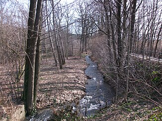
Upper Querenbach
| Upper Querenbach | ||
|
Upper Querenbach |
||
| Data | ||
| Water code | DE : 5418224 | |
| location | Germany, Saxony | |
| River system | Elbe | |
| Drain over | Gablenzbach → Würschnitz → Chemnitz → Zwickauer Mulde → Mulde → Elbe → North Sea | |
| source | southwest of Brünlos 50 ° 40 ′ 25 ″ N , 12 ° 48 ′ 20 ″ E |
|
| Source height | about 583 m above sea level NHN | |
| muzzle | in Stollberg / Erzgeb. Coordinates: 50 ° 41 ′ 57 " N , 12 ° 46 ′ 23" E 50 ° 41 ′ 57 " N , 12 ° 46 ′ 23" E |
|
| Mouth height | about 422 m above sea level NHN | |
| Height difference | about 161 m | |
| Bottom slope | about 38 ‰ | |
| length | 4.2 km | |
| Catchment area | 5.4 km² | |
The Obere Querenbach is a right tributary of the Gablenzbach near Stollberg / Erzgeb. in the Saxon Ore Mountains .
course
The Obere Querenbach - about 2.4 km to the northeast there is the Untere Querenbach - has its source in Brünlos on the S 258 near the former excursion restaurant Waldschlößchen . After about 1 km of walking, it is dammed by the holy pond . This water storage, operated by the city of Stollberg, has a 7.5 m high earth dam and was built in 1949. There are numerous wells in the area that were built to supply the city of Oelsnitz after the First World War . The good quality of the water is due to the fact that the northern edge of the Ore Mountains is interspersed with numerous sloping hollows that are filled with rubble covers that filter the water. Via Mitteldorf the brook flows further to the north-west and flows into the Gablenzbach after a total of 4.2 km.
See also
Individual evidence
- ↑ a b Saxony Atlas
- ↑ a b Map of the Saxony water balance portal
- ↑ Dams directory 2002 - Dams, reservoirs and flood retention basins in the Free State of Saxony No. 83, p. 15 (PDF; 500 kB)
- ↑ Querenbachtalsperre. In: Between Mülsengrund, Stollberg and Zwönitztal (= values of our homeland . Volume 35). 1st edition. Akademie Verlag, Berlin 1981, p. 168.
