Ontario Highway 402
| King's Highway 402 in Ontario, Canada | |||||||||||||||||||||||||||||||||||||||||||||||||||||||

|
|||||||||||||||||||||||||||||||||||||||||||||||||||||||
| map | |||||||||||||||||||||||||||||||||||||||||||||||||||||||
| Basic data | |||||||||||||||||||||||||||||||||||||||||||||||||||||||
| Operator: | Ontario Ministry of Transportation | ||||||||||||||||||||||||||||||||||||||||||||||||||||||
| Start of the street: |
Point Edward ( 43 ° 0 ′ N , 82 ° 25 ′ W ) |
||||||||||||||||||||||||||||||||||||||||||||||||||||||
| End of street: |
London ( 42 ° 55 ′ N , 81 ° 14 ′ W ) |
||||||||||||||||||||||||||||||||||||||||||||||||||||||
| Overall length: | 91 km | ||||||||||||||||||||||||||||||||||||||||||||||||||||||
|
Region : |
|||||||||||||||||||||||||||||||||||||||||||||||||||||||
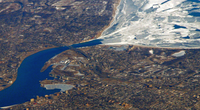
| Highway 402 south of frozen Lake Huron | |||||||||||||||||||||||||||||||||||||||||||||||||||||||
|
Course of the road
|
|||||||||||||||||||||||||||||||||||||||||||||||||||||||
The Ontario Highway 402 begins at the border with the United States on the St. Clair River and ends on Ontario Highway 401 in London . It has a total length of 91 km and is part of the National Highway System.
Routing
The route begins on the border with the United States at the Blue Water Bridge , the western extension is Interstate 69 to Detroit and Interstate 94 to Flint . The limit is exceeded here by an average of 4,400 trucks every day. The western end of the highway is in Point Edward , and from there the highway heads west. Sarnia connects directly to Point Edward . The highway runs right through the city, in the east of the city Highway 40 branches off to the south. To the east of this junction is Sarnia Chris Hadfield Airport , which is connected to road traffic by Highway 402.
The highway runs strictly in an easterly direction until it meets the northern city limits of Strathroy-Caradoc , from where the route runs in a south-easterly direction. South of London, the highway meets Highway 401, which runs from Windsor to Toronto .
history
The first planning for the route began in 1938. After the construction of the Blue Water Bridge, the western section began, but due to the war, the section to Sarnia was not completed until 1953. In 1957 it was decided to extend the route to Highway 401. After minor preparatory work, however, the final route was not determined until 1968, the start of construction was delayed until 1972. Construction took some time, so that the entire route was not completed until 1982.
Individual evidence
- ↑ Provincial Highways Traffic Volumes 2013. (PDF, 192 kB) (No longer available online.) Ministry of Transportation Ontario, 2013, p. 39 , archived from the original on December 13, 2016 ; accessed on December 13, 2016 . Info: The archive link was inserted automatically and has not yet been checked. Please check the original and archive link according to the instructions and then remove this notice.
- ↑ Canada's National Highway System - Annual Report 2015. (PDF, 5.28 MB) Council of Ministers, September 2016, accessed on December 13, 2016 .
- ^ Ontario Border Crossings. Ministry of Transportation Ontario, accessed December 13, 2016 .
- ↑ Directions. Sarnia Chris Hadfield Airport, accessed December 13, 2016 .
- ^ Built Heritage, Cultural Landscape and Planning Section: Heritage Impact Assessment: Christina Street Bridge over Highway 402, Sarnia. (PDF) Archaeological Services Inc, January 2006, p. 4 , accessed on December 13, 2016 (English).
- ^ Sarnia Link to 401 in Project. In: The Windsor Daily Star. September 12, 1957, p. 20 , accessed December 13, 2016 .


