Ossenbeck (Wupper)
| Ossenbeck | ||
|
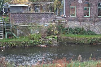
The Ossenbeck flows into the Wupper |
||
| Data | ||
| Water code | DE : 273651532 | |
| location | Wuppertal , North Rhine-Westphalia , Germany | |
| River system | Rhine | |
| Drain over | Wupper → Rhine → North Sea | |
| source | At the allotment garden In den Stöcken in Wuppertal 51 ° 14 ′ 11 ″ N , 7 ° 8 ′ 10 ″ E |
|
| Source height | 239 m above sea level NN | |
| muzzle | In Wuppertal- Elberfeld in the Wupper coordinates: 51 ° 14 '59 " N , 7 ° 7' 47" E 51 ° 14 '59 " N , 7 ° 7' 47" E |
|
| Mouth height | 139 m above sea level NN | |
| Height difference | 100 m | |
| Bottom slope | 53 ‰ | |
| length | 1.9 km | |
| Catchment area | 1.775 km² | |
| Big cities | Wuppertal | |
|
Tributaries and hydraulic structures
|
|||||||||||||||||||||||||||||||||||||||||||||||||||
The Ossenbeck is a left tributary of the Wupper in the Elberfeld-West district of the North Rhine-Westphalian city of Wuppertal .
Location and topography
The Ossenbeck rises at 239 m above sea level. NN near the allotment garden and location In den Stöcken am Friedrichsberg in the residential area of the same name. It flows north, is dammed in two ponds and flows below the streets Viehhofstraße , Güterstraße , Arrenberger Straße and Senefeldstraße, past the eastern portal of the Kiesberg tunnel through the residential area of Arrenberg zur Wupper , where it is about 1.9 kilometers at 139 m ü. NN flows. The Ossenbeck passes under the Düsseldorf – Elberfeld railway line and the 7 federal highway .
The brook gave the Ossenbeck location its name. The location of Im Siepen am Bach went down in the 1920s.
Web links
Individual evidence
- ^ German basic map 1: 5000
- ↑ Topographic map 1: 25,000
- ↑ a b river basin geographic information system of Wupperverbandes
