Pestschanaja (Ob)
|
Pestschanaja Песча́ная |
||
|
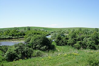
Pestschanaja near Totschilnoje in the Smolensky district |
||
| Data | ||
| Water code | RU : 13010200312115100007804 | |
| location | Republic of Altai , Altai ( Russia ) | |
| River system | If | |
| Drain over | Whether → Arctic Ocean | |
| source | Northern flank of the Sema ridge (northwest Altai Mountains ) 50 ° 56 ′ 52 ″ N , 85 ° 15 ′ 50 ″ E |
|
| Source height | approx. 1500 m | |
| muzzle |
Ob coordinates: 52 ° 25 ′ 15 " N , 84 ° 49 ′ 49" E 52 ° 25 ′ 15 " N , 84 ° 49 ′ 49" E |
|
| Mouth height | 160 m | |
| Height difference | approx. 1340 m | |
| Bottom slope | approx. 4.9 ‰ | |
| length | 276 km | |
| Catchment area | 5660 km² | |
| Discharge at the Totschilnoje A Eo gauge : 4720 km². Location: 54 km above the mouth |
MQ 1932/2000 Mq 1932/2000 |
31.5 m³ / s 6.7 l / (s km²) |
| Right tributaries | Poperechnaja | |
| Communities | Smolenskoye | |
The Pestschanaja ( Russian Песча́ная ) is a right tributary of the Upper Ob in the Altai Republic and in the Altai region .
The Pestschanaja rises on the northern slope of the Sema-comb in the northwestern Altai Mountains in the Republic of Altai. It flows mainly in a northerly direction through the mountains and reaches the plain of the Altai foreland . It passes the Raion administrative center of Smolenskoye and finally flows into the upper reaches of the Ob, 16 km below the junction of the two Ob source rivers Katun and Bija . The Pestschanaja has a length of 276 km. It drains an area of 5660 km². The mean discharge at the Totschilnoje gauge 54 km above the mouth is 31.5 m³ / s. The river is mainly fed by the snowmelt . The Pestschanaja reaches its greatest runoff in the months of April (88.70 m³ / s) and May (83.61 m³ / s).
Individual evidence
- ↑ a b c Pestschanaja in the State Water Directory of the Russian Federation (Russian)
- ↑ a b c Pestschanaja at the Totschilnoje gauge - hydrographic data at R-ArcticNET
