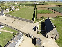
Phare de Saint-Mathieu
| Phare de Saint-Mathieu | ||
|---|---|---|
| Semaphore , abbey and lighthouse Saint-Mathieu | ||
| Place: | Plougonvelin , France | |
| Location: | Finistère , Brittany , France | |
| Geographical location: | 48 ° 19 '48 " N , 4 ° 46' 15" W | |
| Height of tower base: | 19 m | |
| Fire carrier height : | 37 m | |
| Fire height : | 56 m | |
|
|
||
| Identifier : | a white flash every 15 seconds | |
| Scope knows: | 29 nm (53.7 km ) | |
| Function: | Orientation fire | |
| Operating time: | 1740 | |
Phare de Saint-Mathieu is the name of a lighthouse on the Saint-Mathieu point in Plougonvelin in the Finistère department . It was built on the site of the old Saint-Mathieu Abbey . Its range is theoretically 29 nautical miles , which corresponds to about 55 kilometers.
Together with the Kermorvan beacon, it shows the Four Passage (Chenal du Four) , an important north-south passage from or into the Iroise , which leads between the mainland and the island of Ouessant and therefore saves around two days, while, in conjunction with the Portzic lighthouse, it illuminates the entrance to the Bay of Brest .
The lighthouse has been listed as a historic monument of France since May 23, 2011 . It is open to the public for visits.
history
As early as November 19, 1691, it was suggested that a beacon should be lit on the abbey tower. To complete the marking, the Stiff lighthouse was inaugurated on Ouessant in 1699 . Maintaining the costly fires was difficult for economic reasons. The abbey fire was only operated on dark autumn and winter nights. Added to this was the fact that coal was very inefficient and posed a major fire hazard to the abbey.
In December 1695 copper lamps were installed, but they also had various disadvantages. When the oil level fell or windows were soiled by smoke, the visibility of the beacon was significantly restricted.
After complaints from high-ranking military officials, such as B. Tourville , in 1701 the French Navy rented the lighthouse in connection with a residential building and permanently occupied it with a guard. In 1750 the tower was badly damaged by storms.
In 1771, Lieutenant General d'Estaing had some important changes made. A mixture of rapeseed and fish oil was used as fuel for the new wick lamps, and the beacon was encased in polished metal plates. This measure increased the range to 30 km.
In 1820 the lighthouse was equipped with eight lamps and various reflectors , which once again increased the range. But to get a sufficient range of the beacon, the tower was simply too low.
Current lighthouse
Due to the poor condition of the abbey tower, the order to build a new lighthouse was placed on June 15, 1835. This should have a diameter of 3.6 m and a height of 37 m and be built on a round building, equipped with shops and a living area for the lighthouse keeper. A staircase leads to the lighting system, which is around 56 m above sea level . The range is now 29 nautical miles . It was fired with rapeseed or mineral oil before electrification took place in 1935 .
In June 1963, Saint-Mathieu got its current appearance: white with red stripes and the words "SAINT-MATHIEU".
The tower was automated in 1996 and today has a range of 29 nautical miles.


