Pieria Mountains
| Pieria Mountains
Schapka Planina
|
||
|---|---|---|
| Highest peak | Flambouro ( 2188 m ) | |
| location | Imathia , Pieria and Kozani , Greece | |
|
|
||
| Coordinates | 40 ° 14 ' N , 22 ° 9' E | |
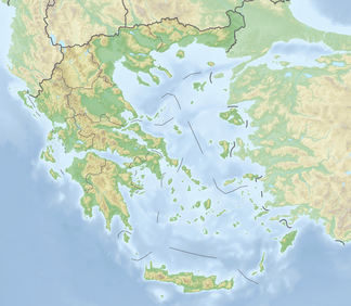
The Pieria Mountains ( Greek Πιέρια Όρη , in Slavic languages Schapka Planina , Шапка) are a mountain range northwest of Mount Olympus . They extend over the Imathia , Pieria and Kozani regional districts .
The Pieria Mountains are an extensive, heavily forested massif. They are not significant because of their height, but rather stand out because of the beauty and number of their peaks and the solitude of the forests. The highest of these is the Flambouro ( Φλάμπουρο ) with 2188 m height.
geography
The mountain range extends from north to southeast over the regional districts of Imathia , Pieria and Kozani . In the north, the foothills stretch into the plane of Thessaloniki. They end at Vergina , Sykia (Συκιά) and Livadi . To the west the mountains merge into the plain of Katerini, while Olympus and the Titaros massif join in the south . The Petriotikos brook forms the border to the massif of Mount Olympus. To the west of it rises the Titaros massif with a maximum height of 1839 m . Both Titaros and Pieria Mountains are bounded to the north by the valley of the Aliakmonas . The highest peak is the Flambouro between the villages of Katafygio in the municipality of Velvendos and Fteri in the municipality of Katerini with an altitude of 2188 m . Other peaks are: Tourla ( Τούρλα , 2104 m ), Avdella ( Αβδέλλα , 2049 m ), Arvanitis ( Αρβανίτης , 2023 m ), Plaka ( Πλάκα , 1938 m ), Chteni ( Χτένι , 1791 m ) and the Pende Pyrιgi. ( Πέγτεgi , 1710 m ). Below the Flambouro is the Koryfi Avdela plateau ( Οροπεδιο-Κορυφή Αβδέλα ) at an altitude of 2049 m .
traffic
The Ethniki Odos 3 crosses the mountains on a winding route . It leads from the south bank of the Aliakmonas reservoir, from Servia south to Elassona .
Flora
The mountains are known for the variety of plants, mainly in the deciduous forests, but also for rare field flowers such as orchid . The forests consist mainly of beech , oak and sweet chestnuts , black pines and pines , as well as Greek firs in the higher elevations.
mythology
Ancient mythology tells of the fact that the "Nine Pieric Muses", daughters of the Macedonian king Pieros and Euippe and gifted with artistic skills, challenged the muses to a singing contest. Their singing filled the mountains and reverberated from the mountaintops and gorges until they were defeated by the Heliconic Muses. For this cheeky thing, they were turned into jarring birds ( magpies ).
history
The first inhabitants of the mountains known by name were the Thracian Pierer . Expelled by the Temenids , the Macedonian kings of Argive origin, they later settled in the eastern coastal area of the Strymon under the Pangaion Mountains .
At the northern foot of the mountains near the ancient city of Aigai you can find the royal tombs of the Macedonians .
Aerosvit flight 241
On December 17, 1997, a Jakowlew Jak-42 of Aerosvit Airlines lost contact with the instrument landing system while approaching Thessaloniki and crashed on the second attempt to land in the Pieria Mountains ( 40 ° 13 ′ 37 ″ N , 22 ° 15 ′ 11 ″ E ) . All crew members and passengers, 70 people in total, died.
tourism
In Elatohori located Elatohori Ski Center in Ano Milia (gr. Άνω Μηλιά) of the parking path of love (Monopati tis Agapis stin Ano Milia, Το Μονοπάτι της Αγάπης στην Άνω Μηλιά, 40 ° 14 '38 " N , 22 ° 16' 10 ″ O ). Few kilometers south of Vergina is the Allerheiligen convent (Iera Moni Agii Pantes, 40 ° 27 '13 " N , 22 ° 19' 46" O ).
literature
- Aspasia Pavlopoulou: Thrace with Herodotus: Representation of an intermediate world, studies on Herodotus history, geography and ethnography of Thrace. Munich 2006, pp. 428-432. Inaugurial dissertation to obtain a doctorate in philosophy at the Ludwig Maximilian University in Munich, Institute for Ancient History.
- Όλυμπος - Olymbos . Bilingual hiking map. 1:50 000. Road editions ΕΚΔΟΣΕΙΣ. Athens 1995 (based on 1950 geospatial data).
Web links
Individual evidence
- ↑ Olympus . hiking map
- ↑ Πιέρια όρη - www.ritini.gr ( Memento of the original from January 12, 2014 in the Internet Archive ) Info: The archive link was inserted automatically and has not yet been checked. Please check the original and archive link according to the instructions and then remove this notice.
- ^ Ovid , Metamorphoses 5, 303.
- ↑ after Thucydides

