Katerini
|
Municipality of Katerini Δήμος Κατερίνης (Κατερίνη) |
||
|---|---|---|
|
|
||
| Basic data | ||
| State : |
|
|
| Region : | Central Macedonia | |
| Regional District : | Pieria | |
| Geographic coordinates : | 40 ° 16 ′ N , 22 ° 30 ′ E | |
| Area : | 682.38 km² | |
| Residents : | 85,851 (2010) | |
| Population density : | 125.8 inhabitants / km² | |
| Post Code: | 60100 | |
| Prefix: | (+30) 23510 | |
| Community logo: | ||
| Seat: | Katerini | |
| LAU-1 code no .: | 1101 | |
| Districts : | 6 municipal districts | |
| Local self-government : |
6 city districts 23 local communities |
|
| Website: | www.katerini.gr | |
| Location in the Central Macedonia region | ||
Katerini ( Greek Κατερίνη , ( f. Sg. )) Is a Greek city and municipality ( Dimos Katerinis Δήμος Κατερίνης).
geography
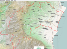
Katerini is located in Macedonia , in the Pieria plain, between the Ori Pierias mountain range and the Thermaic Gulf . Today, Katerini belongs to the Central Macedonia region . It is located near the battlefield of Pydna , where Macedonia under its last king Perseus on June 22, 168 BC. BC against the Romans under Lucius Aemilius Paullus Macedonicus lost its independence.
history
Katerini was probably not founded until the time when the area belonged to the Ottoman Empire (around the middle of the 15th to the beginning of the 19th century). It is probably named after St. Catherine of Alexandria , to whom a small chapel was consecrated not far from the original settlement core. In the second half of the 18th century, Katerini had about four to five thousand inhabitants. The city was liberated from Ottoman rule on October 16, 1912 in the course of the First Balkan War , and Greece was added. After that, Katerini was the capital of a district in the Thessaloniki prefecture until 1949 and, from 1950, the capital of the then newly founded Pieria Prefecture , which existed until 2010. The community was created in its current form in 2010 from the amalgamation of six communities, which have continued to exist as community districts since then. The distance to the second largest city in Greece, Thessaloniki, is almost 70 km, which has been of great importance for the development of the city in recent years.
Transport links
The city is located on the A1 motorway , with which it is connected by two exits . The motorway itself has been running in a tunnel in the urban area for several years. A four-lane ring road around the city is currently under construction to relieve the narrow center of through traffic.
The bus station on the eastern edge of the old town has numerous regional bus connections and long-distance bus routes to Athens , Larisa and Thessaloniki . Various city bus routes (which do not serve the bus station) open up the city districts and surrounding communities such as Svoronos, Nea Ephesos, Paralia , Dion and Olympiaki Akti.
Katerini is on the Piraeus – Thessaloniki railway line . Your station of the same name is an intercity stop.
Culture
The city is home to a branch (department for logistics) of the Thessaloniki University of Applied Sciences.
religion
Katerini is the seat of the Orthodox Metropolitan of the Diocese of Kitros, Katerini and Platamon ( Greek Ιερά Μητρόπολις Κίτρους, Κατερίνης και Πλαταμώνος ). In the course of the resettlement in the 1920s, many Pontic Greeks came to Katerini, they brought their Protestant denomination with them. Katerini developed into one of the centers of the Evangelical Church in Greece . There are also a few Armenians.
Twin cities
sons and daughters of the town
- Phaedrus (* around 20/15 BC - † around 50/60 AD), Roman fable poet in the reigns of the emperors Augustus, Tiberius, Caligula and Claudius.
- Savas Karipidis , (born May 23, 1979) handball professional (currently MT Melsungen )
- Stelios Malezas (born March 11, 1985), professional footballer (currently Fortuna Düsseldorf )
- Kyriakos Papadopoulos (born February 23, 1992), professional footballer (currently Hamburg Sports Association )
- Aikaterini Nikolaidou (born October 22, 1992), rower
- Alexandros Tziolis (born February 13, 1985), professional footballer (currently AS Monaco )
Web links
Individual evidence
- ↑ Results of the 2011 census at the National Statistical Service of Greece (ΕΛ.ΣΤΑΤ) ( Memento from June 27, 2015 in the Internet Archive ) (Excel document, 2.6 MB)


