
Chalkidona
|
Municipality of Chalkidona Δήμος Χαλκηδόνος (Χαλκηδόνα) |
|||
|---|---|---|---|
|
|||
| Basic data | |||
| State : |
|
||
| Region : | Central Macedonia | ||
| Regional District : | Thessaloniki | ||
| Geographic coordinates : | 40 ° 45 ′ N , 22 ° 41 ′ E | ||
| Area : | 389.54 km² | ||
| Residents : | 33,673 (2011) | ||
| Population density : | 86.4 inhabitants / km² | ||
| Seat: | Koufalia | ||
| LAU-1 code no .: | 0713 | ||
| Districts : | 3 municipal districts | ||
| Local self-government : |
9 city districts 5 local communities |
||
| Website: | www.dimos-chalkidonos.gr | ||
| Location in the Central Macedonia region | |||
 |
|||

Chalkidona ( Greek Χαλκηδόνα ( f. Sg. ), Katharevousa Chalkidon Χαλκηδών) is a Greek community around 30 km northwest of Thessaloniki . It was formed from three municipalities on January 1, 2011 and comprises 17 small towns and villages. The administrative seat and largest settlement is the small town of Koufalia with almost 8,000 inhabitants.
geography
Chalkidona is located in the Central Macedonian Plain on both sides of the Axios river , which in Chalkidona fans out into its delta and leaves the municipality about 15 kilometers before its mouth. A few kilometers west of Gefyra is the Ellis Dam, which dams the Axios for irrigation for agriculture. He has created a wetland with some river islands, which are home to a rich wild fauna as well as wild horses and which are part of a Natura 2000 area that includes the entire Axios and the estuaries of other rivers.
The Loudias touches the area to the west and forms the border to the neighboring municipality of Alexandria , to the south the municipality of Delta separates Chalkidona from the Aegean Sea . Other neighboring communities are Pella to the west, Peonia and Kilkis to the north and Oreokastro to the east.

Horses on the Axios
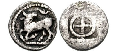
Silver coin from Ichnai
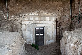
Macedonian tomb in Gefyra

Museum of the Balkan Wars in Gefyra


history
Prehistoric settlement from the Neolithic to Iron Age has been proven in the Koufalia area, one of the settlements was inhabited until Roman times and possibly corresponds to the ancient city of Ichnai ( ancient Greek Ἴχναι ). At that time the area was still on the Aegean coast. Macedonian tombs from the 5th century BC Were excavated between Gefyra and Agios Athanasios. Since the founding of Thessaloniki, the area belonged to the rural area of the city, the Roman Via Egnatia crossed the Axios at Gefyra and connected the area with the metropolis.
The population in the Chalkidona area was predominantly Slavic Orthodox and Turkish Muslim in the 19th century and was almost completely exchanged between 1913 and 1928 as a result of the Balkan Wars , the First World War and the Greco-Turkish War . For example, around 80 percent of the descendants of Greek refugees from Topolowgrad still live in Koufalia , Mesimvria is the Greek name of the city of Nesebar . The village of Yaylacık (Greek Gialiatzik or Giailatzik ) took in around 150 refugee families from Kadıköy and was renamed Chalkidon after its Greek name in 1926 , which in 2011 also became the name of the larger community. All place names were replaced by Greek between 1926 and 1928.
Attractions
In the village of Gefyra, before 1926 Topsin or Topçular, a mansion was acquired by the Greek Ministry of Defense in 1999, which served as the headquarters of Crown Prince Constantine during the First Balkan War from November 6th to 9th and in which on October 26th July. / November 8, 1912 greg. by Hasan Tahsin Paşa the surrender of Thessaloniki was signed. The building was transformed into a museum of the Balkan wars; In 2006 Tahsin's bones were buried in the museum courtyard.
traffic
Street
Chalkidona is located at the intersection of the old national road 2 as an east-west connection with the motorway 1 , which continues along the Axios to Macedonia and is the main north-south connection of Greece. Parallel to the national road runs south of the municipality with the A 2, the main connection in northern Greece in an east-west direction.
rail
Chalkidona has two stations on the Thessaloniki – Idomeni railway line, which was opened here in 1872 : Gefyra ( km 23.4) and Kastanas (km 36.5). There is hardly any passenger traffic here, currently (2020) only one pair of trains runs on the route, the Hellas Express from Belgrade to Thessaloniki - and only during the summer season. Otherwise only goods traffic takes place here.
air traffic
The Thessaloniki airport is approximately 58 kilometers by road south-east of Chalkidona.
Community structure
By 1997 Chalkidona was divided into 14 independent communities. They were initially merged to form the communities of Agios Athanasios, Chalkidona and Koufalia, which were combined into one community with the 2010 Kallikratis program . The 14 old parishes have had the status of urban districts (Ez. Gr. Dimotiki kinotita, from 2000 inhabitants) or local communities (topiki kinotita) since 2011 - and elect a council as local representation. The population figures come from the results of the 2011 census.

- Municipality of Agios Athanasios - Δημοτική Ενότητα Αγίου Αθανασίου - 14,753
- Municipality of Agios Athanasios - Δημοτική Κοινότητα Αγίου Αθανασίου - Άγιος Αθανάσιος - 4,967
- Gefyra District - Δημοτική Κοινότητα Γεφύρας - Γέφυρα - 3,059
- Municipality of Nea Mesimvria - Δημοτική Κοινότητα Νέας Μεσημβρίας - Νέα Μεσημβρία - 3,050
- Vathylakkos District - Δημοτική Κοινότητα Βαθυλάκκου - Βαθύλακκος - 2,337
- Local community Anchialos - Τοπική Κοινότητα Αγχιάλου - Αγχίαλος - 738
- Local community Xirochori - Τοπική Κοινότητα Ξηροχωρίου - 602
- Baleika - Μπαλαίικα - 35
- Xirochori - Ξηροχώρι - 567

- Municipality of Chalkidona - Δημοτική Ενότητα Χαλκηδόνος - 8.341
- Municipality of Adendro - Δημοτική Κοινότητα Αδένδρου - Άδενδρο - 2.079
- District of Chalkidona - Δημοτική Κοινότητα Χαλκηδόνος - Χαλκηδόνα - 3,094
- Municipality of Mikro Monastiri - Δημοτική Κοινότητα Μικρού Μοναστηρίου - 2.095
- Loudias - Λουδίας - 789
- Micro Monastiri - Μικρό Μοναστήρι - 1.306
- Local community Eleousa - Τοπική Κοινότητα Ελεούσης - Ελεούσα - 385
- Local community Parthenio - Τοπική Κοινότητα Παρθενίου - Παρθένιο - 502
- Local community Valtochori - Τοπική Κοινότητα Βαλτοχωρίου - Βαλτοχώρι - 186

- Municipality of Koufalia - Δημοτική Ενότητα Κουφαλίων - 10,579
- Municipality of Koufalia - Δημοτική Κοινότητα Κουφαλίων - 8,139
- Koufalia - Κουφάλια - 7,850
- Ergatikes Katikies - Εργατικές Κατοικίες - 289
- Prochoma district - Δημοτική Κοινότητα Προχώματος - 2,440
- Akropotamos - Ακροπόταμος - 596
- Kastanas - Καστανάς - 630
- Prochoma - Πρόχωμα - 1.214
- Municipality of Koufalia - Δημοτική Κοινότητα Κουφαλίων - 8,139
Individual evidence
- ↑ a b Results of the 2011 census at the National Statistical Service of Greece (ΕΛ.ΣΤΑΤ) ( Memento from June 27, 2015 in the Internet Archive ) (Excel document, 2.6 MB)
- ↑ Data sheet for the Natura 2000 area
- ↑ Collection of sources on the population of Macedonia by Dimitri Lithoxoou, accessed on August 9, 2014 (Greek)
- ↑ a b Renaming and administrative history of the database of the EETAA (Greek Society for Development and Decentralization) ( Memento of the original from October 16, 2013 in the Internet Archive ) Info: The archive link was inserted automatically and has not yet been checked. Please check the original and archive link according to the instructions and then remove this notice.
- ↑ Presentation of the museum on the website of the Greek Army (Greek)
- ^ Henning Wall: Railway Atlas Greece . Schweers + Wall, Cologne 2018, p. 18.
- ^ Bac: The railways in the Republic of North Macedonia . In: Eisenbahn-Revue International 5/2020, pp. 244–248 (248).