Pim (river)
|
Pim Пим |
||
|
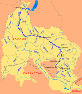
Course of the Pim (Пим) in the catchment area of the Ob |
||
| Data | ||
| Water code | RU : 13011100212115200045617 | |
| location | Khanty-Mansi Autonomous Okrug ( Russia ) | |
| River system | If | |
| Drain over | Whether → Kara Sea | |
| source | around 180 km west of Nojabrsk 63 ° 11 ′ 6 ″ N , 71 ° 42 ′ 1 ″ E |
|
| muzzle | 90 km west of Surgut in the Ob Coordinates: 61 ° 15 ′ 21 " N , 71 ° 58 ′ 36" E 61 ° 15 ′ 21 " N , 71 ° 58 ′ 36" E
|
|
| length | 390 km | |
| Catchment area | 12,700 km² | |
| Discharge at gauge Pim (place) A Eo : 11,800 km² Location: 66 km above the mouth |
MQ 1956/1987 Mq 1956/1987 |
85 m³ / s 7.2 l / (s km²) |
| Left tributaries | Watjaun (Ватъяун), Kosamyjacha , Watjaun (Ватьяун), Kontuntur , Ljarkni , Tutlimjaun , Tapegan , Jakjaun , Watschimjaun , Miltonjaun | |
| Right tributaries | Sortympym , Wotschingjaun , Ai-Pim , Entl-Juchlyngjaun | |
| Medium-sized cities | Ljantor | |
| Small towns | Nizhnesortymsky | |
The Pim ( Russian Пим ) is a right tributary of the Ob in the West Siberian lowlands in the west of the Asian part of Russia .
course
The Pim rises on the Siberian ridge in the Autonomous Okrug of the Khanty and Mansi near the border with the Autonomous Okrug of the Yamalo-Nenets . It meanders through the sparsely populated Autonomous District in a predominantly north-south direction. The city of Ljantor , a center of oil production, lies on its lower reaches . After 390 km the river flows into the Ob near the village of Ljamina.
Individual evidence
- ↑ a b Article Pim in the Great Soviet Encyclopedia (BSE) , 3rd edition 1969–1978 (Russian)
- ↑ a b Pim in the State Water Directory of the Russian Federation (Russian)
- ↑ Pim at the Pim gauge - hydrographic data at R-ArcticNET
