Pisuerga
| Río Pisuerga | ||
|
Río Pisuerga in Valladolid |
||
| Data | ||
| location | Spain | |
| River system | Duero | |
| Drain over | Duero → Atlantic | |
| source | in the Cantabrian Mountains 42 ° 59 ′ 13 ″ N , 4 ° 22 ′ 23 ″ W |
|
| Source height | approx. 1620 msnm | |
| muzzle | in the Duero coordinates: 41 ° 33 ′ 1 " N , 4 ° 51 ′ 56" W 41 ° 33 ′ 1 " N , 4 ° 51 ′ 56" W |
|
| Mouth height | approx. 675 msnm | |
| Height difference | approx. 945 m | |
| Bottom slope | approx. 3.3 ‰ | |
| length | 288 km | |
| Catchment area | 15,757 km² | |
| Big cities | Valladolid | |


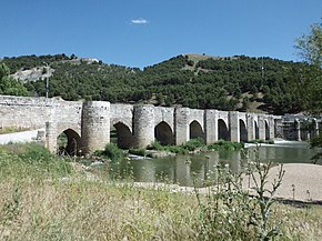
The approximately 288 km long Río Pisuerga is a river in the provinces of Palencia and Valladolid in northern Spain ; it is the second largest tributary of the Duero .
course
The Río Pisuerga has its source at an altitude of about 1620 m on the Sierra de Peña Labra in the Cantabrian Mountains . Its source is on the northern border of the province of Palencia in the autonomous region of Castile and León . The Pisuerga flows mainly in a southerly direction and joins the Duero after about 283 km behind the city of Valladolid .
Tributaries
Reservoir
The river's water level has been very steady since the 1950s. The reason for this is the large dam at Aguilar de Campoo , which collects the water from the rainy upper valleys of the river. This regulation allowed a large expansion of the irrigated cultivation areas along the course of the river through the Castilian plateau .
Places on the Río Pisuerga
- Santa Maria de Redondo
- Cervera de Pisuerga
- Aguilar de Campoo
- Becerril del Carpio
- Herrera de Pisuerga
- Ventosa de Pisuerga
- Zarzosa de Riopisuerga
- Castrillo de Riopisuerga
- Olmos de Pisuerga
- Naveros de Pisuerga
- San Llorente de la Vega
- Melgar de Fernamental
- Osorno la Mayor
- Itero de la Vega
- Torquemada
- Magaz de Pisuerga
- Venta de Baños
- Tariego de Cerrato
- Dueñas
- Valoria la Buena
- Cabezón de Pisuerga
- Santovenia de Pisuerga
- Valladolid
- Arroyo de la Encomienda
- Simancas
