Plešné jezero
| Plešné jezero (Plöckensteinsee) | ||
|---|---|---|

|
||
|
Plešné jezero (Plöckensteinsee) seen from the southwest |
||
| Geographical location | Bohemian forest | |
| Drain | Jezerní potok → Vltava → Elbe | |
| Data | ||
| Coordinates | 48 ° 46 '35 " N , 13 ° 51' 55" E | |
|
|
||
| Altitude above sea level | 1090 m nm | |
| surface | 7.48 ha | |
| length | 507 m | |
| width | 160 m | |
| volume | 617,000 m³ | |
| scope | 1,242 m | |
| Maximum depth | 18.3 m | |
| Middle deep | 8.25 m | |
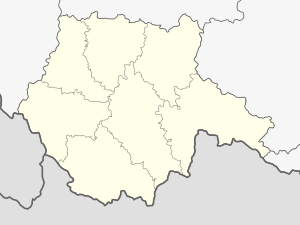
The Plešné jezero (formerly Czech Plekenštejnské jezero , German Plöckensteinsee or Plöckensteiner See ) is a glacial lake in the Bohemian Forest . It is located on Czech territory in the municipality of Nová Pec below the Plöckenstein at 1090 m above sea level. It was created by the consequences of glaciation in the Würme Ice Age , where a glacier left moraine walls up to forty meters high . It is the most extensive moraine landscape in the entire Bohemian Forest.
To support the rafting operations in the Schwarzenbergschen Schwemmkanal , the lake was dammed by two and a half meters between 1789 and 1793. In 1877, in memory of Adalbert Stifter , who with his story Der Hochwald created a literary monument for the Plöckensteinsee, a large granite obelisk was installed in the sea wall ( Adalbert Stifter monument ). Stifter also mentioned the lake in the story Granit .
Eastern Alps gentian , hermaphrodite crowberry and large-leaved willow thrive on the banks . The area was barely accessible to the public due to its proximity to the border (530 meters northeast of the Austrian-Czech border near Plöckenstein, and 1.7 km east of the border triangle Germany-Czech Republic-Austria) until the fall of the Iron Curtain . The cross-border hiking trail Plöckensteinerseeweg (Ö-CZ) leads from Holzschlag in the Šumava National Park to the Plöckensteiner See.
- Image gallery


