
Port Townsend
| Port Townsend | |
|---|---|
| Nickname : City of Dreams | |
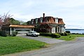
 Center of Port Townsend |
|
| Location in county and state | |
 |
|
| Basic data | |
| Foundation : | 1851 |
| State : | United States |
| State : | Washington |
| County : | Jefferson County |
| Coordinates : | 48 ° 7 ′ N , 122 ° 46 ′ W |
| Time zone : | Pacific ( UTC − 8 / −7 ) |
| Residents : | 8,334 (as of: 2000) |
| Population density : | 460.4 inhabitants per km 2 |
| Area : | 24.5 km 2 (approx. 9 mi 2 ) of which 18.1 km 2 (approx. 7 mi 2 ) is land |
| Height : | 40 m |
| Postal code : | 98368 |
| Area code : | +1 360 |
| FIPS : | 53-55855 |
| GNIS ID : | 1524589 |
| Website : | www.cityofpt.us |
| Mayor : | Michelle Sandoval |
Port Townsend is a city in Jefferson County in the US state of Washington . It is also the county seat and is located in the extreme northeast of the Olympic Peninsula . It extends over an area of 24.5 km² and in 2010 had 9,113 inhabitants and 4,544 households.
history
The British navigator George Vancouver named the place in 1792 initially Port Townshend (for his friend George Townshend, PC). In what is now Jefferson County, the Chimakum , Hoh , Klallam , Quinault and Twana lived around 1850 .
The first settlement by non-Indians took place on April 24, 1851. Soon afterwards, a seaport was built on the eastern coast , which still exists today. It is one of the last three preserved ports in the country from Victorian times and is partly a National Historic Landmark . There is a lighthouse at Point Hudson.
To protect the settlers during the Puget Sound War , the US Army built Fort Townsend around four kilometers south in 1856 . The garrison was withdrawn as early as 1859, but the post remained and was reactivated in 1874 under pressure from the city administration. After a fire, the fort was abandoned in 1895. Today the site is Fort Townsend State Park .
The early settlers owed peace with the surrounding Indians, as the Puget Sound War , to Klallam chief Chetzemoka (approx. 1810 to 1888), known as the "Duke of York", and his wife, who was known as "Queen Victoria" and further wars took place between Indians and the US Army.
The place was also known as the "City of Dreams" because it raised hopes during the speculative boom between 1870 and the end of the century that the largest Pacific port in the USA could be built here. But with the economic crisis from 1893, the stock market crash of 1893, the boom collapsed due to a lack of capital. To this day, Port Townsend has been heavily influenced by this construction phase.
From 1897, Fort Worden was built north of the city , a coastal fortification that, together with Fort Flagler and Fort Casey, should block the entrance to the Puget Sound for enemy ships. Fort Worden served as a military facility until 1953, and since 1973 the site has been open to the public as Fort Worden State Park .
Port Townsend Historic District
The economic decline caused a strong emigration, so that many houses were empty in the 1920s. The city did not start growing again until the 1970s, because many retirees settled here and tourism offered new business opportunities. In May 1976, parts of the place were added to the National Register of Historic Places as a Historic District . Since May of the following year, this protected area has the status of a National Historic Landmark.
Twin town
- Ichikawa ( Hyōgo Prefecture ) in Japan (since 2002)
sons and daughters of the town
- Jacob Jebsen (1870–1941), German-Danish shipowner
- Vince Wallace (1939–2012), jazz musician
- Wayne Bastrup (born 1976), actor
- Steve Grandinetti , musician
photos

Center and Admiralty Inlet

Harbor on Puget Sound

Jefferson County Courthouse

Bell Tower
Frank Bartlett's house

Library at the port


Web links
- Official website (Engl.)
- Guide to Port Townsend (Engl.)
Individual evidence
- ↑ United States Census Bureau
- ↑ Port Townsend Historic District on the National Register of Historic Places , accessed March 10, 2020.
- ↑ Listing of National Historic Landmarks by State: Washington. National Park Service , accessed March 10, 2020.
- ↑ Steve Grandinetti. In: stevegrandinetti.com. Accessed May 17, 2019 .