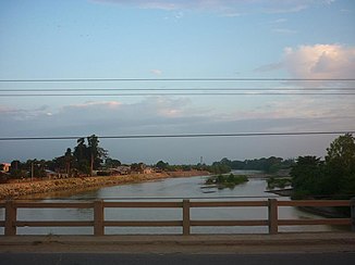
Río Jubones
| Río Jubones | ||
|
Río Jubones at La Iberia |
||
| Data | ||
| location |
|
|
| River system | Río Jubones | |
| Confluence of |
Río León and Río Rircay 3 ° 20 ′ 30 ″ S , 79 ° 19 ′ 53 ″ W |
|
| Source height | approx. 940 m | |
| muzzle |
Gulf of Guayaquil ( Pacific Ocean ) Coordinates: 3 ° 10 ′ 10 " S , 79 ° 56 ′ 32" W 3 ° 10 ′ 10 " S , 79 ° 56 ′ 32" W |
|
| Mouth height | 0 m | |
| Height difference | approx. 940 m | |
| Bottom slope | approx. 10 ‰ | |
| length | approx. 90 km (including Río León: 170 km)
|
|
| Catchment area | 4054 km² | |
| Outflow A Eo : 4054 km² |
MQ Mq |
59 m³ / s 14.6 l / (s km²) |
| Right tributaries | Río Masucay | |
| Reservoirs flowed through | Minas-San Francisco dam | |
| Medium-sized cities | Pasaje | |
| Communities | La Iberia | |
The Río Jubones is an approximately 90 km long tributary of the Pacific Ocean in the southwest of Ecuador .
River course
The Río Jubones arises in the Cordillera Occidental at the confluence of the Río León and Río Rircay . It flows west through the mountains. It forms the provincial border between Azuay (in the north) and Loja (in the south) over a distance of 15 kilometers and then the provincial border between Azuay (in the north) and El Oro (in the south) over a distance of 25 kilometers . The E59 trunk road follows the course of the river. The Río Jubones leaves the mountains and reaches the coastal plain. At river kilometer 29 the river passes the southern city of Pasaje . Then the Río Jubones turns to the northwest. At river kilometer 17 the trunk road E25 crosses the river. Eventually this reaches the Gulf of Guayaquil , where it forms a small river delta .
Hydrology
The Río Jubones drains an area of 4054 km². The mean discharge is 59 m³ / s.
Use of hydropower
Minas-San Francisco dam
A dam ( ⊙ ) was built between 2012 and 2019, 71 km above the estuary . The gravity dam has a height of 65.4 m. The storage space is 14 million m³. A 13.9 km long tunnel (4.75 m Ø), a 68 m high water tower (16 m Ø) and a subsequent 530 m long pressure pipe (3.77 m Ø) lead the water to a cavern power station ( ⊙ 3 vertical Pelton turbines each with 91.6 MW, 65 m³ / s design flow , 510 m drop height , 1290 GWh / year). The water is led back into the river from the power station via a 1.6 km long tunnel (5 m Ø). The government awarded the project directly to the Chinese company Harvin Electric.
La Unión hydroelectric power station
There are plans for a hydropower plant further downstream, the La Unión power plant. A 12.19 km long tunnel (4.8 m Ø), a 97 m high water tower (15 m Ø) and a subsequent 847 m long pressure pipe (4.8 m Ø) would transfer the water to the above-ground power plant (2 Francis Turbines , 65 m³ / s expansion water volume, 170 m head, 94 MW, 400 GWh / year). Below the power station, a drainage channel is to lead the water back into the river.
![]() Map with all coordinates: OSM | WikiMap
Map with all coordinates: OSM | WikiMap
Web links
Individual evidence
- ↑ a b Water Resources Assessment of Ecuador (PDF, 1.0 MB) United States Southern Command, US Army Corps of Engineers, Mobile District and Topographic Engineering Center (web.archive.org). September 1998. Retrieved January 12, 2019.
- ↑ a b c Hidroeléctrica Minas San Francisco, en acción . La Hora. January 16, 2019. Retrieved January 19, 2019.
- ↑ a b MINAS - SAN FRANCISCO AND LA UNIÓN HYDROELECTRIC PROJECTS • ECUADOR . www.geodata.it. Retrieved January 19, 2019.
- ↑ Enerjubones . Corporación Eléctrica del Ecuador (CELEC). Retrieved January 19, 2019.
