Río Tacuarí
| Río Tacuarí | ||
| Data | ||
| location | South America , Uruguay | |
| River system | Río Tacuarí | |
| Drain over | Laguna Merín → Canal São Gonçalo → Lagoa dos Patos → Atlantic | |
| source | west of Puntas del Parao in the Cuchilla Guazunambí | |
| muzzle |
Laguna Merín Coordinates: 32 ° 46 ′ 13 ″ S , 53 ° 18 ′ 35 ″ W 32 ° 46 ′ 13 ″ S , 53 ° 18 ′ 35 ″ W.
|
|
| length | 230 km | |
| Catchment area | 3600 km² | |
| Left tributaries | de las Islas, de la Coronilla, Fiera, del Cerro Colorado, del Abrojal, Arroyo Laguna del Negro , Arroyo Saca Calzones , Arroyo Medina , NN, NN, Arroyo Conventos , del Cerro Verde, Laureles, Bilanguillo, Arroyo Chuy , Arroyo Amarillo , del Tarumán, de la Divisa, Bañado Grande, NN (de la Totora or La Palma), de las Palmas, NN (de las Pajas or de la Aguada de Felipe), Arroyo Malo , NN, NN, del Mangrullo, Arroyo Arbolito , Arroyo Garao , NN, de las Palomas, NN, Arroyo de Santos , del Ceibo, Grande | |
| Right tributaries | NN, Yerba Sola, NN, Cañada del Sauce , Infiernillo, del Paso Hondo, del Paso de la Arena, Campamento, Arroyo del Parado , Arroyo Laureles , Blanquillo, NN, Arroyo del Caracú , Manguera de Julián, del Sauce, Arroyo Rabón , Arroyo Campamento , Divisoria, del Rodeo, Isla de los Ceibos, de la Palma, de la Teja, Arroyo Campamento , del Palmar, NN | |
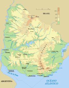
The Río Tacuarí is a river in eastern Uruguay .
It rises in the area of the Cerro Largo department west of Puntas del Parao in the Cuchilla Guazunambí . From there it first flows in a northerly direction for a total length of 230 km and changes the direction of flow after a relatively short distance to the east, to then flow south of Melo from northwest to southeast to the border of Treinta y Tres . He passes the places Arachania and later also Plácido Rosas . On its further course it forms the department boundary up to the mouth. It finally flows into the Laguna Merín west-southwest of Lago Merín . The size of its catchment area is about 3,600 km². A tributary of the Río Tacuarí is the Arroyo Chuy del Tacuarí .
The previously unknown cichlid species Gymnogeophagus tiraparae was discovered in the Río Negro and Río Tacuarí basins .
Individual evidence
- ^ Enciclopedia Geografica del Uruguay
- ↑ Report in AquaNet magazine ( page no longer available , search in web archives ) Info: The link was automatically marked as defective. Please check the link according to the instructions and then remove this notice. dated April 22, 2009
- ↑ A new species of Gymnogeophagus from the río Negro and río Tacuarí basins, Uruguay (Teleostei: Perciformes) by Iván González-Bergonzoni, Marcelo Loureiro and Sebastián Oviedo (English; PDF file; 1.57 MB)

