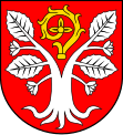
Gmina Radwanice
| Gmina Radwanice | ||
|---|---|---|

|
|
|
| Basic data | ||
| State : | Poland | |
| Voivodeship : | Lower Silesia | |
| Powiat : | Polkowicki | |
| Geographic location : | 51 ° 34 ′ N , 15 ° 56 ′ E | |
| Residents : | see Gmina | |
| Postal code : | 59-160 | |
| Telephone code : | (+48) 76 | |
| License plate : | DPL | |
| Gmina | ||
| Gminatype: | Rural community | |
| Gmina structure: | 17 localities | |
| 13 school authorities | ||
| Surface: | 83.97 km² | |
| Residents: | 4810 (Jun. 30, 2019) |
|
| Population density : | 57 inhabitants / km² | |
| Community number ( GUS ): | 0216062 | |
| administration | ||
| Community leader : | Sabina Zawis | |
| Address: | ul. Przemysłowa 17 59-160 Radwanice |
|
| Website : | www.radwanice.sisco.pl | |
The Gmina Radwanice is a rural municipality in the powiat Polkowicki of the Lower Silesian Voivodeship in Poland . Its seat is in the village of the same name ( German Wiesau ) with around 2100 inhabitants (2006).
structure
The rural municipality of Radwanice includes 13 places (German names until 1945) with a Schulzenamt:
- Buczyna ( Buchwald , 1937–1945 Buchendamm )
- Drożów ( punishment )
- Drożyna ( Druse , 1937–1945 meadow bush )
- Jakubów ( St. James' Church )
- Kłębanowice ( Klemnitz , 1937–1945 Roggendorf NS )
- Lipin ( Leipe )
- Łagoszów Wielki ( Large Logical )
- Nowy Dwór
- Nowa Kuźnia ( Neuhammer )
- Przesieczna ( Andersdorf )
- Radwanice ( Wiesau )
- Sieroszowice ( Kunzendorf )
- Strogoborzyce
Other localities in the municipality are Borów ( Berndorf ), Dobromil ( Guttenstädt ), Teodorów and Ułanów ( Greif ).
Individual evidence
- ↑ population. Size and Structure by Territorial Division. As of June 30, 2019. Główny Urząd Statystyczny (GUS) (PDF files; 0.99 MiB), accessed December 24, 2019 .
- ↑ The Historical Place Directory
