Rance (camouflage)
| Rance | ||
|
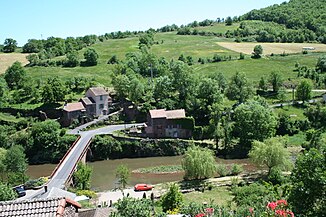
The rance at Combret |
||
| Data | ||
| Water code | FR : O37-0400 | |
| location | France , Occitania region | |
| River system | Garonne | |
| Drain over | Tarn → Garonne → Atlantic Ocean | |
| source | in the parish of Murasson 43 ° 45 ′ 38 " N , 2 ° 49 ′ 36" E |
|
| Source height | approx. 900 m | |
| muzzle | near Saint-Pierre , in the municipality of La Bastide-Solages , in the Tarn Coordinates: 43 ° 56 ′ 42 ″ N , 2 ° 29 ′ 59 ″ E, 43 ° 56 ′ 42 ″ N , 2 ° 29 ′ 59 ″ E |
|
| Mouth height | approx. 210 m | |
| Height difference | approx. 690 m | |
| Bottom slope | approx. 11 ‰ | |
| length | approx. 63 km | |
| Left tributaries | Liamou , Toudoure | |
| Right tributaries | Gos , mousse | |
The Rance is a river in France that runs in the Occitania region . Its headwaters are in the French Massif Central , in the Lacaune Mountains , which are located in the southern part of the Causses . It rises in the municipality of Murasson , generally drains north-west through the Grands Causses Regional Nature Park and flows into the Tarn after around 63 kilometers at Saint-Pierre , in the municipality of La Bastide-Solages, as a left tributary . On its way, the Rance touches the Aveyron and Tarn departments .
Places on the river
- Peux-et-Couffouleux
- Mounes-Prohencoux
- Belmont-sur-Rance
- Combret
- Saint-Sernin-sur-Rance
- Balaguier-sur-Rance
- Plaisance
- Curvalle
- La Bastide-Solages
