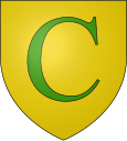
Curvalle
|
Curvalle Curvala |
||
|---|---|---|

|
|
|
| region | Occitania | |
| Department | Camouflage | |
| Arrondissement | Albi | |
| Canton | Le Haut Dadou | |
| Community association | Monts d'Alban and Villefranchois | |
| Coordinates | 43 ° 57 ' N , 2 ° 28' E | |
| height | 206-696 m | |
| surface | 38.63 km 2 | |
| Residents | 398 (January 1, 2017) | |
| Population density | 10 inhabitants / km 2 | |
| Post Code | 81250 | |
| INSEE code | 81077 | |
Curvalle ( Occitan : Curvala ) is a French commune with 398 inhabitants (as of January 1, 2017) in the Tarn department in the Occitanie region . The municipality belongs to the arrondissement of Albi and the canton of Le Haut Dadou (until 2015: canton of Alban ). The inhabitants are called Curvallois .
location
Curvalle is about 31 kilometers east of Albi . The Tarn River and the Rance flowing into it limit the municipality to the north. Curvalle is surrounded by the neighboring communities of Trébas and La Bastide-Solages in the north, Plaisance in the east and north-east, Balaguier-sur-Rance in the east, Miolles in the east and south-east, Massals in the south, Paulinet in the south-west, Alban in the west and south-west, Saint -André in the west and northwest and Cadix in the northwest.
Population development
| year | 1962 | 1968 | 1975 | 1982 | 1990 | 1999 | 2006 | 2013 |
| Residents | 1,027 | 969 | 773 | 707 | 526 | 494 | 462 | 408 |
| Source: Cassini and INSEE | ||||||||
Personalities
- Danièle Gaubert (1943–1987), actress, buried here
