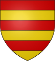
Valderiès
|
Valderiès Valdariás |
||
|---|---|---|

|
|
|
| region | Occitania | |
| Department | Camouflage | |
| Arrondissement | Albi | |
| Canton | Carmaux-1 Le Ségala | |
| Community association | Carmausine Ségala | |
| Coordinates | 44 ° 1 ' N , 2 ° 14' E | |
| height | 216-424 m | |
| surface | 20.42 km 2 | |
| Residents | 852 (January 1, 2017) | |
| Population density | 42 inhabitants / km 2 | |
| Post Code | 81350 | |
| INSEE code | 81306 | |
Valderiès ( Occitan : Valdariás ) is a French commune with 852 inhabitants (as of January 1, 2017) in the Tarn department in the Occitania region (before 2016: Midi-Pyrénées ). Valderiès belongs to the arrondissement of Albi and the canton of Carmaux-1 Le Ségala (until 2015: canton of Valderiès ).
geography
Valderiès is about ten kilometers northeast of Albi am Cérou , which borders the municipality in the north. Valderiès is surrounded by the neighboring communities of Saint-Jean-de-Marcel in the north, Andouque in the east and northeast, Saussenac in the south and east, Le Garric in the west and southwest and Rosières in the west.
The former route nationale 603 runs through the municipality .
Population development
| 1962 | 1968 | 1975 | 1982 | 1990 | 1999 | 2006 | 2013 |
|---|---|---|---|---|---|---|---|
| 708 | 674 | 637 | 624 | 735 | 752 | 881 | 824 |
| Source: Cassini and INSEE | |||||||
Attractions
- former monastery on the Puy Saint-Georges, ruin
Web links
Commons : Valderiès - Collection of images, videos and audio files

